BACK TO WEATHER-BLOG MENU
The Welsh Weather & Dyfi Valley landscapes Image-Library - Click HERE
Very few storm-intercepts were done, mostly due to having to conserve funds (good for the old carbon-footprint anyhow) but there was a memorable exception on the 23rd of July when I took on this slow-moving beast on the Machynlleth-Llanidloes Mountain Road:
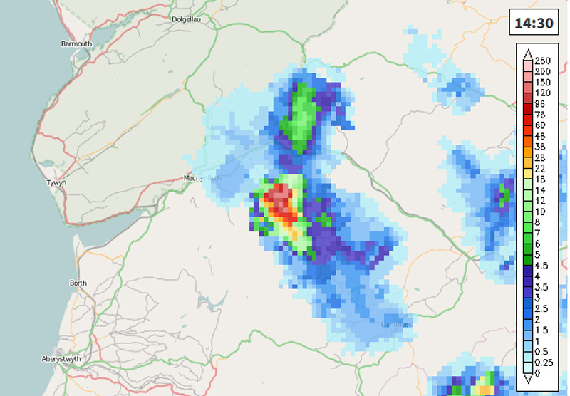
When I arrived up there it was still developing with precip starting to break out: this shows that an unassuming storm can quickly get quite spectacular so bear with me....

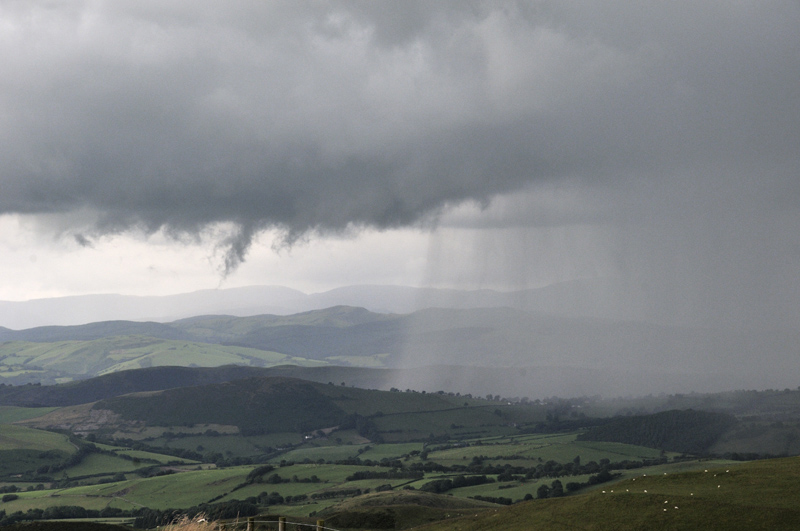
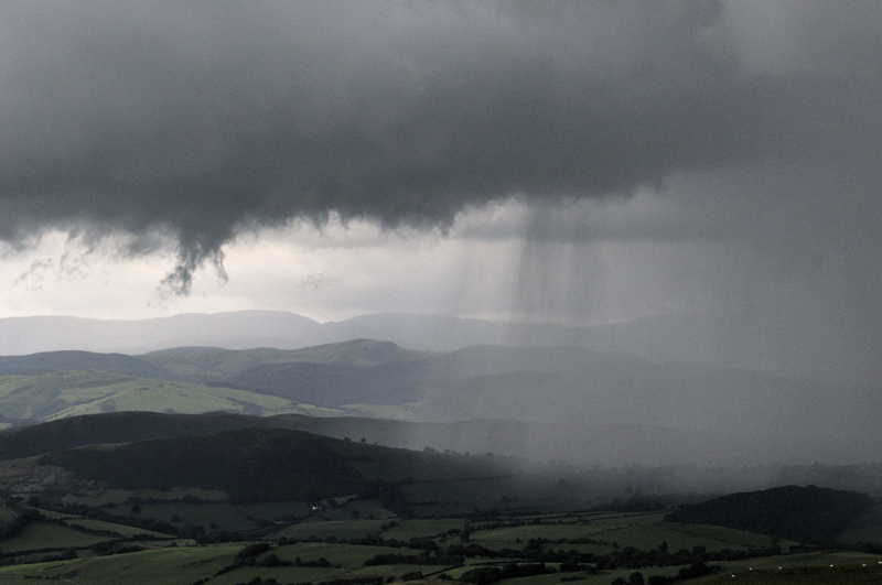
Within minutes, development had shifted westwards. A strong updraught is shown by the scud rapidly ascending into the cloud - and behind that a violent precipitation-core marks an equally-strong downdraught! This and the images below were taken at around the same time as the radar screen-grab above.

Difficult to choose between these so I've bunged them all in!

While thus engrossed, a second core developed very quickly overhead and the situation went from a few spots of rain to this in moments. It was absolutely hammering it down: had any thunder occurred I doubt I would have heard in with the din on the car roof!
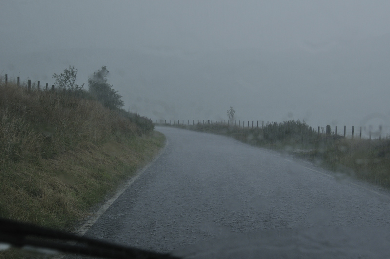
It was time for a sharp exit, duly made. And that was pretty much it in terms of impressive storms in 2017, although mention should be made of the brief but active storm on the night of July 19th. This I enjoyed from the windows of my flat at Penmaendyfi, with some excellent lightning to my north-west. Under the core of the storm, it got a bit more spectacular with a direct strike to the Peniarth Arms at Bryncrug, north of Tywyn: the Fire Service attended and guests were evacuated to be on the safe side.
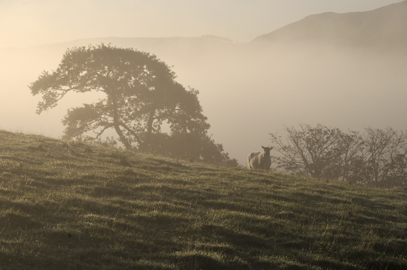
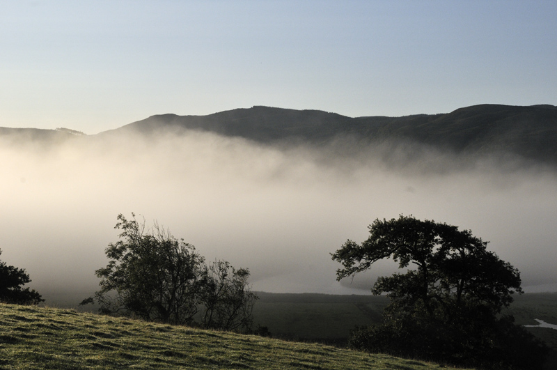
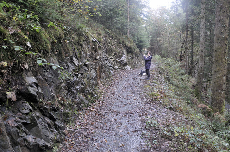
Penmaendyfi is situated on a low hill overlooking the Dyfi Estuary's upper reaches and as such it has presented opportunities for some new angles on the Dyfi Valley and its scenery. This I am glad of, as one can easily fall into the bad habit of photographing the same things all the time - it's a bit like the way the tabloids always feature shots of waves at Aberystwyth every time it's windy. It gets boring after a while! So a fair few of the images below are from Penmaendyfi and Cwrt.
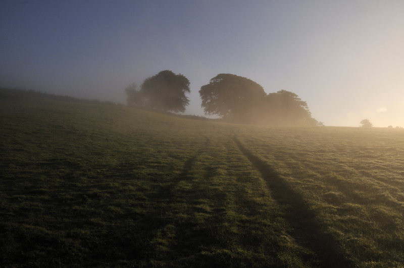
Autumnal fogs, flowing slowly down the Dyfi Valley, have featured on the pages many times. At Penmaendyfi, the ground is not quite high enough to be completely clear of them, but nevertheless some interesting possibilities exist:
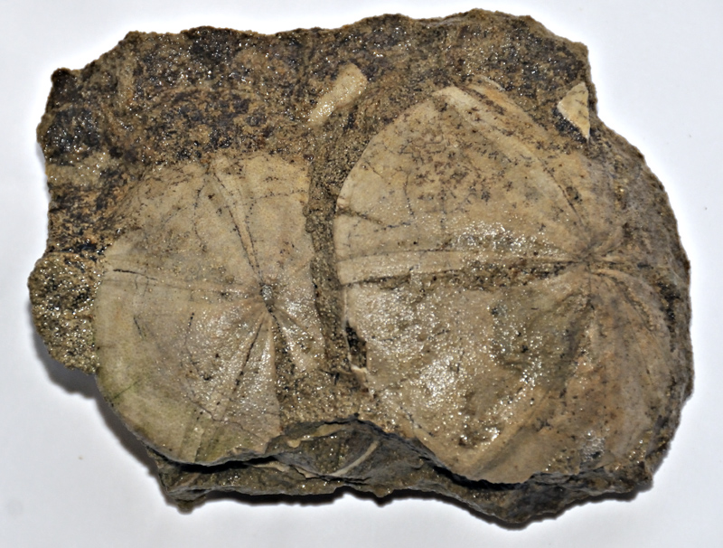
Quick geological interlude as a catch-up from the last post: the finds keep coming. I was amazed to find these fossilised Middle Jurassic sea-urchins in a boulder of limestone up at Tonfanau. I've found various fossils there but nothing as good as these beauties:

The best one after a scrub-up:
The last post was all about the rediscovery of the Magnificent Uralite Porphyry. This amazing rock has generated a great deal of interest and most importantly it caught the attention of a third year geology student from the University of Kingston-on-Thames who was looking for a dissertation project in North Wales and contacted me not long after the previous post. Bingo! It's so hard to get much done in the Earth Sciences in Wales these days (usual mixture of apathy and underfunding - it seemingly gets worse and worse) but this rock was about to get a lot more attention than I had expected. No money in it for me of course, but data - hard data such as lots of whole-rock geochemistry - that I would have an equal share of. Can't get fairer than that!
We spent two days in the field looking at the Porphyry and adjacent intrusive rocks: here we are examining the neighbouring Daren Wyddan Intrusion, a possibly-related bit of igneous rock:
Here's the top of the Porphyry outcrop looking down steeply onto the road that runs up the Mawddach Valley from Ganllwyd:
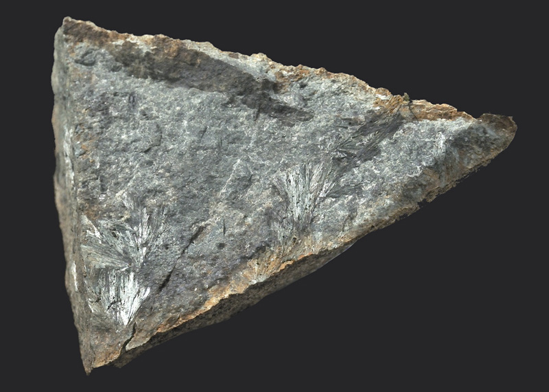
Up there I made another interesting discovery: some nicely-crystallised actinolite - the fibrous green crystals on this sample. Several centimetres long, they are the best known Welsh examples of this mineral.
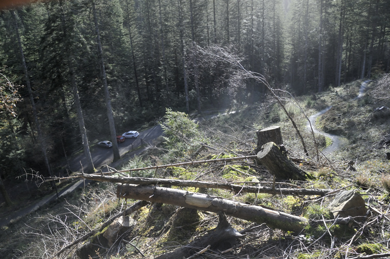
There's more mapping to do in the vicinity, but the weather has really been incredibly non-cooperative of late. Hopefully some decent bright days, with good visibility, will be more of a feature of early 2018 than they were of late 2017, when the mist often seemed to descend almost to the Valley floor!
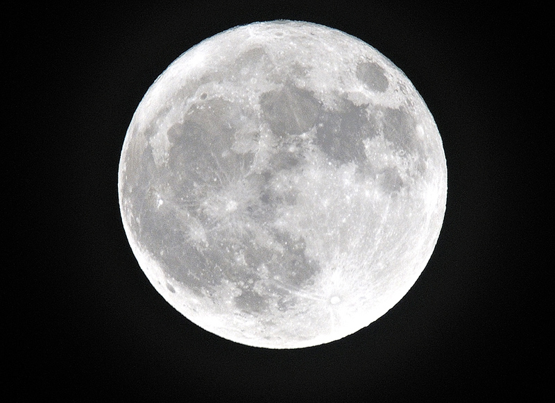
One early December night made up for the murk, with a widely-publicised "Supermoon" making an appearance. It took me a while to capture it due to drifts of broken cloud, but I persevered:
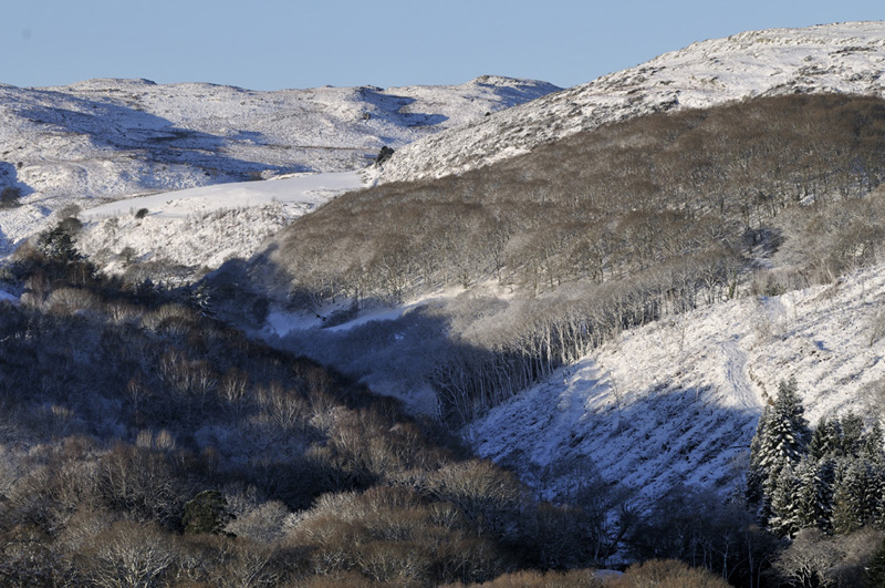
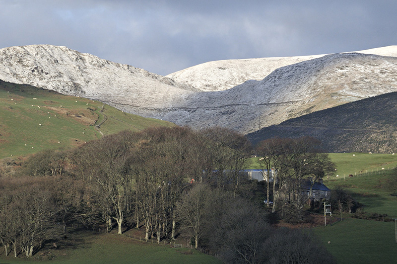
By the standards of recent years, December 2017 was quite a snowy month, especially around the 10th when a frontal airmass ran into colder air over Wales and a day's snowfall resulted. At Penmaendyfi, only some 10-12 cm fell, but on the higher ground a 15-20 cm fall drifted extensively. This was the view that afternoon, looking south:
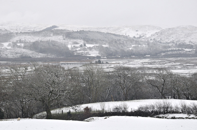
and east.....
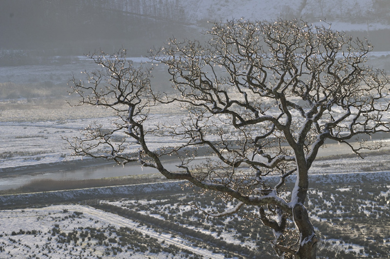
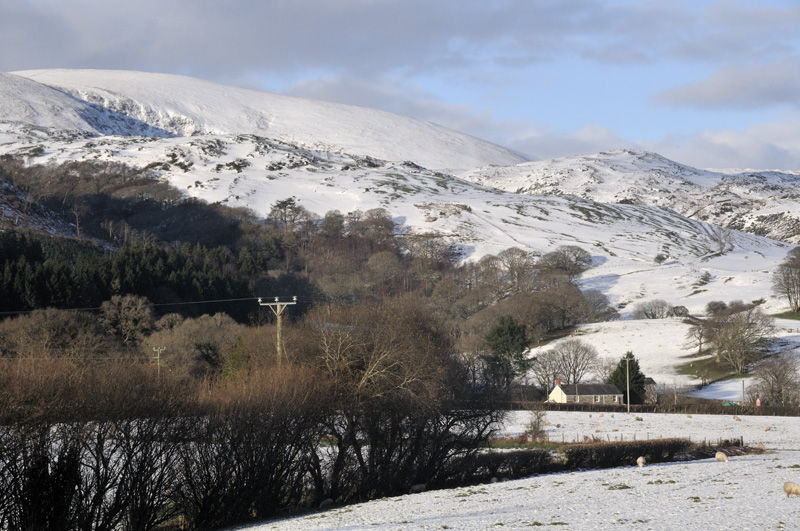
The following day dawned bright and I set out to look for a few new perspectives of the Dyfi Valley:

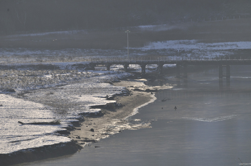
The railway bridge at Glandyfi:
To the north-west, the foothills of the Tarennau:
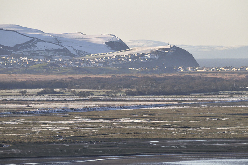
This view I particularly liked, looking down the Estuary with Ynyslas and Cardigan Bay beyond and the A493 and Cambrian Coast line atop one another in the middle ground:

Borth, from a completely different perspective:
By that afternoon, the snow-cover was already thinning:

Not so on Tarrenhendre, of course!
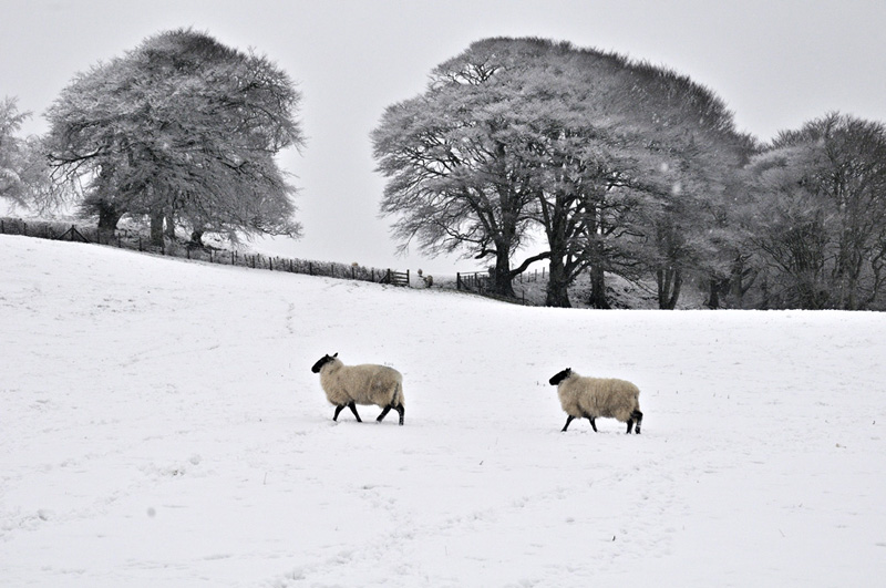
There then followed an incredibly long period during which, it seemed, one warm sector after another plagued us. That means mild, of course - well 10-11C at this time of the year - but an almost endless bout of grey claggy weather during which if it wasn't raining it was drizzling! Such conditions continued right up to Christmas, when a squally cold front cleared it all away. On the 28th I had a tramp around and was delighted to find this brave wee thing sticking two fingers up to the weather:
More snow had fallen on the tops again:
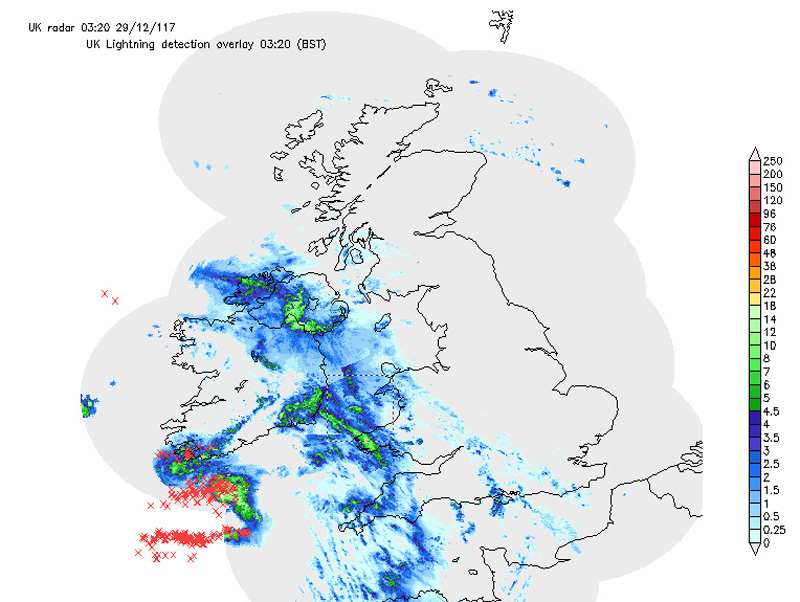
The 29th of December was a day that promised much but did not deliver here. Look at this screengrab of the early-morning radar!
Each red 'X' is a lightning strike - that is a very active storm for wintertime.
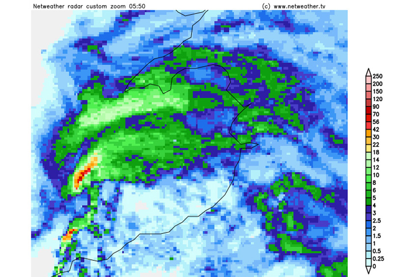
A bit later and this feature was approaching the Welsh coast. It looked so like the 17th November 2016 storm that caused a swathe of severe damage across Wales and the north Midlands and it was heading straight for me! To its south, an S-shaped line of strong convection - a Line-Echo Wave-Pattern or LEWP, with further severe weather potential. But for all the promise, this time there was no especially severe weather but just heavy rain and a blustery wind out there in the darkness. Still, one has to be on the case with these things!
The final flourish of 2017 was provided some time over the New Year - I had not needed the car for a day or two so don't know exactly when this tree came down, but what a near miss! My car was literally feet away from being a write-off!
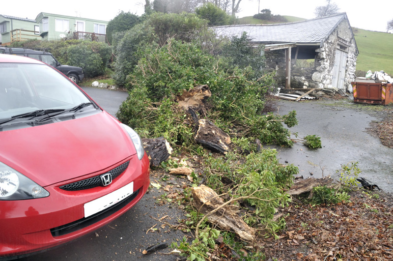
Oh well, that's the next month's firewood sorted!
So it only remains to wish my readers, some of whom might have wondered where I had gone, a great 2018 and here's hoping for some more interesting weather to get engaged with in the coming months. Some decent spring conditions would do for a start. I lost the veg-garden in 2017 - someone bought it - but was offered another straight away: however doing anything on the ground is a no-no at the moment. To do so would do damage the soil as it is so wet. So the digging will have to wait for the time being, at least. Here though I will be free of the bank-voles, whose population exploded at Dyfi Bridge in 2017 - they were destroying mature chard plants by eating their roots from underground. That's serious! How the new owners deal with that is anyone's guess but it will be a huge challenge.
The Welsh Weather & Dyfi Valley landscapes Image-Library - Click HERE
BACK TO WEATHER-BLOG MENU