BACK TO WEATHER-BLOG MENU
The Welsh Weather & Dyfi Valley landscapes Image-Library - Click HERE
With all of the above happening, there has been little time for weather-photography but as I said last year, from now on the emphasis here will be on exceptionally interesting events for the simple reason that I have a lot going on in my life! And it just happened that September 10th 2023 was one such day: a visual feast of cloudscapes from a thunderstorm outbreak that only delivered when I had all but given up on it!
The job is a natural extension of what I've been doing for several years now: writing about science. That in turn is an extension of this lengthy blog, that I've updated regularly since the early 2000s as my writing skills developed. The time and effort that I put into this blog is nowadays mostly diverted into my books and the paid writing - that's just how it goes.
But things still go one in the skies above and in my general surroundings and I do not ignore that! Spring 2023 could not have some sooner. The winter was uneventful here although due to the situation with Dad I was away a lot of the time. Perhaps the weirdest christmas I have ever had was last year: I had travelled over to the Midlands only to find Dad's hospital totally shut to visitors due to a flu outbreak. From then through to early January I hung on alone in the old family home, throwing myself headlong into the work every day. It made the time fly past.
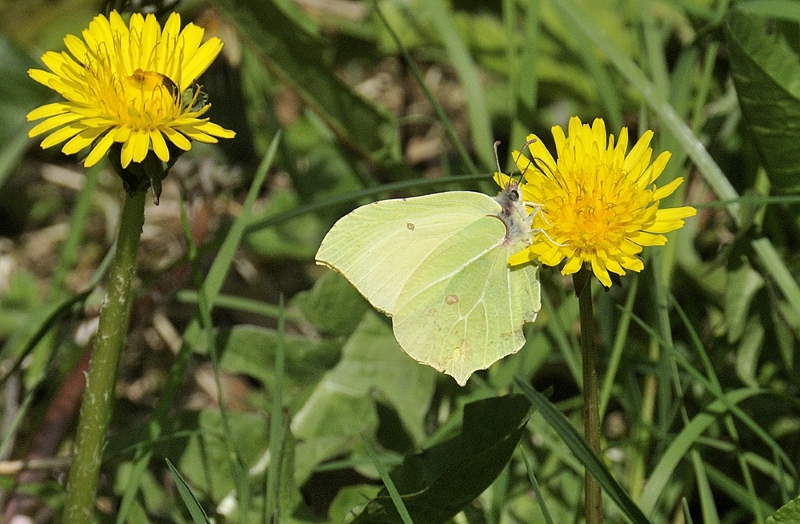
Dad died in hospital in late February and I was by then thankful for having got so far ahead with the work because of all the time-consuming admin that was to follow. Back here, spring brought its usual delights. The place I am staying is a complex of old mill-buildings that have largely gone over to nature and the biodiversity is impressive to put it mildly: it has always seemed to me that if you leave nature to it, it just does its thing. I've recorded 19 species of butterfly here, for example, and that's not by trying that hard, They started to appear in March and April, with plenty of Brimstones in particular:
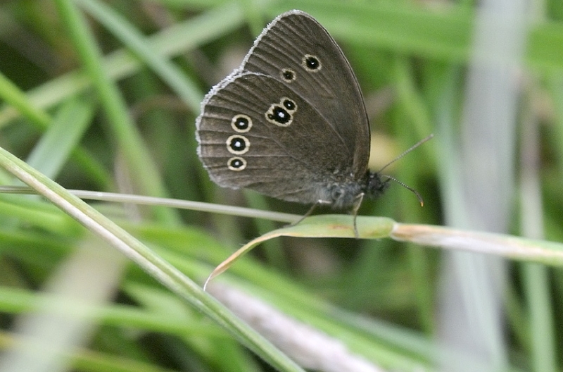
By June-July and into August it was time for the Browns to put in an appearance, including numerous Ringlets:
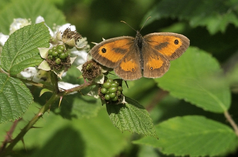
...and a bit later, Gatekeepers..
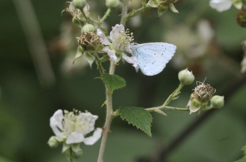
Pairs of Holly blues were also in evidence...
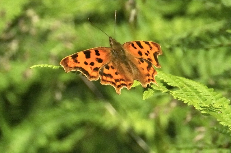
...and on a large patch of flowering brambles, up to a dozen Commas were visible whenever it was sunny.
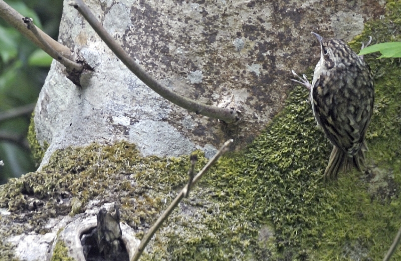
One afternoon while taking a break by
the bramble patch with the camera, I looked up and on a
nearby ash-tree there was a tree-creeper. All happening
here!
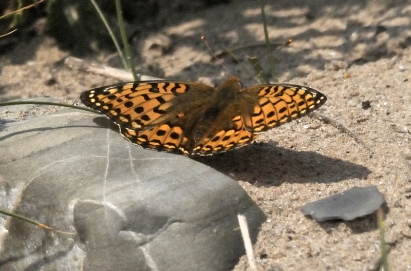
A little further afield, my association with Ynyslas has continued, giving talks about the place, selling the book about it and wandering the beach and dunes. There's one particular area that holds a good population of Dark Green Fritillaries and they were much in evidence one bright and breezy afternoon. Getting a close shot of them nectaring on the nodding and swaying flower-heads proved challenging until one came down for a bask on the bare sand right by me!
So, what about those storms?
There were a few thundery outbreaks in summer 2023, but
the one on September 10th was by far the best. That
Sunday had proved uninteresting because a lot of outflow
detritus was occupying the Mid-Wales skies. I had
virtually given up on the idea of going for a look at a
decent storm and with high tide at half past six I
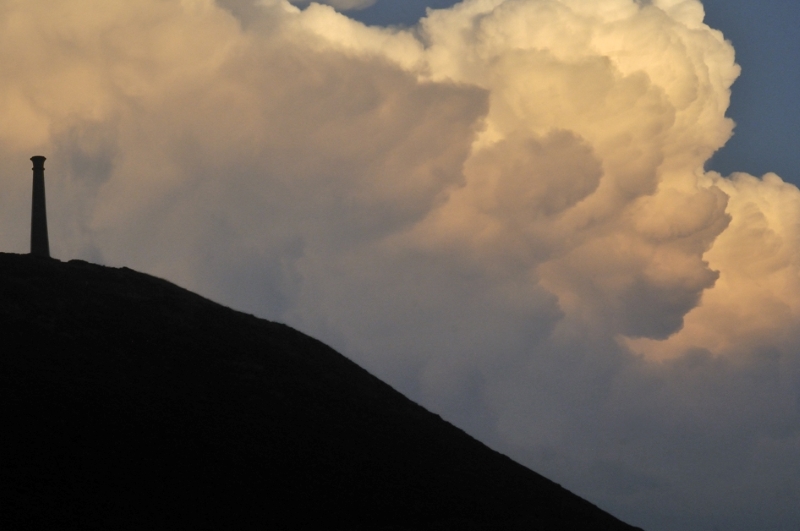
instead went to Aberystwyth to see if there were any
mackerel around. On most recent fishing trips I've
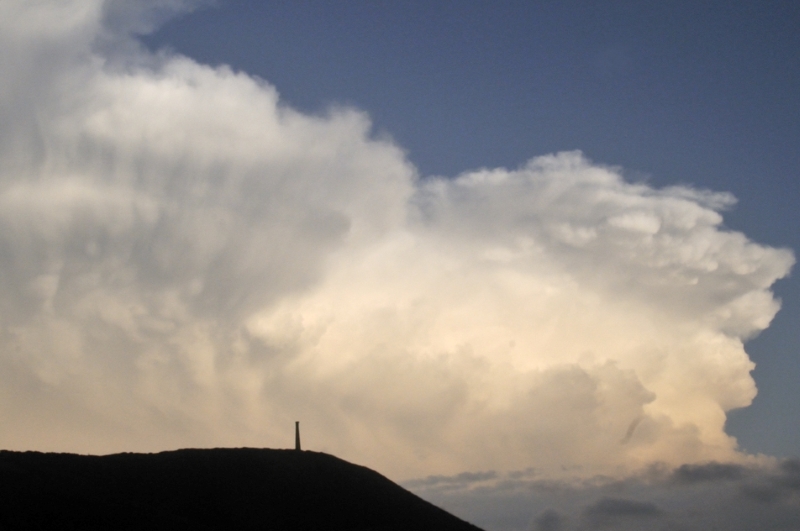
caught a few. I hadn't been there long when the skies
cleared to the east to reveal this:
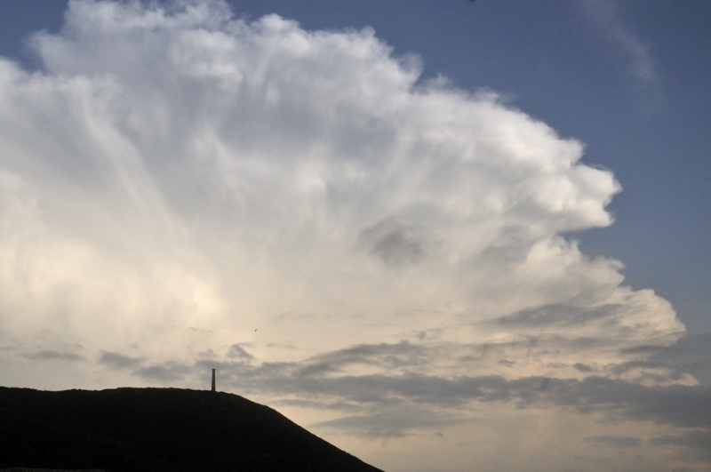
Wow - a spectacular thunderstorm
cloud-top. I lost interest in the mackerel - lots
fishing for them and nobody catching in any case - since
the views were far more interesting!
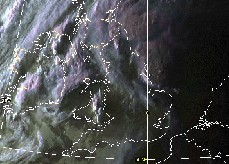
You can clearly see the storm cluster
of which the above image was a part on visible satellite
imagery (below),
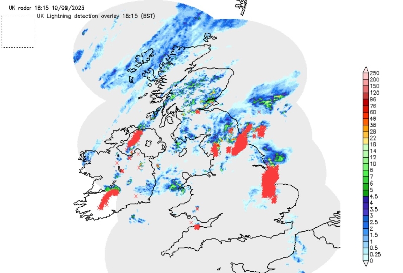
Here's some lightning plots (strikes =
red crosses) showing the progression of affairs from
Netweather. Firstly we have initiation well to the SE of
my position, in southern mid-Wales:
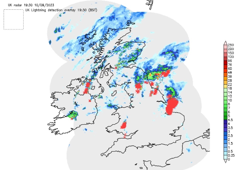
Then the system literally exploded
into life over the following hour, tracking NE through
the heart of Wales
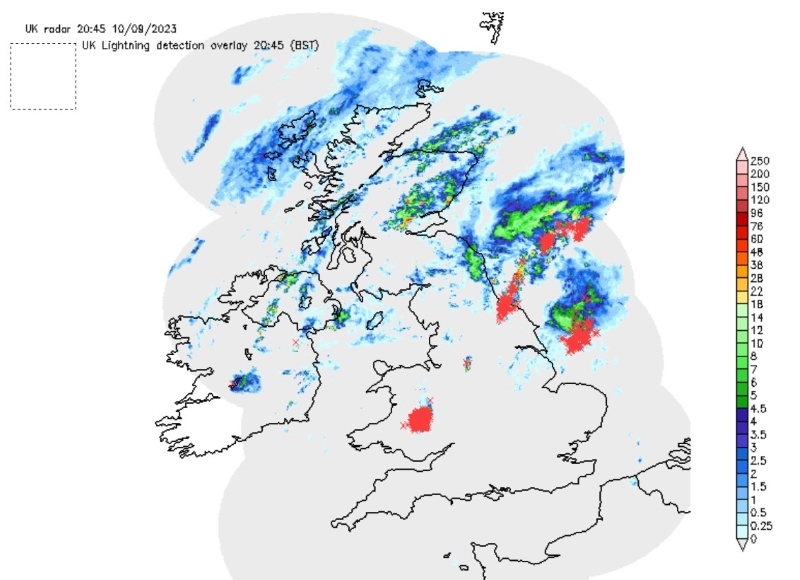
And was still going over an hour later!
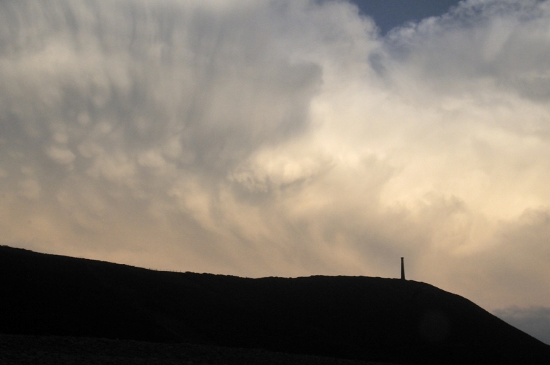
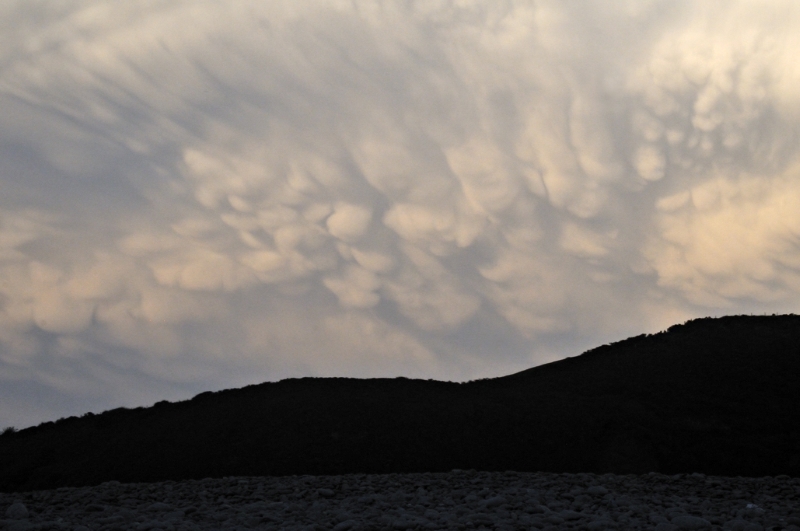
From my vantage point, more than 40
miles from where the storms were overhead, the view was
unimpeded by low cloud, revealing a line of anvils
extending north as new cells grew at the line's southern
end where the warmth and moisture - i.e. storm-fuel -
were most available. Here's a sequence in chronological
order:
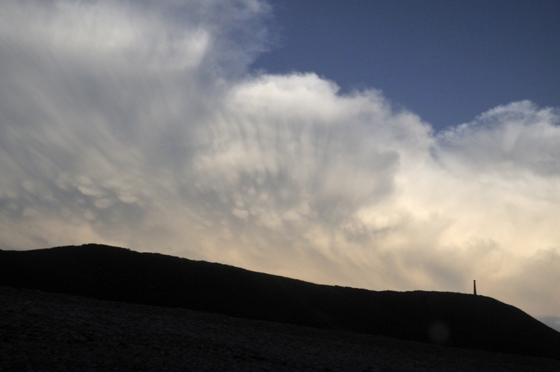
The shot above shows the storm's anvil
cirrus being sheared out to the NW although the steering
flow at the time was from the SW to NE.
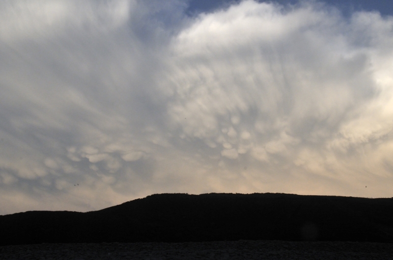
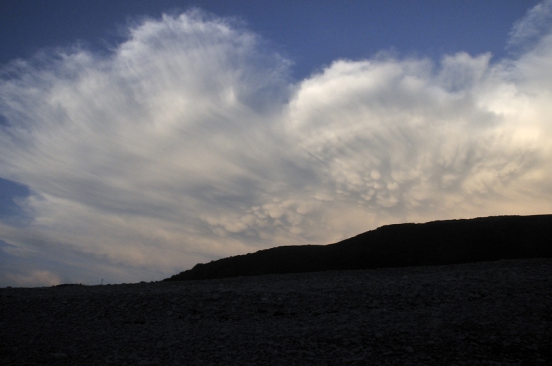
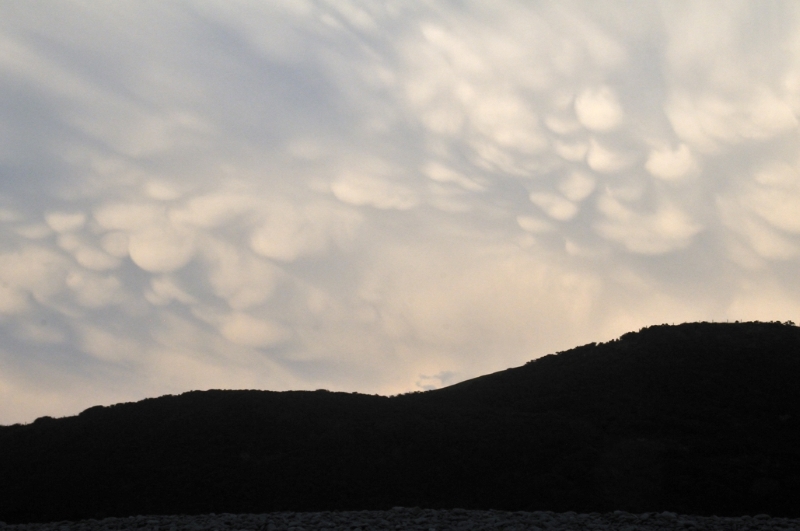
Some of the best mammatus I'd seen for
years!
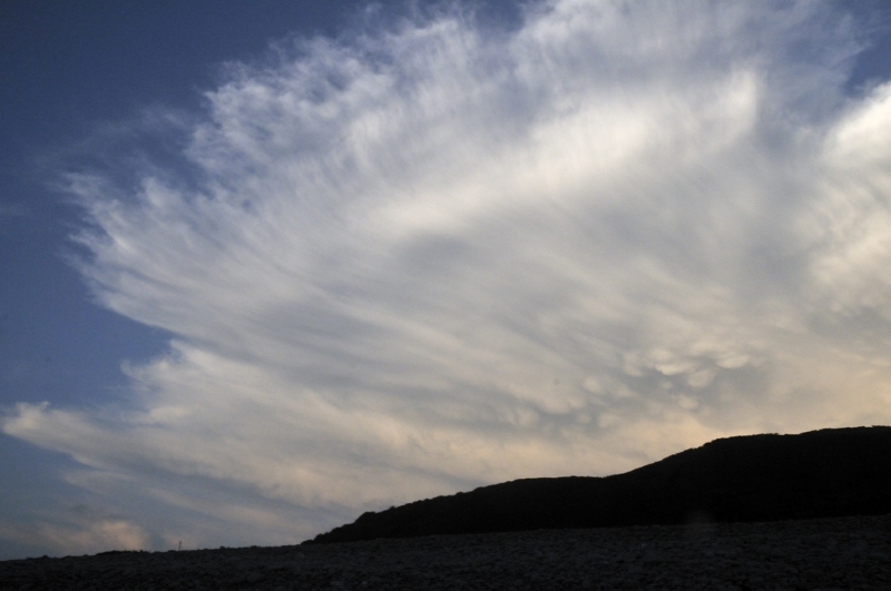
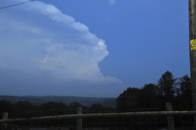
This developing cell at the southern
end of the line was the interesting one from a lightning
perspective because on setting off home after sunset, I
realised it was literally crackling with electrical
discharges.
I stopped on a back-road with a good
view to the SE and watched the show for a while - almost
all of it intracloud lightning but at 1-2 discharges per
second it was awesome. I had none of my other
photographic kit with me so was unable to get a good
tripod-shot - managed to get this handheld one as dusk
was falling. After dark, what a fireworks display! I
just enjoyed it. The lightning was visible all over
Mid-Wales with many videos posted on social media.
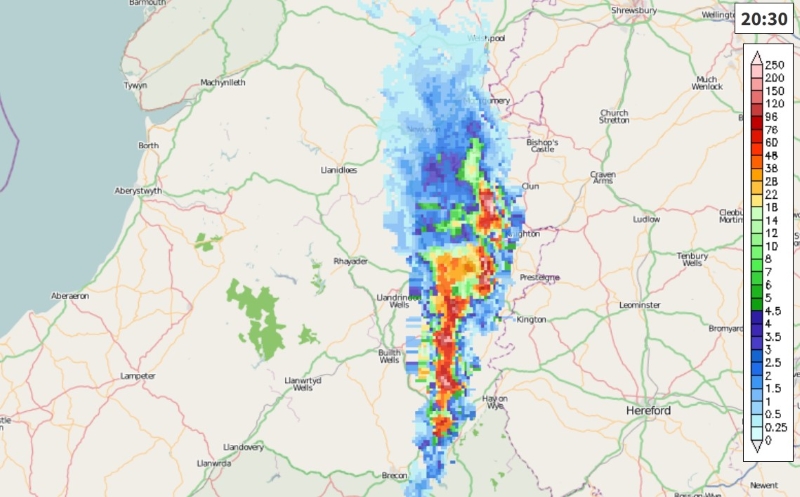
Many people commented on the lack of
thunder. But what they had not accounted for was the
distance of the storm from them. The radar below shows
its position at half past eight - around when the above
image was taken and the lightning started to become more
visible. The storm was over eastern Powys by then -
given that generally thunder can only be heard up to ten
miles from a lightning strike, it's unsurprising this
storm was, to many, "silent".
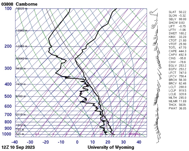
Some idea may obtained regarding the airmass that produced the storm. Below are the midday weather-balloon data from an ascent over Camborne, 170 miles away to the south-west. Several things may be noted. The arrows to the R are wind speed and direction, showing that at the height of the steering winds (~850 hPa - numbers along Y axis in large blue font) the wind is SSW at 15-20 knots, so by around early evening this airmass would have reached mid-Wales.
On the graph, the wandering solid back lines represent temperature (R) and dew-point (L). The numbers (degrees Celsius) are along the X-axis, at the bottom. One can see the temperature steadily falling with increased altitude as you'd expect, until a height of around 250 hPa (numbers in large blue font on Y axis, far L) is reached, when it abruptly increases. This marks the position of the tropopause - where the troposphere ends and the overlying stratosphere starts. One can see from the heights (small font on inside of Y axis) that the tropopause was at around 10,600 metres above sea level at this time.
The tropopause is a strong temperature inversion, so it stops the ascending buoyant air of a thunderstorm updraught: the air simply loses all buoyancy! That's why the icy cirrus making up the top of a thundercloud eventually spreads out sideways beneath the tropopause, creating the familiar anvil-shaped cloud-top, over ten kilometres above Earth's surface on this occasion.
So when people are perplexed about the lack of thunder with this storm, the explanation is that the lightning was too far away for the sound to carry, but was easily visible because it was occurring in the upper part of a cloud that was taller than Everest!
More whenever the next noteworthy event takes place!
The Welsh Weather & Dyfi Valley landscapes Image-Library - Click HERE
BACK TO WEATHER-BLOG MENU