WINTER 2007-8
part 4: Waterspout off Aberystwyth!
BACK TO WEATHER-BLOG MENU
New!
Fine Art Prints & digital images for sale-
Welsh Weather & Dyfi Valley landscapes Slide-Library - Click HERE
Although
February was a mostly quiet month weatherwise, it began with a stormy
start and at 0500 on Monday 4th February I was awoken by a loud rumble
of thunder. The forecast had further thundery possibilities so I had a
morning drive to the coast and watched as odd bits of rather
unphotogenic dark cloud rolled in and gave heavy showers of rain and
small hail.
Visibility was not particularly good so I missed a much more intense
storm rolling across the Bay, heading straight for Aberystwyth - hi-res
Netweather radar for 10.40am below.....
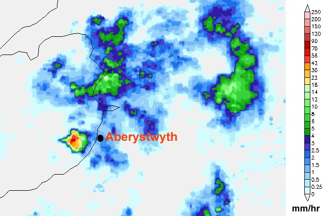 With a 70mm/hr+ core it was quite a monster. I was in the Tywyn area and heading south through murk and rain (blue on the radar plot) at the time and it was only when I got to Aberdyfi at about 11.00 that I could see much. The tail-end of the stormcloud was visible and had that hard, dark appearance typical of a strong updraught-base, i.e. interesting - so I pulled into the car-park alongside the beach at Aberdyfi and got the binoculars on it..... |
|
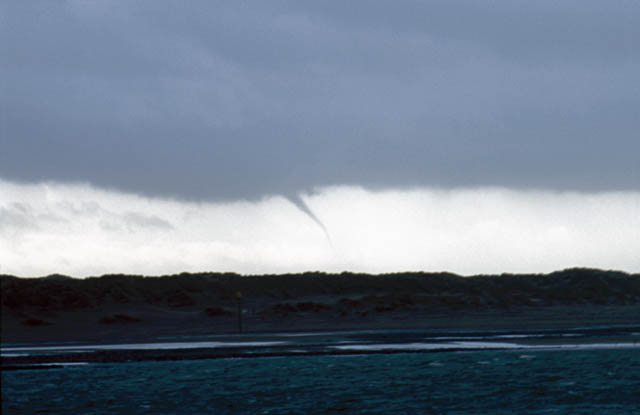
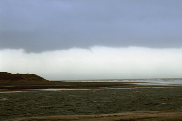 In no time at all I espied a thin funnel-cloud descending from the cloudbase through the drizzle.... |
|
 These are through a 300mm telephoto hand-held in a gale! |
|
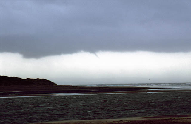
 The funnel then seemed to give up the ghost, but I was still interested in this area of the cloud, and swung the jeep round into a position where I could wedge myself against the door-pillar with the 300mm lens but also get some shelter from the rain..... |
|
 Pretty much as the naked eye would see it. The lowered area may well be a shallow wall-cloud - an area of low-level rotation within the stormcloud, and where further funnel development would be possible - and that's exactly what happened next!! |
|
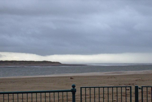
 This time the funnel grew very rapidly and headed towards ground.... |
|
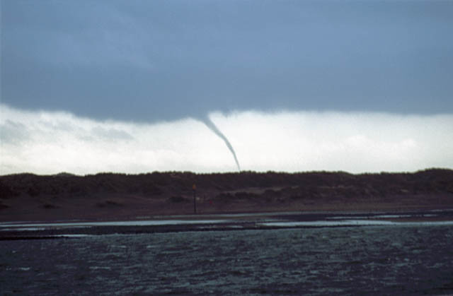 I guessed it was out over the sea, so would be reported as a waterspout. My vantage point meant that the dunes at Ynyslas blocked the view of its very base, but there was no hope of getting anywhere better - the Dyfi Estuary was in the way for starters! |
|
 |
|
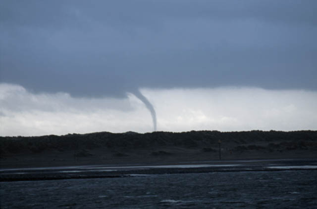 Really quite powerful in appearance now.... |
|
 I think I can see spray in this image being drawn into the vortex, giving it a paler colour.... |
|
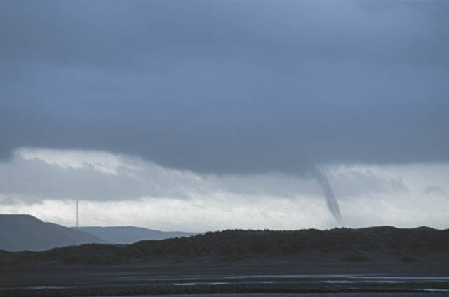
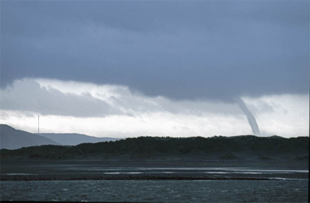 Here, it is getting thinner from above - a sure sign of weakening.... |
|
 ...and here a sheath of spray mostly conceals the narrow central vortex as it starts to retreat back up.... |
|
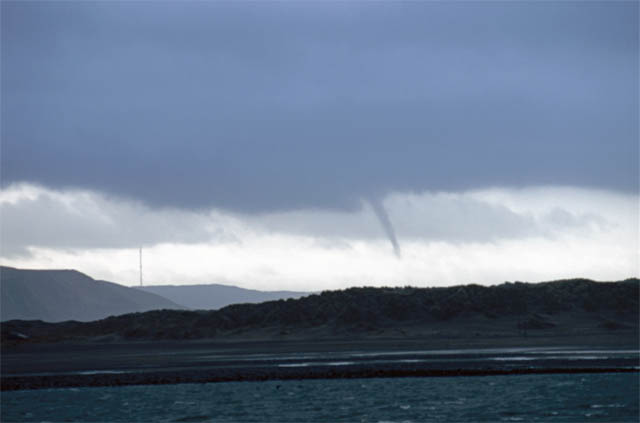 This is the "rope-out" stage, and within seconds it had disintegrated and was no more. My guess was that it was somewhere near Aberystwyth and after emailing a BBC Wales contact this was confirmed - numerous excellent photos were taken as it churned along off Aberystwyth Harbour. Reports that it followed a heavy hailstorm with thunder and lightning are consistent with the visual observations and the radar which showed that heavy shower moving inland from Aberystwyth at the time, weakening as it went (remember that in Winter, warm sea surface temperatures often drive convection, which weakens when a convective storm leaves the sea environment for the land environment).... Another nice early-season catch then! The rest of February has seen little serious convective activity and the same goes for March - traditionally a quiet month for convective storms, albeit often delivering some strong gales, about which more to come soon! |
|
BACK TO WEATHER-BLOG MENU New! Fine Art Prints & digital images for sale- Welsh Weather & Dyfi Valley landscapes Slide-Library - Click HERE |