BACK
TO WEATHER-BLOG MENU
New!
Fine Art Prints & digital images for sale-
Welsh Weather
& Dyfi Valley landscapes Slide-Library - Click HERE
| March
21st arrives and with it the Vernal Equinox and the feeling that Winter
has finally packed its bags and left, with temperatures at last hitting
double figures by day and the sun feeling warm. This is of course
premature as snow and frost can occur pretty much anytime into the
Spring, but a touch of optimism feels like a good idea! Winter has really clung on this year, especially up in the hills, where the dry and often sunny weather has seen me out for a walk or two. Only in the past few days have the tinder-dry anticyclonic conditions abated with some much-needed rainfall - March has been a very dry month indeed, with a spate of big grassland fires occurring. More about that further down: we'll start with a Sunday afternoon stroll on the 7th, when I parked-up at the top of the Machynlleth-Llanidloes Mountain Road, from where this was the telephoto view towards Plynlimon: 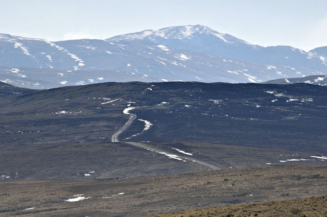 This is all excellent walking country with a network of good tracks and footpaths, one of the latter being well sought-after on the southern flank of Moel Fadian. After a quarter-mile of crunching across frozen bog and tussocks, I picked it up and in no time arrived at the summit trig-point at 564m... 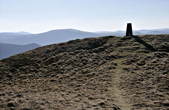 The view south-west from the summit across to Plynlimon is one of the best aspects of the latter mountain: however, with the low afternoon sun in the same direction, all attempts to get a decent image failed miserably! I dropped off the western end of the ridge and skirted around the top of the great ravine of Esgairfochnant, itself black in shadow, bit nicely framing the Tarrenhendre-Tarren Y Gesail ridge across the Dyfi Valley: 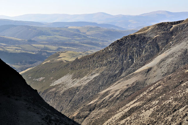 Continuing on across deep-frozen bog and deep heather, I met the path to Glaslyn and walked around it anticlockwise. At its SW end, thin ice-floes had been aggregated together by the constant SE wind of the last few days: 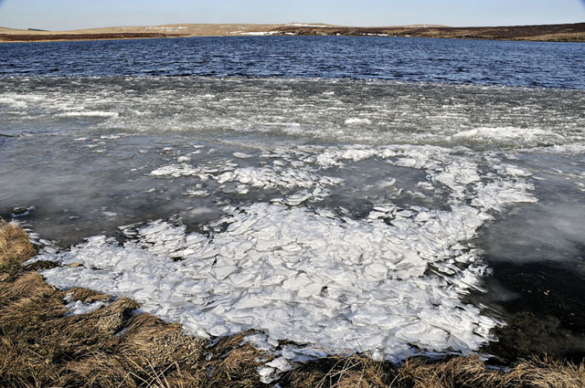 Here's a detail. Wind is a very competent agent for moving and piling up ice: the same thing happens with the sea-ice in the Arctic - but on a much, much greater scale! 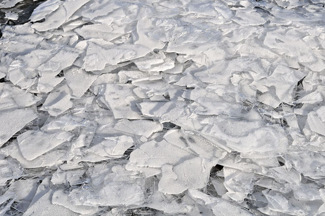 Here's a retrospective of the route, with the summit of Moel Fadian in the distance:  From the exit path from Glaslyn, I followed the main track back to the road. It was heavily banked-up with deep snow in places; fortunately, freeze-thaw cycles had left the snow hard enough to walk over without sinking in.... 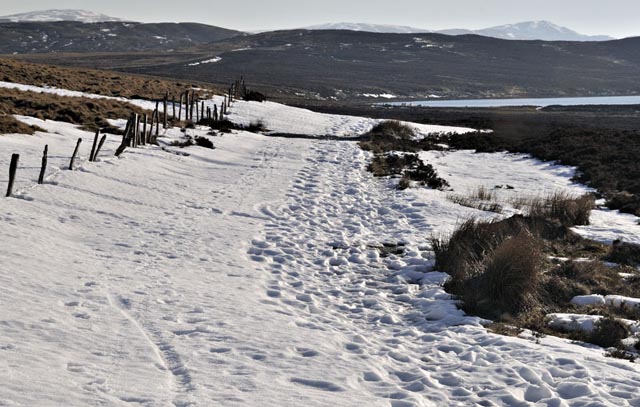 On the 9th, I spotted a few Celandines along roadsides closer to the coast. Normally, these would be everywhere by now - everything is incredibly late following the coldest UK winter since that of 1978-79. I remember those late-seventies winters well - there were two harsh ones in a row. In February 1978 I had a silly mishap on the Glyderau in Snowdonia: hopelessly ill-equipped (one ice-axe, no crampons, crappy sheepskin mitts) I was ascending Bristly Ridge where an awkward rock-step demanded more tactile ability than the frozen-solid mitts permitted. So I took them off and whilst trying to pocket them managed to drop one. The move made, I arrived at the top of the ridge with completely numb fingers. It was so cold, with iron-hard snow and a 60mph Easterly wind, that earlier in the day I had discovered my plastic bottle of orange squash, deep in my rucksack, was completely frozen solid. As the circulation returned to my fingers, with it there came a pain that can accurately be described as akin to putting your hands into a flame and leaving it there! Eventually it subsided, but in the days that followed the skin on my fingertips split all over the place and a visit to the GP revealed the first case of frostbite he had ever seen (he was in Dorridge, a rather sleepy West Midlands village-cum-suburb!). Fortunately, it was the only case of frostbite I have had, too! Before venturing into the higher mountains again in winter conditions, I had made sure that I had amassed the correct equipment for the job. Believe you me, if you ever get frostbite, you'll do everything in your power to avoid getting it again! 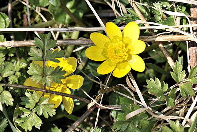 Dry conditions in the late Winter-early Spring period are the time when controlled burning of heather, gorse and grass is undertaken - before the nesting season gets underway. Again on the 9th, I watched this burn being done near Abertafol:  Here's a zoom-out. It is not without attendant risks though as the dead vegetation and litter on the ground are all tinder-dry. There have been a number of larger blazes in recent weeks: on the 17th there was a major blaze near Caersws that lit up the night sky - I was coming back from Newtown and was cursing not having a camera with me - according to reports I have read, 38 firefighters attended that incident.... 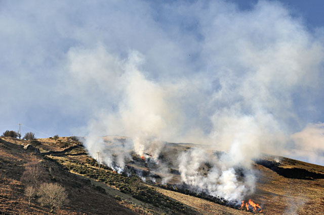 On the 14th, another Sunday stroll was mooted: this time I decided on a longer route - out to Bugeilyn, where I found a beautiful arrowhead last summer amongst the old peat-diggings. Had the frost-heave brought any others to the surface? There was only one way to find out! Here's the view down to Bugeilyn farm with the lake beyond: 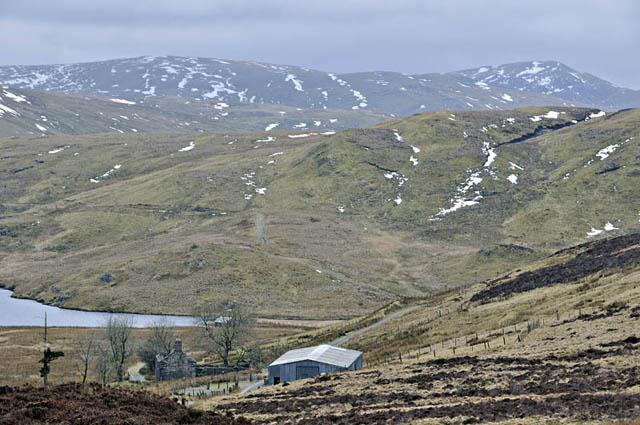 The arrowhead-search merely served to confirm that they are an extremely rare find! What was interesting, though, was the permafrost-like layer of ice, several inches down in the peat, and a testimony, on a mild day, to how deeply Winter has bitten up here in the hills. On my return I followed Bugeilyn's western shore, passing the out-take that sends water down via a tunnel to Nant-y-Moch - these lakes all being part of the Rheidol hydro-electric power station's supply: 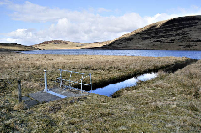 By the time I reached the northern end of the lake again, it was a beautiful sunny afternoon and quite warm out of the stiff nor-westerly breeze..... 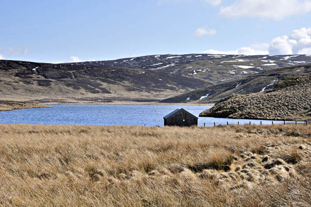 Heading back up past the ruin of Bugeilyn farm with its attendant grove of weatherbeaten ash and Hawthorn.... 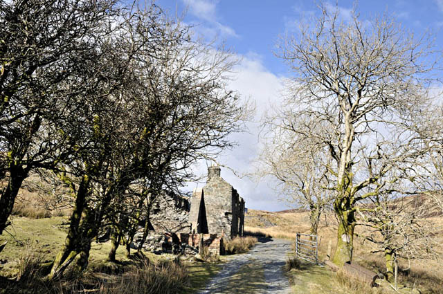 Beyond the farm, the track passes into the Glaslyn Nature Reserve - one of Montgomery Wildlife Trust's reserves, encompassing a mixture of heather moor and regenerating moor where there was improved grassland. It's being allowed to go back to nature. I decided to head for the edge of the escarpment that looks down into the Dyfi Valley: difficult-going in the summer with only sheeptracks and deep bogs, the fact that the ground was still frozen made life a lot easier. I headed out for the indistinct top of Foel Esgair-y-llyn, passing this minature pool en-route, with Moel Fadian in the background....  Foel Esgair-y-llyn throws a graceful ridge down northwards from its top, a feature that dominates the view looking up towards the escarpment from the mountain road. Here's the view down into the valley, with Tarrenhendre, Cadair Idris and Dyfi Forest forming the background. But the main reason to visit this top was the view back towards the ravine of Esgairfochnant. It was in shadow at this point but eyeballing the clouds overhead I felt sure it would become nicely-illuminate in due course, so getting out of the wind, I sat down in the heather and waited.... and waited... 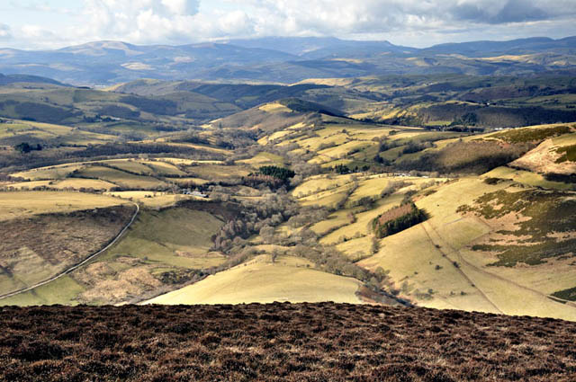 Finally, after over half an hour, I managed to get this shot in dappled sunlight:  The whole ravine is not visible in the above image..... 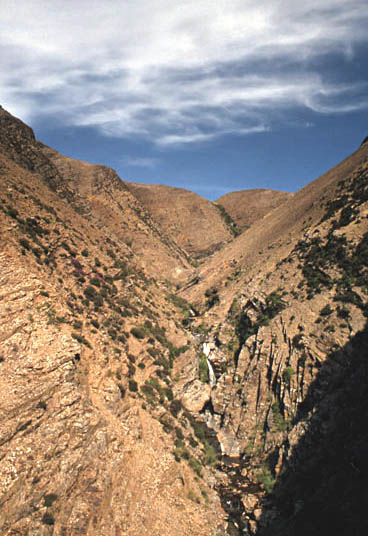 This is one taken from well down in the ravine, around about 1994. A mate and I explored it top to bottom, abseiling the occasional rock-step and sliding on scree/clattering across disintegrating slabs for the remainder. It's a most unusual feature for Central Wales, but its formation has been due to the shattered nature of the host-rocks - faulted mudstones of the lower Silurian Cwmere Formation. Most slopes are so steep and so mobile that nothing much has managed to gain root purchase on them. The rusty colour is due to the high pyrite content of the mudstone - this weathering to iron oxides. As an idea of scale, the highest gully visible in this image takes two 50m fixed ropes to climb back up - much easier with jumars to pull on as everything underfoot is disintegrating and sliding back down! Here's a zoom-out with Glaslyn to the R - which is where I headed for before returning along the track to where I'd parked. 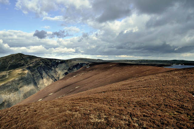 Two excellent walks, then: in the days since, several of us have been extremely busy organising the launch of our Transition Initiative, which was a very enjoyable event held at Y Plas, Machynlleth, on March 18th. Talking of which, my personal Transition Project #1 - the veg-garden - will be OK to plant by early April - several weeks later than last year but with the soil needing to warm up a bit, that's no bad thing. Sure beats having everything coming up anaemic-looking and stunted! |
|
BACK TO WEATHER-BLOG MENU New! Fine Art Prints & digital images for sale- Welsh Weather & Dyfi Valley landscapes Slide-Library - Click HERE |