BACK
TO
WEATHER-BLOG
MENU
New!
Fine
Art
Prints
&
digital
images
for
sale-
Welsh Weather
& Dyfi Valley landscapes Slide-Library - Click HERE
| It's
May 10th and all gardeners in the vicinity are feeling a lot more
relaxed about life after three days' worth of thundery downpours. It's
been a phenomenally dry Spring up to this point and although we need
more rain again, the past weekend has really helped with over an inch
falling in the Machynlleth area. The convective activity provided a few chances to get out with the camera with some success (images to come below); prior to that my attention was focussed on keeping the garden going. I've upgraded my rainwater-collector with a butt I picked up at the local recycling centre for a quid - the one in the middle - which after the weekend is a third full already. This is a surprisingly effective method of harvesting rainwater if you have a sloping area. Part-burying the butts helps with the gradient but also importantly reduces evaporation in warm weather. The only other things you need are some bits of old hosepipe, something to bodge a round hole near the top of each butt and some plumbers' putty to seal things up. When full, this will hold one hell of a lot of water! 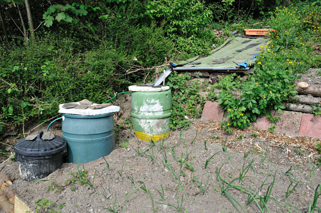 Although the weather has been dry, the garden has managed surprisingly well. Given that reeds and sallow naturally grow there, I suspect there is a reasonable supply of groundwater - these are not things that will establish themselves on dry banks. As a consequence everything is coming on well. It's been a great Spring for butterflies. The resident Commas, Peacocks and Tortoiseshells are back, as are the Speckled Woods: 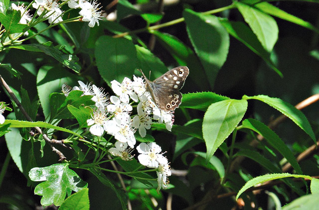 This one is mopping up water on a recently-watered patch: although the stones have dried out, the soil is giving it enough.... 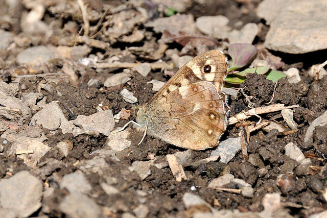 Orange Tips have been there every day - the male: 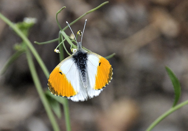 ...and the female. Both seem to prefer wild flowers, of which there are now plenty, with Cranesbill blooming around most beds and Red Campions now well-established in places.... 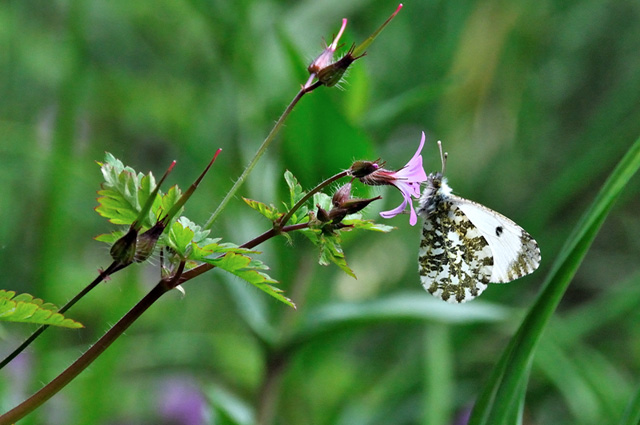 Green-veined whites also like the Cranesbill 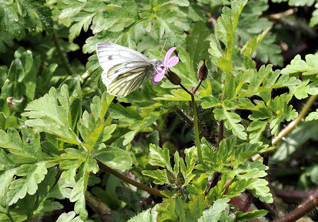
A first since I started the garden - a Small Copper. 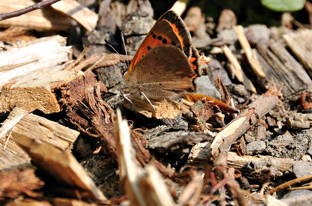 All welcome (apart from the Cabbage Whites, but they've not shown just yet).... The vicinity of the compost-heap is home to several slow-worms which like to bask just under the lid and enjoy the heat given off by composting plant-debris.  During one of my storm-photography sessions at the coast, I came across plenty of seaweed, giving the compost-heap a big recharge. Can't beat seaweed for composting. The slow-worms don't seem to mind particularly - they come back every year once the nights turn colder....  The dry spell culminated in a week-long blast of warm Easterly winds of exceptionally low humidity. One afternoon the winds could actually be seen to be whipping up clouds of dust - winter flood-silt - from the pastures near Dyfi Bridge. I dared not have any weed-burning sessions for fear of the bone-dry forestry above the plot. Finally, the Atlantic started to win the airmass-battle and the winds veered south-easterly and then southerly. Now, with the source of air not from the dry Continent but from the SE Atlantic, warmth and moisture really cranked up. On the evening of Friday 6th May, the first plume destabilised, bringing spectacular elevated thunderstorms to the southern UK and bands of thundery rain affected many areas overnight. A further injection of warmth and moisture arrived on Saturday 7th and this was forecast to be convectively unstable so that afternoon, I headed up the Machynlleth-Llanidloes mountain road to see if much was happening. From the top of the pass, the air was a mass of broken convective cloud, here viewed over the twin Bronze-age cairns of Carn Hyddgen: 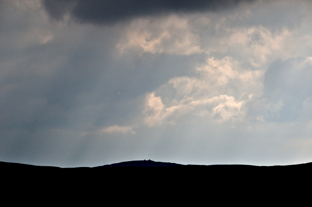 Wave upon wave of convective towering cumulus passed through, the abundant wind-shear evidenced by the R-wards tilt of the towers. There was a very real chance of severe thunderstorms should any cell actually get it together... 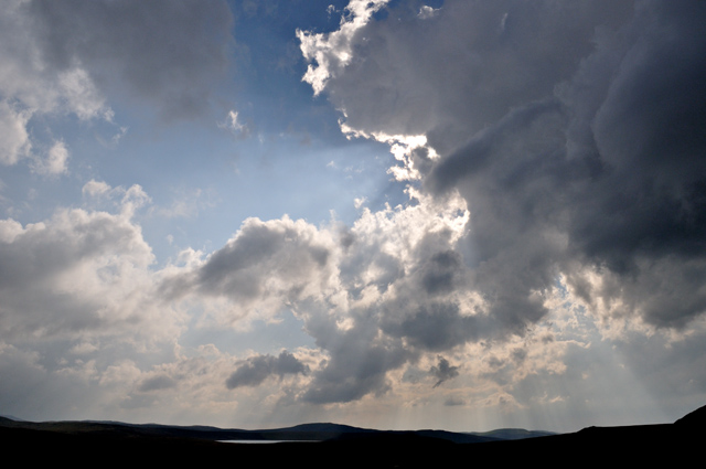 Storms eventually fired late afternoon, becoming electrified as they moved up into North Wales during the evening. This massive, cauliflower-shaped cluster was one of them at an early stage of development, but they were too far away through the haze for detail to be seen.... 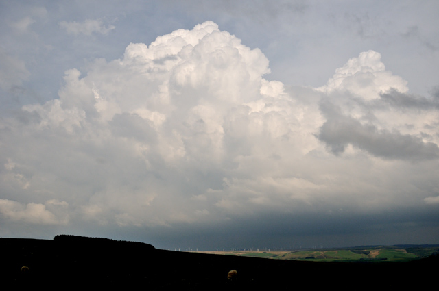 That night, an upper vorticity-maximum swung in from the SW, causing large-scale lift within the plume, with further bands of heavy, thundery rain resulting (hoorah!) and finally a cold front moved in from the west, clearing the remains of the plume away eastwards and introducing a maritime airflow, with much better visibility and still with plenty of convective instability present as cold upper air pools moved through. On the afternoon of the 8th, with masses of showers and some thunderstorms plotting out upwind (to my south), I headed to Borth (with current fuel prices, all my storm-intercepts have to be strictly local): on arrival there was little going on and what cells were heading through were in a state of decay. I went and looked for seaweed instead!  Half an hour later the scene had changed dramatically, with a very heavy cell out to sea: 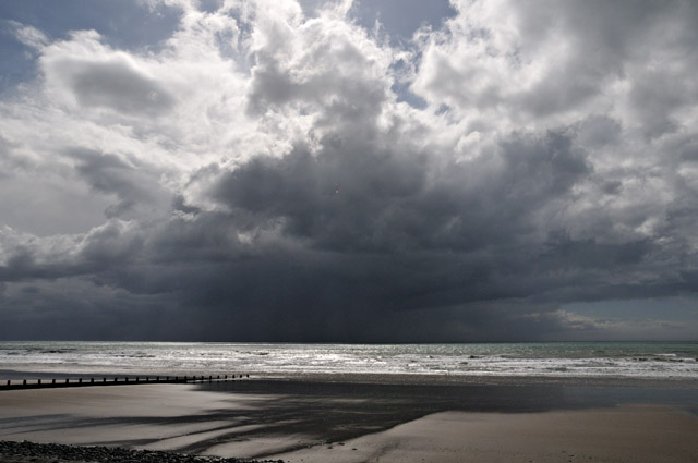 Here's a simple telephoto: I like the contrast between the clear sunlit sea and the impenetrable gloom of the storm behind: 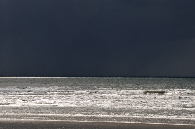 Coming along from the south, a clump of towering cumulus clouds had started to glaciate i.e. their tops are turning into wispy cirrus, composed of ice-crystals. These were all shortlived storms, with tops going straight to fluffy anvils, as opposed to the solid-looking cloud-tops that you get when storms really mean business... 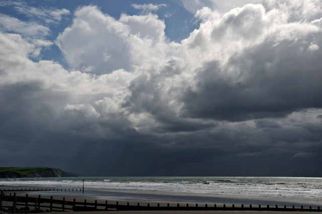 However, the storm still had a lot of torrential rain coming out of it! Here's a zoom-in to the south of Borth. The curved slabby rock-face L is known as Harp Rock. 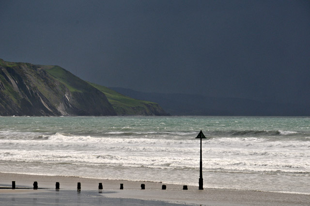 Out due west at the same time, rain-shafts indicated another convective cell had matured and was raining-out: 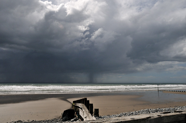 As the cell to my south also matured and rained-out, it sent a gust-front moving out sideways towards me:  Here the gust-front is very close. The car-radio was at this point making a crazy amount of static-noise - a clicking, popping sound, indicating the environment to be pretty highly-charged, although there were no strikes associated with this storm. 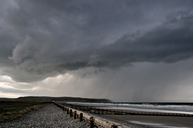 Over it came, followed hard on its heels by lashing heavy rain that cleared the beach pretty much there and then. Beyond, another gust-front was following, this time from a completely decayed cell to the SW: 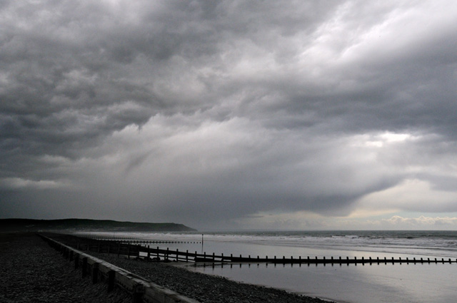 In view of the lack of action now evident upwind, I followed the outflow-boundary marked by this gust-front inland, where it collided with a developing updraught. Outflow-boundaries are like little cold-fronts, so they lift the environmental air ahead of them, and can cause further storms to fire up or accelerate the process with developing ones. Outflow meets inflow - and off it kicks: 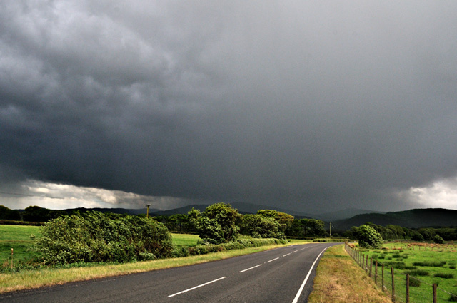 I followed this system as it tracked across the hills towards Machynlleth. By the time I got out to the golf-course on the eastern side of the town, it was spitting out lightning bolts every so often, the thunder rolling around in the way it always does in hill-country, echoing from one side of the valley to another. A good end to a stormy afternoon! The unstable conditions continued on Monday 9th, with the ingredients for thundery weather of a more organised nature in place, as suggested by Paul Knightley's forecast on UK Weatherworld: "Large upper low to the west of the UK is pretty much vertically stacked with surface low. Numerous vorticity maxima are rotating around the system within the well-mixed returning polar maritime airmass. Deep layer shear is generally fairly low, especially across Eire/N Ireland /20-25 knots/. However, low-level shear is reasonable /15-20 knots/ across much of the risk area, hence a chance of tornadoes. The best chance of more organised convection, with a somewhat higher wind/hail/tornado threat appears to be from SW England through Wales and into parts of the Midlands/northern Cent S England. Here 0-6km shear of 25-35 knots is sufficient for organised structures, perhaps with weak mid-level rotation. Multicells and bowing structures are possible, with a small chance of brief supercell-type structures. With reasonably low LCLs and 0-1km shear of 15-20 knots, isolated tornadoes are also possible. If cells become more organised, a small area may be upgraded to a WATCH." Periodically checking the Netweather radar, my eye was drawn to a multicell line that was moving up through Wales (below) - the brightest colours indicate the heaviest rainfall rates. I set off up the mountain road once again at 1200 for a brief but eventful intercept.... 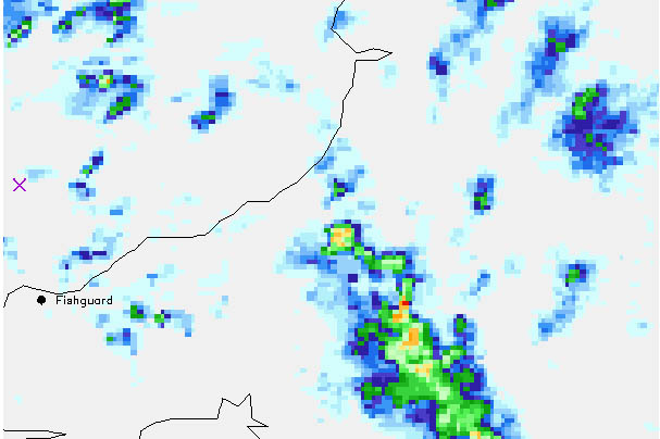 Here, the anvil cirrus dominates the skyline - it stretched from left to right as far as the eye could see. I continued on uphill.... 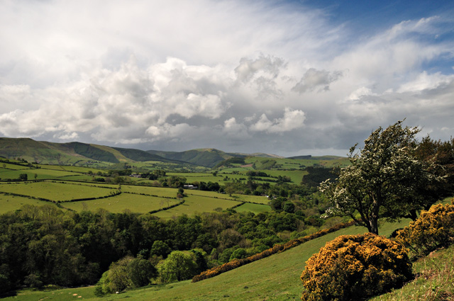 By the time I reached the top of the pass, the multicell line was coming up the southern part of the Plynlimon massif, the summit visible R.  As it got close, I headed a little down the northern side of the pass again and watched as the northern part of the line surged forwards over Machynlleth, obscuring the view like a curtain slowly being drawn. A few flashes of lightning were visible through the murk....  Continuing down a little more, I got to a section where the road follows an exposed ridge, and suddenly the wind hit: it was as if a high-velocity hosepipe was being jetted at my windward windows and the vehicle rocked alarmingly. I got in behind a banked section for a bit of shelter and took this through the windscreen: the small trees were bending almost ninety degrees at times! 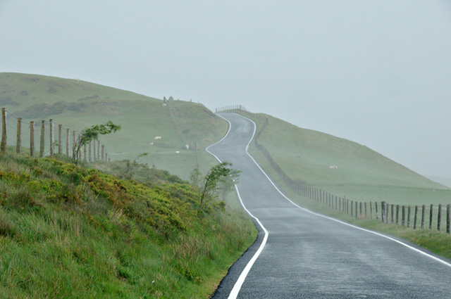 These were some of the strongest straight-line winds I have been in. Organised multicells like this can certainly generate pretty severe conditions! High cloud from the anvil was streaming away northwestwards and I headed back to Machynlleth to get past it. This was the view from the golf-course, with lots of small mammatus on the anvil underside indicative of the strong turbulence associated with the system:  In this satellite-image, taken at 1354BST, the anvil outflow can be seen streaming away from the line of storms (the solid white "blobs"). By mid-afternoon the outflow covered almost all of Wales, stifling convection until it cleared in the early evening and further storms trundled across East Wales, some quite violent - but out of my range. 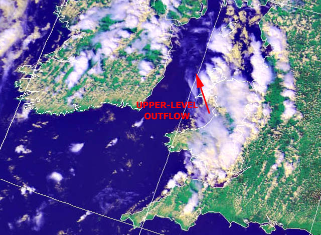 The low pressure system that brought the thundery showers remains out in the mid-Atlantic but is slowly drifting north-east, so it will continue to dominate our weather for the rest of the week with further showers continuing to improve the groundwater situation for gardeners. I don't think anybody is likely to complain about that - well if they do I think they'll find themselves being ignored! |
|
BACK TO WEATHER-BLOG MENU New! Fine Art Prints & digital images for sale- Welsh Weather & Dyfi Valley landscapes Slide-Library - Click HERE |