BACK TO WEATHER-BLOG MENU
New! Fine Art Prints & digital images for sale-
Welsh Weather & Dyfi Valley landscapes Slide-Library - Click HERE
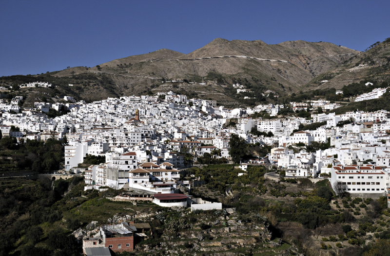
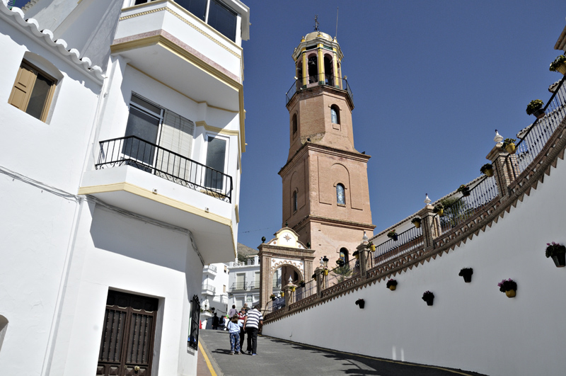
The road up to the Square in Competa. The Square is a popular meeting-place for locals and visitors alike...
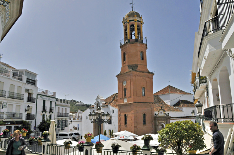
It boasts several cafes, all vying for trade with their Menu del Dia, this being two courses and a drink all for between 7.5 and 9 Euros. That means you can get a tasty salad plus a meat/veg course plus a pint of San Miguel for a fraction of what you would have to hand over in the UK. This became a favourite end-of-walk destination for me! Competa also has plenty of shops and a bustling Saturday market where it can be quite difficult to leave a stall without kilos of extra fruit and veg, all of first-rate quality. The one adjustment is of course to remember that many shops close over the siesta, between 1400 and 1700. One gets used to the idea quickly enough.
Out in the Campo, dwellings are accessed via single-track roads, most of them tarmac these days. In places, they feature impressive drops off their sides: they are not for faint-hearted drivers and even less so for routinely careless ones, who will see their life-expectancy dramatically lowered...
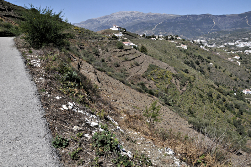
This shot of the Campo is fairly typical of the district. Soils are very thin and stony, which is probably why most growing is centred around trees and not delicate things like spinach or parsnips. Most of the area seems to have been terraced since time immemorial. It's a bit like my sloping veg-garden back home, but on a much steeper and gargantuan scale. Vines, olives, almonds, citrus fruits and avocados all feature strongly and those with just a few vines or olive trees can take their produce to a local co-operative where a commensurate quantity of olive oil, wine or whatever can be received in exchange.
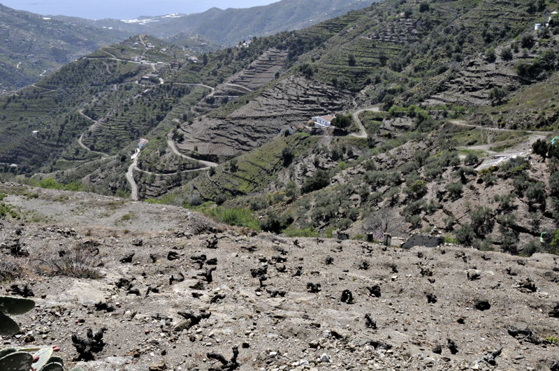
Mornings at this time of the year often see growers burning their brash in preparation for the coming season. Livestock are less prevalent, with a few lone goatherds tending their flocks and very few sheep - completely unlike Mid-Wales.

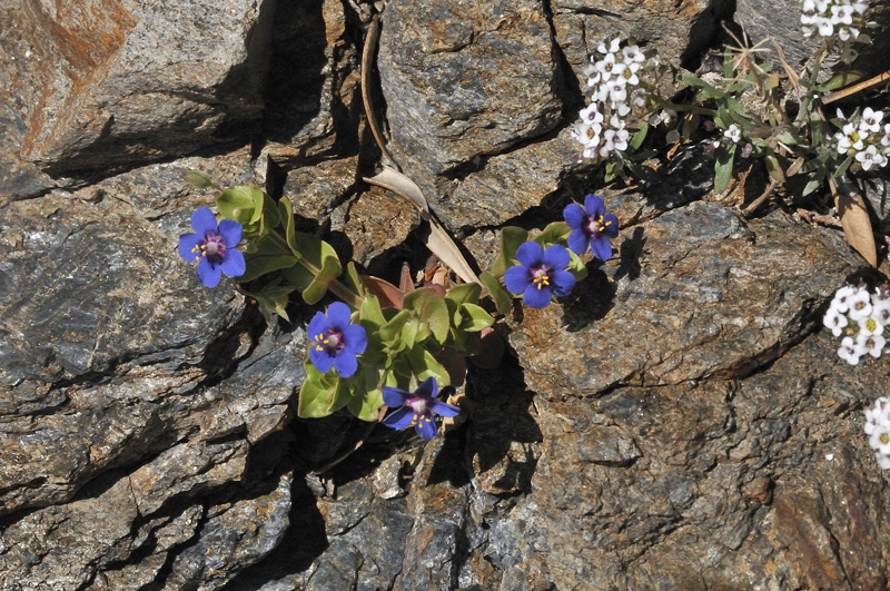
Wildflowers of all imaginable colours abound. It took a while to identify this one - looking like some kind of weird gentian, it is in fact an azure-blue variant of Scarlet Pimpernel that is found around the Mediterranean.
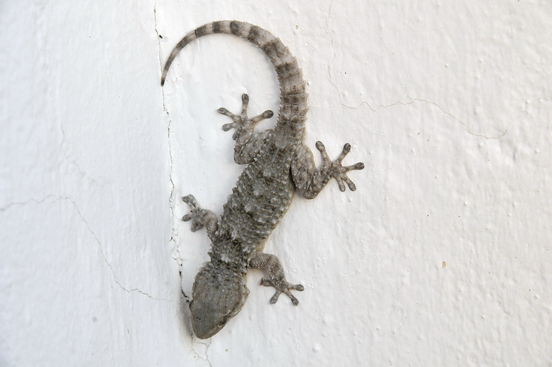
Wildlife is abundant on the Campo. It includes several species of reptile, including of course the Gecko...
Insects abound and their abundance and diversity is something one rarely meets with in the UK. This beastie is an Egyptian Grasshopper...
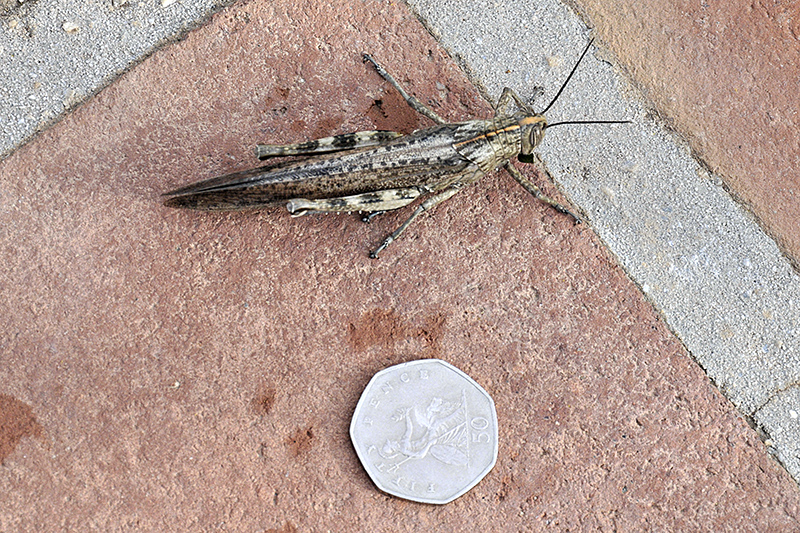
The same critter face-on...

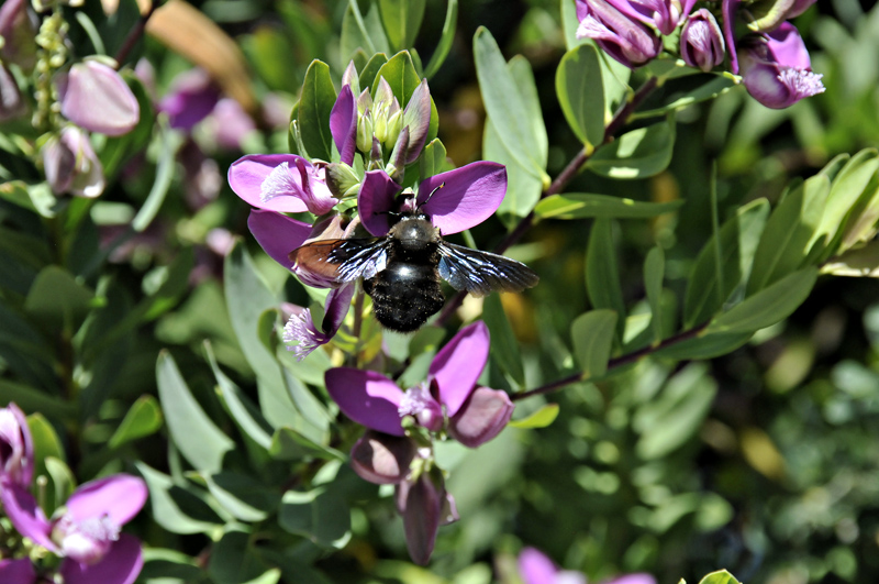
Butterflies abound too, but are fiendishly difficult to photograph, fast-flying across the country and settling but rarely. Swallowtails and Clouded Yellows were sighted several times a day. Bees, including honeybees, are present in healthy numbers, swarming over the newly-opened orange blossom. They were accompanied by a range of other species including many of these large bumble-bees with metallic blue wings. The place is an entomologist's paradise. Other observations of arthropods included various centipedes including the weird-looking Spanish House Centipede which I found in the bath one morning. It has a bite like a bee-sting, apparently. Assuming that it was stuck, like a house-spider, I went out, planning to photograph it later. We never saw it again!
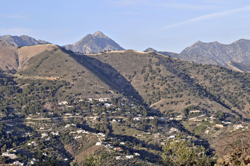
More wildlife shots to come in the next part: now I'll move onto the landscape. This huge whaleback of a mountain, dominating many views of the Competa district, is La Maroma, over 2000 metres high and the westernmost mountain of that height on the Iberian Peninsula. It's the one mountain most of the locals climb at some point, although the ascent is said to be arduous. Many climb it in the snowy conditions that pay a brief visit each winter. I noted that it is one of those mountains that tends to brew its own weather, with low cloud-banks developing over the ridge and obscuring visibility on a frequent basis. One would need a better understanding of local weather-patterns to pick a day for a completely clear ascent. The views from the top are said to be spectacular.

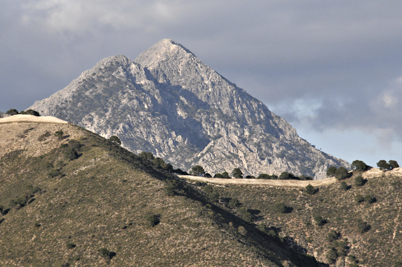
Much more enticing, though, is Cerro de Lucero, or simply Lucero on some maps. This spectacular, triangular rock-peak of 1779 metres draws the eye wherever and whenever it is sighted and is certainly on my to-do list now I've found a route to its other side, where there is a good path to the summit.
Here's a telephoto of Lucero, lit by the setting sun.
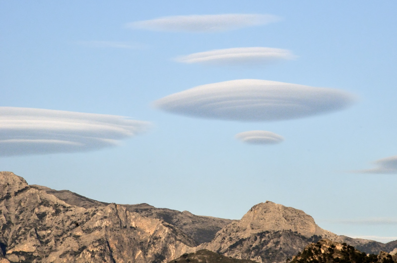
Weather enthusiasts might think it's all boring blue sky here (which was welcome after a dreary damp winter in Wales). They would be wrong. The weather is surprisingly varied. Certain rules-of-thumb apply: it's almost always hazy over the Mediterranean and when it rains, which isn't often, it does so with a vengeance. But whether I just got lucky or whether this is representative, I found good light and cloudscapes on many occasions during the two weeks I spent there. Just on the second night, we were treated to an amazing display of lenticular clouds over the mountains of the Sierra Almijara to our north-east:
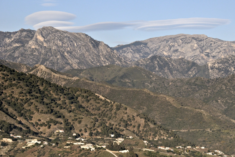

I got around the creeping shadows of sunset by cropping to panorama format:
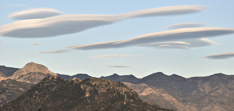
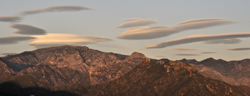
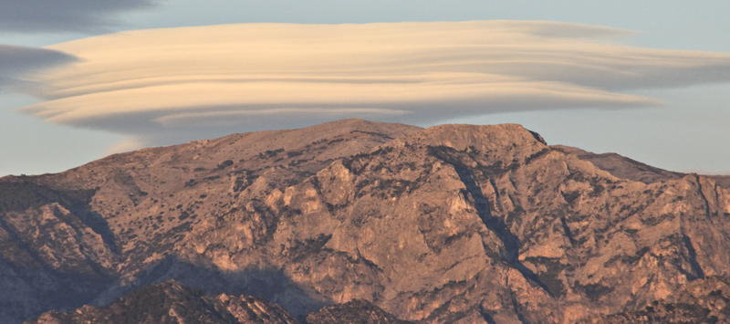
The dominant peak here is Cerro Cisne, the only one in the district whose summit requires rock-climbing to reach.

In some of the images further up-page, readers may have noticed a somewhat bare-looking set of hills in front of Lucero. These constitute the third type of country: the foothills of the Sierras at up to 1100 metres high (the fourth being the really high, rocky ground of the Sierras themselves). However, this group of hills is particularly interesting because it constitutes a regenerating ecological blank slate.
The climate hereabouts is arid, with significant rain a rarity outside of winter and spring. That in turn means that the risk of forest fires is often severe and one such fire of massive proportions broke out in late June 2014. These hills, with their pine forest and shrubby undergrowth, went up like a torch, with hundreds of emergency personnel fighting the blaze and hundreds of people evacuated from their homes. It took several days to put the fire out, by which time the area had been devastated.
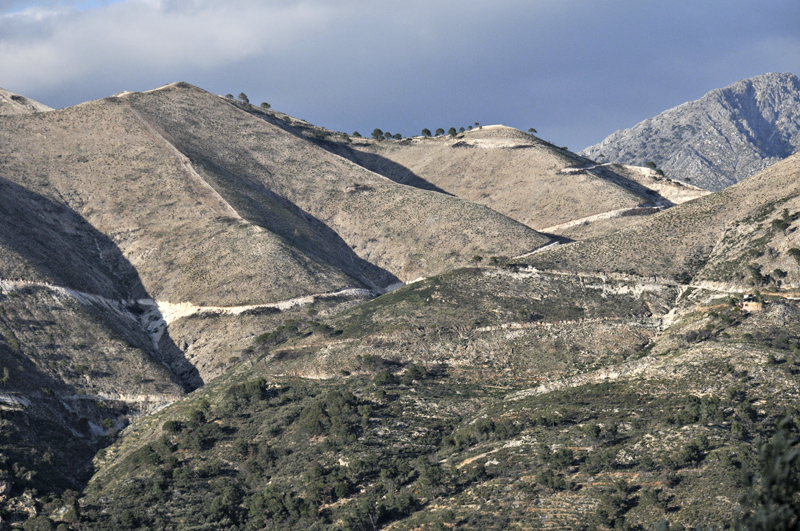
I was intrigued to see if it had recovered, just twenty months later, so one morning I set off from Competa to investigate, walking up the system of forest-roads that form a useful network through the area. On the way I passed a typical watercourse: dry most of the time (like most of the rivers, too), but with fans of debris deposited by the occasional flash-floods that are another feature of the local climate...

The route gains height steadily, passing a scattering of pines that survived the blaze....
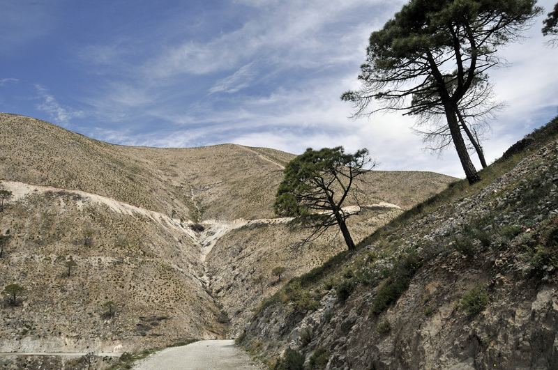
Approaching the mountain pass called Puerto de Colado....
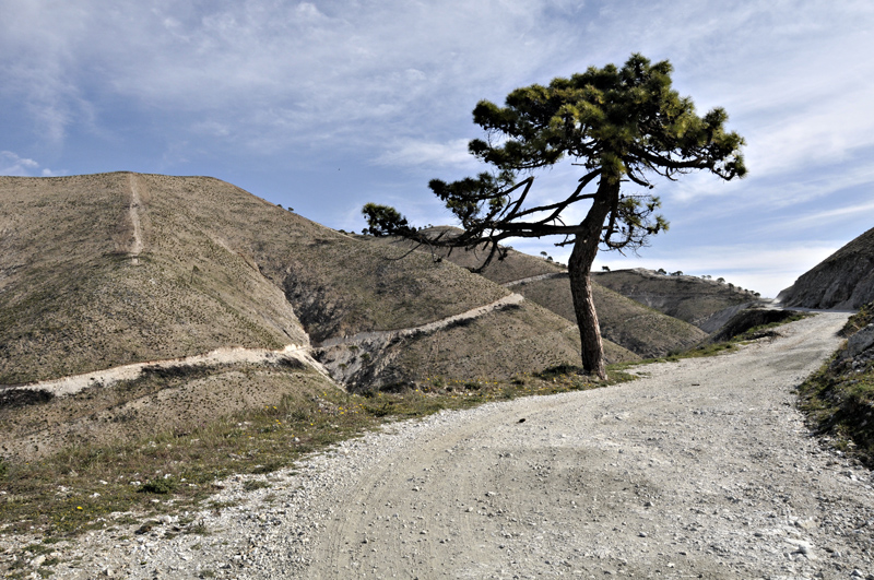
Puerto de Colado, situated at 900metres and with a view north, towards Lucero, that deserves the descriptive term, "stunning" (it will appear in the next part). The hill to the right is Cerro Julienne (1060 metres).
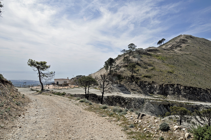
The way up Cerro Julienne is up a fire-break, presumably bulldozed in haste during the wildfire. It is steep and horribly loose, but one climbs hills because they are there - and it seemed an ideal spot to see how the land was faring....
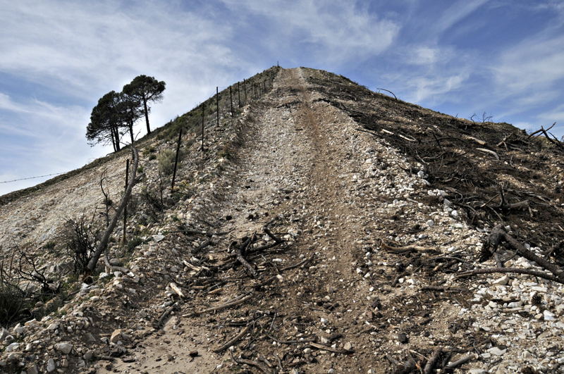
On the summit, I was surrounded by wildflowers and huge numbers of butterflies and other insects - a most encouraging sign. Here's the view along the continuation of the ridge, showing the devastated land R and the more usual arid scrub and forest on the left of the firebreak, with the Campo beyond:
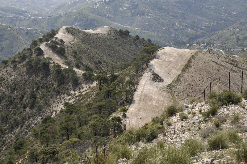
Looking north-west from the summit with part of the La Maroma massif in the background.
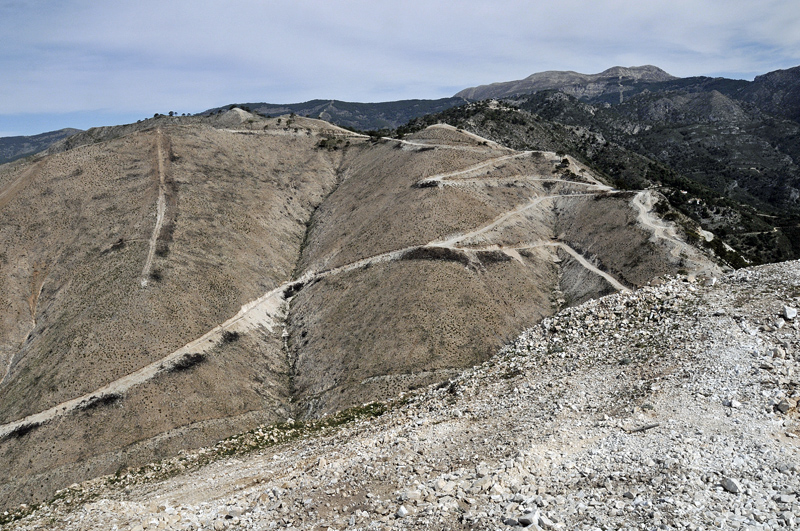
Descending back to Puerto de Colado I wandered along the tracks to the next ridge, a little higher at over 1100 metres...
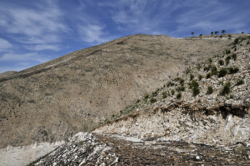
Looking along the next ridge from one of its tops, Competa down to the R with the Campo, coastal sprawl and Mediterranean in the background.
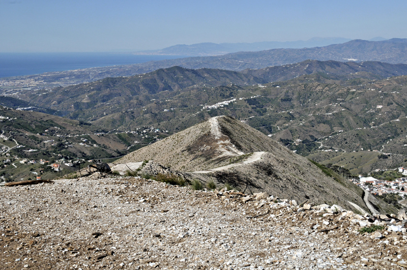
One day, en-route to the mountains further north, the haze over the Mediterranean thinned enough to bring some of the mountains of North Africa into view. Not sure if the white is a snow-cap or cloud in this telephoto image:

So, how is this fire-blasted area faring? There is little soil as such. The bedrock is marble - a recrystallised limestone, hence the pale colour. Because it also contains sand, when it weathers the sand-grains are released, so that the soil - if it can be called that - is a mixture of sand, marble debris and, now, charcoal. Blackened tree-trunks and brash are everywhere. But as this image shows, a green carpet is slowly threading its way between the chunks of marble...
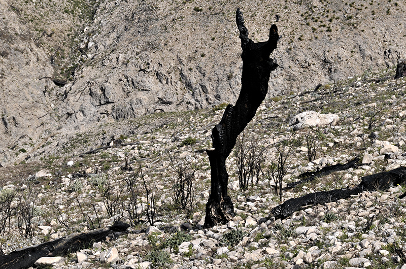
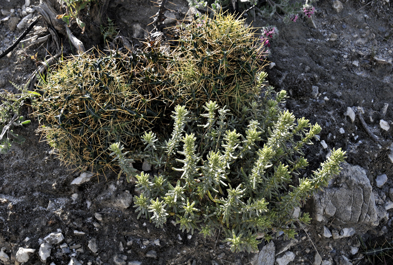
I could have done with a flower-book, as most of these are unfamiliar forms, although the spiny plant looks like some kind of thistle, perhaps evolved to deter the wild goats that range in these hills, along with wild boar and ibex.
This one's more familiar!
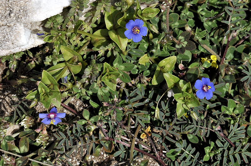
Any ideas?
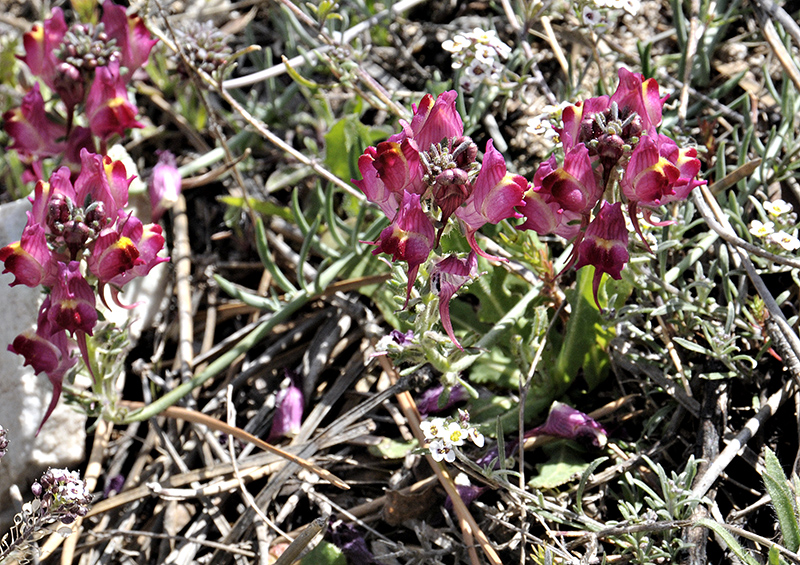
This looks like some kind of toadflax:
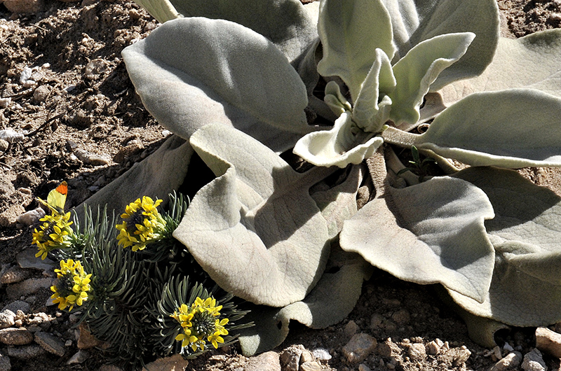
That's a mullein on the right - they also inhabit my veg-garden. A Moroccan Orange-tip is nectaring on the flowers to the L - a beautiful butterfly that I endeavoured to capture through the lens on several occasions (next post).
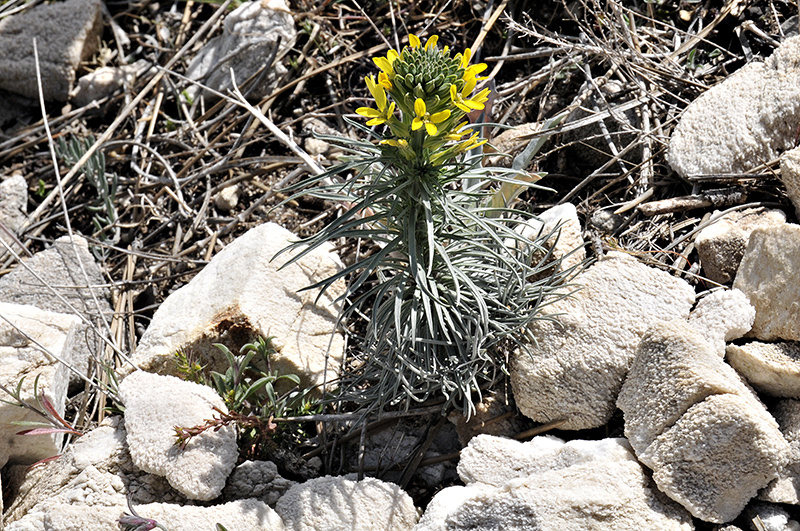
This looks like a relative of kidney-vetch...

A solitary red poppy...

That's but a tiny sample. Young pine saplings, rosemary and lavender and many other forms were noted in abundance. Everywhere one looked there was life. Give these hills a few more years and they will have regenerated back to their former glory: it is inspiring to see how resilient Nature can be to such overwhelming destruction.
The next part of the southern Spain account will reveal the pristine landscapes beyond these regenerating hills, where I spent many a happy hour wandering with the camera.
BACK TO WEATHER-BLOG MENU
New! Fine Art Prints & digital images for sale-
Welsh Weather & Dyfi Valley landscapes Slide-Library - Click HERE