BACK
TO WEATHER-BLOG MENU
New!
Fine Art Prints & digital images for sale-
Welsh Weather
& Dyfi Valley landscapes Slide-Library - Click HERE
Grabbing the kit, I set off on foot towards the edge of town - the plan was to get clear of street-lights and their sodium-glow and to gain a bit of height. The rougher-ground parts of Machynlleth golf-course would suit both purposes. En-route I stopped to take in the amazing view:
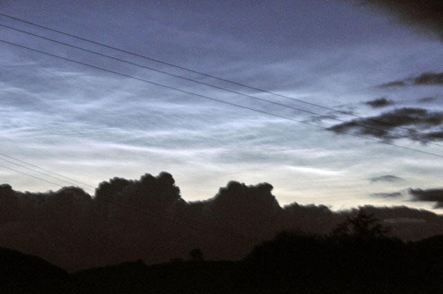 A bright display stood above the low bank of cumulus. Light levels were very low and the cloud-motion made for a blurry image - plus the overhead cables were irritating!  Slightly further on. It was about 0330 and the display was just getting brighter and brighter as dawn approached! 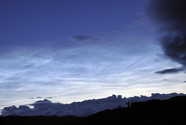 The cloud-blur was easing now that faster exposure was possible. I then climbed to get a better view: 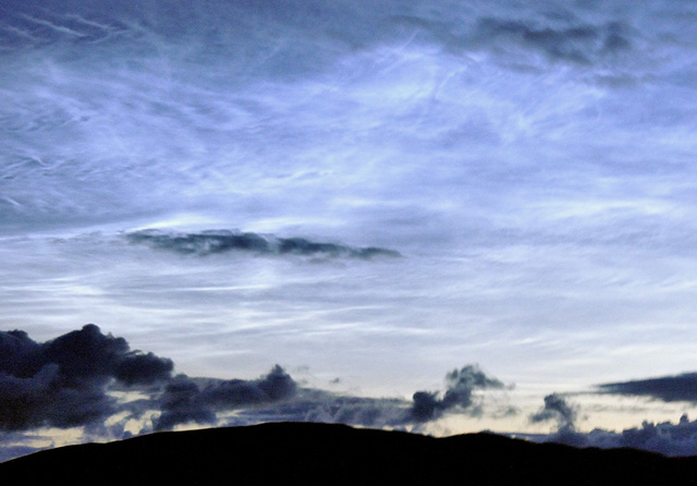 A bit shakey this one: I included it for the classic "herringbone" structure top L! I then found a decent fencepost to rest the camera on and get some "proper" non-shakey shots, of which this was my favourite, with a star visible top L (on the hi-res version there are several more):  ....while this one, taken with a wideangle lens, shows how extensive the display was - pretty much from the horizon to overhead! 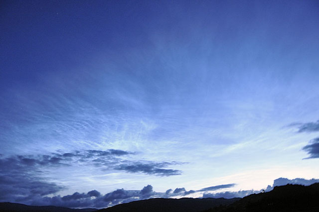 As dawn approached, the display began to fade from the east:  As I wandered home, in serious need of coffee by now, the last vestiges of the display continued to glimmer aloft, before cloud moved in from the west. I've written twice before about these mysterious "Clouds on the Edge of Space", but haven't even tried to explain what they are and how they are thought to form. So I thought I'd do a bit of research myself and provide an account. There is a lot of ongoing technical research into these clouds at the moment - if you Google "AIM satellite mission" you will find reading material aplenty. This is just an introduction to the subject, but here goes: We'll start with a cross-section through Earth's atmosphere. 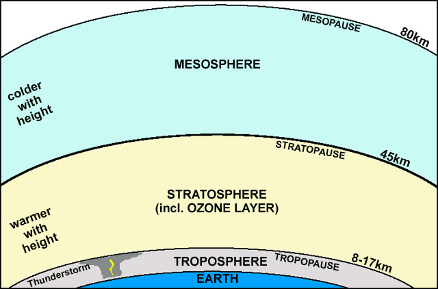 THE TROPOSPHERE The bit we live in is the Troposphere. About 80% of all the molecules that make up the atmosphere are contained within this bit, variably 8-17km deep (it's thinner at the poles, thicker at the Equator). In its upper part there is a lesser density in terms of molecules - including oxygen - and the air is said to be "rarefied" - that's why people get out of breath on high mountains of over 4000m. What we collectively refer to as "weather" all goes on in the Troposphere and thunderstorms extend right up to its top - the Tropopause. Here, there exists an abrupt boundary - up to the Tropopause it gets colder with altitude, but above it gets warmer again. That's why convection stops at the Tropopause and the anvil-shaped tops of thunderstorms spread out beneath it. Warm air cannot convect up into warmer air - it's against the laws of Thermodynamics!! THE STRATOSPHERE Above the Tropopause we enter the Stratosphere, a thick layer of rarefied air, with about 20% of the molecules that make up the atmosphere contained within. No weather as such goes on here, but importantly it contains a layer enriched in ozone, which blocks a lot (>>90%) of harmful UV light from the Sun: without that ozone, life as we know it would not exist as it does. THE MESOSPHERE At the top of the Stratosphere, the Stratopause marks the boundary with the very cold, extremely rarefied Mesosphere. This is where most meteors burn up. Containing just 0.1% of the molecules in the atmosphere, it is a hostile place in which temperatures may be as low as -100C near the top - the Mesopause. The latter zone, only a few kilometres thick, marks the next boundary into the Thermosphere above, which is a deep (several hundred km), virtually airless layer, where satellites such as the International Space Station orbit the planet. An interesting feature is that Mesopause is cooler during the summer than the winter, the opposite of what one might expect. This is due to a summer-to-winter circulation, in the form of gravity-waves, that results in upwelling of rarefied air at the summer pole (i.e. the North Pole in our summer) and downwelling at the winter pole. The rising air expands and cools, obeying as it does the laws of physics, and the result is the colder Mesopause during the summer. It is the mesopause that concerns us, for that is where, 80km up, Noctilucent (or more correctly Polar Mesospheric) clouds occur. WHAT ARE NOCTILUCENT CLOUDS MADE OF? Clouds are made either of water droplets or ice particles, depending on the temperature of the air in which they exist. In the freezing heights of the Mesopause, ice is the key substance. It nucleates on any handy "cloud-seeds", just as happens at lower levels. These seeds are almost certainly microscopic meteoritic dust particles, which are common at this height. HOW DOES WATER-VAPOUR GET SO HIGH?? This is a tricky one. Normally, water vapour rises towards the Tropopause, freezes and falls back towards the surface as rain or hail. Only a very small amount gets through into the Stratosphere and even less to greater heights. One potential solution is that water is made in the Mesosphere by the reaction of free oxygen and hydrogen atoms. It is thought that, while water vapour condenses and falls at the Tropopause, a trace-gas, methane, does not. It continues to rise until above the Ozone Layer, where bombardment by UV radiation splits it into its constituents - carbon and hydrogen. The hydrogen, being super-light, floats on up towards the Mesopause, where it reacts with any oxygen it meets, to form water. The diagram below sketches this out. 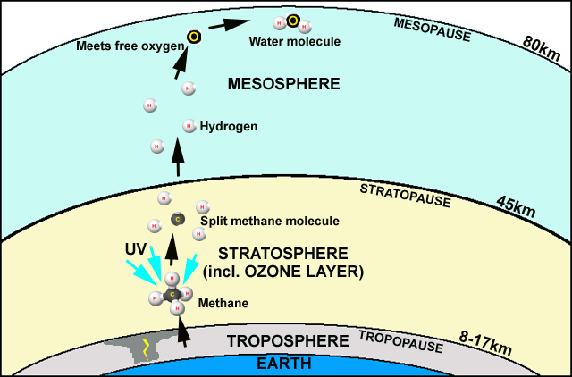 Another hypothesis holds that rocket exhausts supply some water vapour to the Mesopause. This may account for an element of the water vapour present, but it fails to explain why noctilucent clouds have been seen since the 1880s. Super-explosive volcanoes like Krakatoa in 1883 and large impacts like Tunguska in 1908 have also been cited as having an influence. Some scientists point out that noctilucent clouds were first described after the 1883 eruption, and that after Tunguska there were some very bright displays. However, noctilucent clouds have in recent years been seen more often, been seen further and further south from their usual Polar habitats and are getting brighter. Why? AIM SATELLITE MISSION - PRESS-RELEASE FROM NASA, APRIL 11 2007 NASA AIMS TO CLEAR UP MYSTERY OF ELUSIVE CLOUDS AT EDGE OF SPACE WASHINGTON - NASA is preparing to launch the Aeronomy of Ice in the Mesosphere (AIM) spacecraft, the first mission dedicated to exploration of mysterious ice clouds that dot the edge of space in Earth’s polar regions. These clouds have grown brighter and more prevalent in recent years and some scientists suggest that changes in these clouds may be the result of climate change. AIM will conduct the first detailed probe of this unusual phenomenon typically observed approximately 50 miles above the Earth’s surface in the mesosphere. The mesosphere is the region just above the stratosphere. Researchers know very little about how these polar mesospheric clouds form, why they are being seen at lower latitudes than ever before or why they have recently grown brighter and more frequent. "These clouds are indicators of conditions in the upper reaches of the Earth’s atmosphere, and are an important link in the chain of processes that result in the deposition of solar energy into Earth’s atmosphere," said Mary Mellott, AIM program scientist, NASA Headquarters, Washington. "AIM will provide an understanding of how and why these clouds form, an important contribution toward the NASA goals of understanding the fundamental physical processes of our space environment and how the habitability of planets is affected by the interaction of planetary magnetic fields and atmospheres with solar variability. Bristling with instruments, AIM has been up there collecting data since late April 2007. For lots more information, try going to the Mission Homepage: http://www.nasa.gov/mission_pages/aim/index.html Or try this fact-packed site: http://aim.hamptonu.edu/index.html Are noctilucent clouds at a maximum this year due to the fact that we are at a Solar Minimum? Are they getting more extensive due to climate change? How exactly do they form - which hypotheses are correct? What can we expect to see in the years to come? It will be
interesting to find out what the data being collected up there are
going to tell us!
|
|
BACK TO WEATHER-BLOG MENU New! Fine Art Prints & digital images for sale- Welsh Weather & Dyfi Valley landscapes Slide-Library - Click HERE |