dramatic wall-cloud over Cardigan Bay
BACK
TO WEATHER-BLOG MENU
New!
Fine Art Prints & digital images for sale-
Welsh Weather
& Dyfi Valley landscapes Slide-Library - Click HERE
| In
my latest post I mentioned that I had not heard thunder since 25th
November 2009. That can now be amended to 18 hours! Yesterday - 14th
July - saw the first storm-chase of 2010. I can't think of a year with
such a lack of convective storms here - it bears testimony to prolonged
nature of the blocked pressure pattern that has finally given way to a
more mobile regime. Low pressure systems have since been tracking in to bring welcome falls of rain to many parts of the UK, to the relief of my garden! On the 14th, a low was centered to the S of Ireland, bringing a southerly returning polar maritime airflow in across Wales, and with it, inherent instability. Had the pressure-gradient around the low been slacker, the classic Summer set-up of a sea-breeze convergence zone would have been on the cards - often photogenic and a ready spawning-ground for funnel-clouds. However, the airflow at the 850hPa level - say 1500m above sea-level - was quite strong at over 30 knots. This is the height you need to look at to determine the strength of the steering flow - that is - the direction and speed at which any storm will move. Such a flow would be detrimental to any sea-breezes setting up: on the upside, it would generate plenty of shear - stronger winds aloft that would separate storm updraughts and downdraughts, allowing stronger convective cells to develop and increasing the risk of a tornado. Showers broke out from the morning onwards and it was merely a matter of choosing a target - the chase was on! Considering the possibilities, I was swayed by the low LCL - the Lifted Condensation Level, which is where the cloudbase forms. This was not far above the mountains, so I plumped for the wider open skies at the coast. Furthermore, by early afternoon the radar (see below) was showing intense cells over the western Gower peninsula. A simple extrapolation would bring these northwards over Cardigan Bay. Sea temperatures were by now high enough to sustain - not kill - convection. All the ingredients being nicely in place, I set off from Machynlleth, heading for Borth - only 12 miles away too, thus keeping costs down! 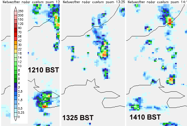 I arrived just after 1300 BST and settled down to the view and Radio 4. The only notable distraction for the first hour was this flock of dunlin working the tideline:  Just after 1400, a fisherman arrived and well to the south the Gower cell crossed the coast near Newquay, northward on its journey over the bay. Very heavy rain was evident - the radar plot above shows a rate of 42-56mm/hr at 1410 and this was continued as the storm moved out over the bay. I was immediately drawn to some lowerings in the cloudbase at its southern end..... 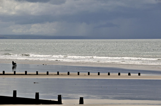 As the storm moved north I had a much better view of the structure: 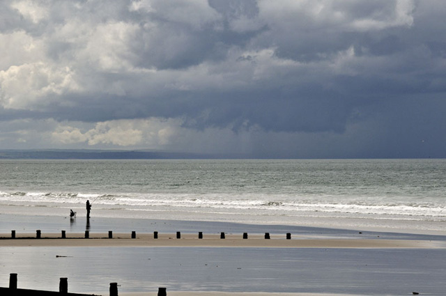 It was changing in shape all the time.... 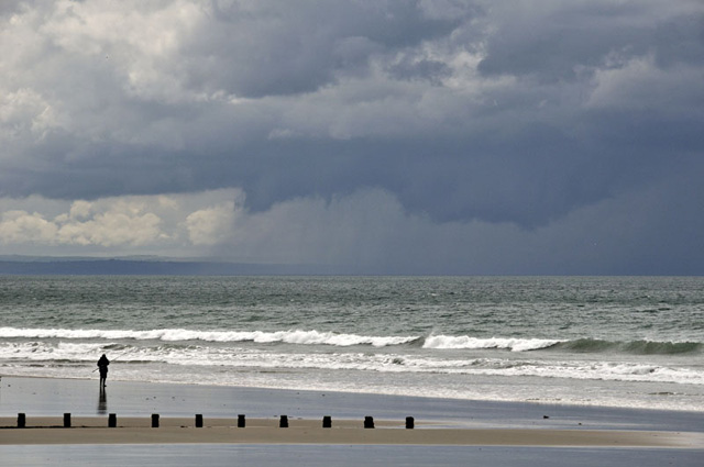 ....reaching more than halfway down to the sea..... 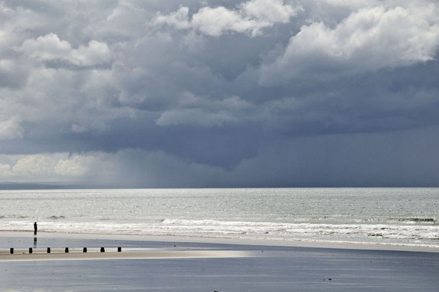 I zoomed in with a telephoto: 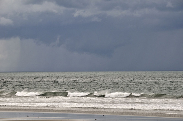 Here, a little obscured by rain briefly:  It was now straight out to sea from my vantage-point high on the shingle: 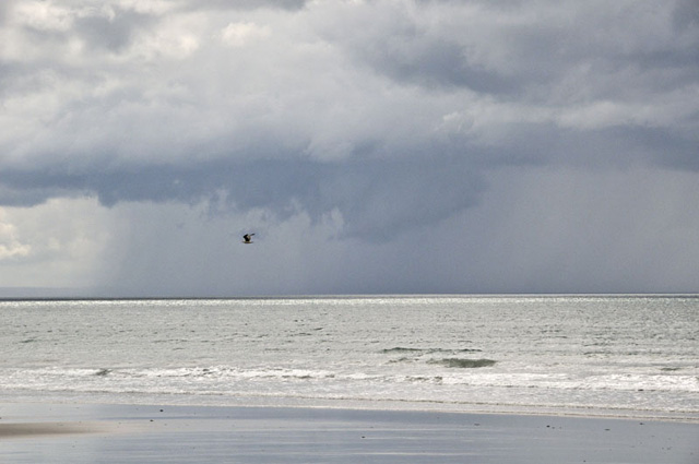 Changing all the time:  At one point a ragged tail of cloud was feeding into it from the south: 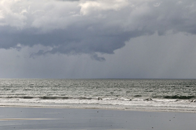 Heavy precipitation was now extending behind it:  Taking on a wedge-shaped appearance: 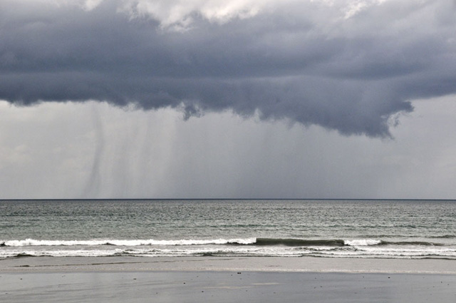 Compacting:  Growing an almost funnel-like protuberance: 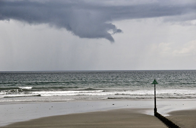 And a few minutes later - I lost it to sight! A shower that was hugging the coastline came up and obscured it in heavy rain! By then I had been watching the feature for 36 minutes, hoping it would drop a tornado, for a wall-cloud, which was what it was, is a prime place for a twister to form - an immediate focus of attention for any storm-chaser be it here or in the Great Plains. I don't recall featuring wall-clouds in detail on here before so I'll explain what they are. A wall-cloud occurs beneath the cloudbase of a strong convective (thunderstorm) cell. As in the above images, it is always rain-free - there is no precipitation falling out of it, because the air is in fact moving up through it into the stormcloud. It marks the position of the storm's updraught - the point where air flows into the storm - also known as the inflow region. The images also show that the wall-cloud has formed just adjacent to the tail end of the precipitation or outflow part of the storm: therefore we have inflow and outflow regions side-by-side. This results in rain-cooled moist air being pulled back into the updraught along with the ambient air in the immediate vicinity. The rain-cooled air quickly becomes saturated and condenses at lower levels as a consequence, hence the formation of cloud at anomalously lower levels than the surrounding cloudbase. Wall-clouds often exhibit strong rotation. Some rotation is apparent in the images above but it was not the crazy merry-go-round spinning that is seen in some images and videos of Great Plains supercells. The reason why such features are of great interest to chasers is as follows: in the same way that an ice skater pulls their arms in to spin faster, if a rotating storm updraught or mesocyclone becomes stronger and stronger, the area of rotation can become narrower and its speed increases. At the upper end of the scale, the rotating air flows up into the storm so fast that the resulting tornado will lift anything in its path - from litter to, in extreme examples, whole buildings. But - at the same time - not all wall-clouds produce tornadoes, and not all tornadoes form beneath wall-clouds. They are simply a good place to look, and hope! The showers briefly cleared revealing blue skies and, in the distance, banks of towering cumulus. More convection was on the way.... 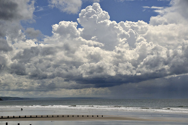 Out to sea, around 1600, and extremely heavy rain is gushing from this cell...  .... generating strong downdraught winds that are blowing the rain diagonally forward from where they are fanning out on meeting the sea surface - for anyone in the vicinity on a small boat, this would be a nasty squall. 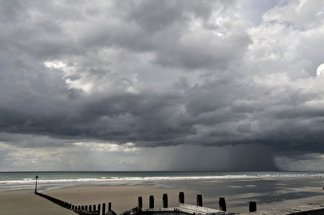 A
mess of decaying cells was approaching my vantage-point, so I headed
home. A quick check of the radar showed a very intense storm heading
just east of Machynlleth, so I popped up to the golf-course and watched
as it passed just a mile or two away, spitting out a few spectacular
cloud-to-ground lightning bolts and filling the ears with loud booming
thunder - a great end to a day too long in coming! As one might say to
a long-lost friend, "don't leave it so long next time"!
|
|
BACK TO WEATHER-BLOG MENU New! Fine Art Prints & digital images for sale- Welsh Weather & Dyfi Valley landscapes Slide-Library - Click HERE |