BACK
TO WEATHER-BLOG MENU
New!
Fine Art Prints & digital images for sale-
Welsh Weather
& Dyfi Valley landscapes Slide-Library - Click HERE
The second
half of January 2009 was markedly stormy compared to the first,
featuring the Atlantic in all its wrath. The weather "peaked" on
January 17th, with a sub-950mb low situated just to the NW of the
UK. This storm brought winds gusting to 94mph (at Capel Curig) and
70-80mph quite widely around the Welsh coast. Belmullet in Co. Mayo
topped out with 108mph! The storm struck Wales in the early evening,
with the most intense winds lasting just a few hours, but followed by
squally thunderstorms that persisted through the night - I enjoyed a
lightning-show at about 3 o'clock on Sunday morning, which made a nice
change. I normally sleep through such things, only to find out about
them the next day - "did you see the lightning last night? It was
amazing" etc!
This
page deals with the storm and the weather that followed. It also
features me getting to grips with a digital SLR - a Nikon D300, which
is a steep but enjoyable learning-curve because it gets me out there
taking as many photos as possible as I get familiar with the squillions
of options on the thing. I reckon there is a subtle improvement in the
images as you go down this page - they are in order of taking - as I
gradually figured out how to set the thing to aperture-priority (as I
always shot with the Canon A1s) and get the ISO locked onto 200. The
lens is a Nikkor 18-200mm (27-300mm film equivalent) which covers
almost everything - good to avoid too many lens-changes in adverse
conditions - but Mifsuds in Devon found me a nice used Tokina 12-24 mm
ultrawide for really big skies. What is impressive about these modern
lenses is the vibration reduction technology they deploy - it goes a
long way to eliminate camera-shake which in turn means a bit less
messing about with tripods. All good stuff in fast-moving
situations......
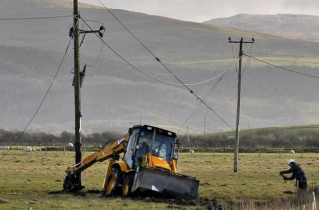 The image above is a tiny crop from a much bigger shot, taken on Sunday 18th following the storm. Machynlleth fared reasonably well but towards the coast, more damage was evident, in this case well on the way to being fixed. A friend at nearby Llancynfelyn had a large branch land on her woodshed and car (amazingly not doing TOO much damage) and down towards Ynyslas, houses were missing slates and ridge-tiles. Luckily the tide was a small neap, so that coastal damage was minimal!  Down at Aberystwyth, the sea was still in an angry mood.... 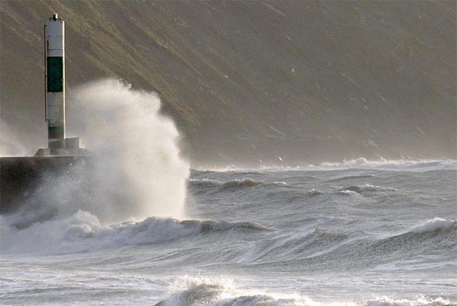 ....giving opportunities for playing around with different zoom lengths! I was glad to have a UV filter covering the lens, as in between shots a lot of salt had to be removed! 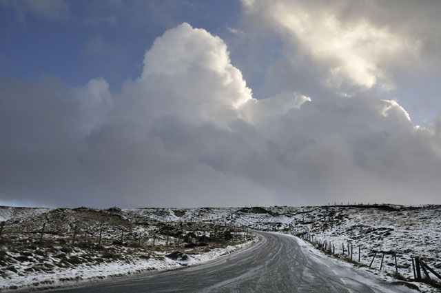 Although stormy, the weather was not especially mild. This Westerly-dominated setup is known as "cold (or cool) zonality" i.e. the weather's coming in off the Atlantic, but the air is not from the warm sub-tropics but from colder northern parts. This means lots of showers, especially in coastal areas and over adjacent hills, with hail falling widely and snow over higher ground. Here, the top of the Machynlleth-Llanidloes mountain road is decidedly slushy and either side there is a good coating of snow.... 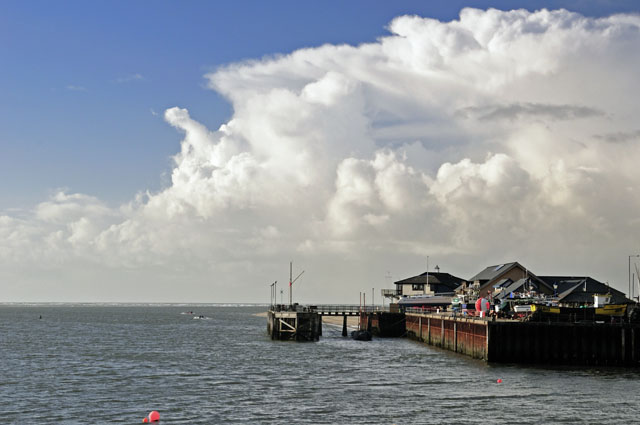 Tuesday January 20th brought a promising outlook of clear skies and local convective storms, enough to warrant an afternoon trip to the coast. Arriving at Aberdyfi a large thunderhead dominated the skyline. I pushed up the coast a bit but it fell apart before making landfall so I popped up onto the hill above Aberdyfi to mess about with the telephoto end of the zoom.... 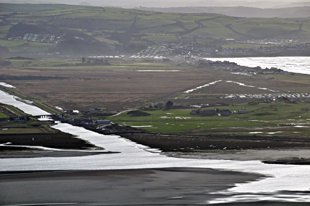 I'll revisit this spot when the light's a bit better - an afternoon high tide might make for an effective shot. Still, the original when viewed at full size has a great deal of sharp detail! In the meantime, something interesting on the SE horizon caught my eye.... 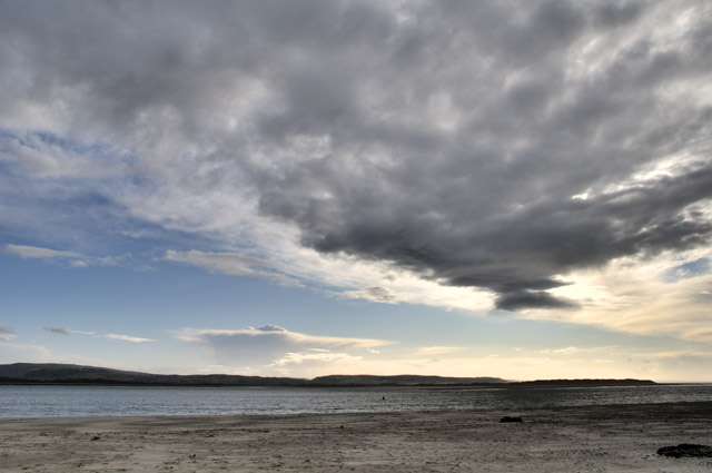 Back at Aberdyfi beach, I could see a distant storm's anvil.....  Telephoto shot. Classic overshooting top - the "bulge" of cloud rising from the middle of the flat top of the anvil. Thunderstorm anvils form at the Tropopause - the boundary between the Troposphere (where virtually all weather goes on) and the Stratosphere above. Here, there is a monster temperature inversion - it gets warmer into the Stratosphere, so the buoyant warm air rising through the cold Troposphere meets its match at the Tropopause, loses its buoyancy and spreads out beneath it, to make the familiar anvil-shape. Overshooting tops occur when particularly powerful updraughts push through the Tropopause by dint of their momentum, although the air cannot convect any further upwards. Imagine a fountain - this is simply a cloud version! The diagram below, in which the thick black line on the RHS plots temperature change with height (temperature scale along bottom), has the Tropopause marked by the red arrow: 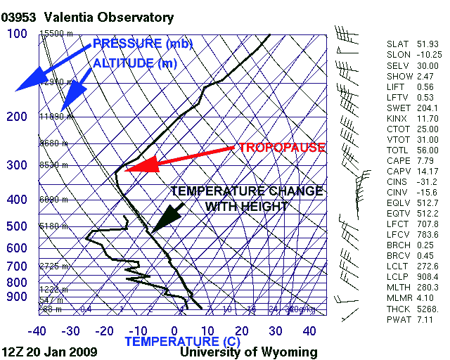 Valentia, in S Ireland, is "upstream" of mid-Wales in a SW wind, so this atmospheric sounding, taken from the ascent of a weather-balloon two hours before the storm was photographed, gives a good picture of the atmosphere over Wales at the time. On the left-hand side we have air pressure (L) and altitude (R). We can thus see that the Tropopause was, at this time, situated at about 8300m (Everest is 8848m high), where the air pressure was just 330mb. The Tropopause is always a long way up but the exact height varies from day to day. Let's just go back to the photo: 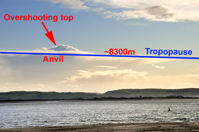 (note the Tropopause is in reality flat at any one point - the apparent slope is just perspective) So basically we are looking at a cloud-top at almost the height of Everest. How far away was it? About 80km away. It went over a friend's place in the western Brecon Beacons giving thunder and 10mm hailstones. This is where weather-forums like UK Weatherworld come in handy - it was easy to check this out and a look at the rainfall radar correlated the info. Quite a significant thunderstorm for the time of year! 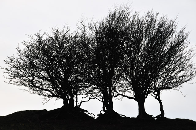 During the same day I was drawn to these trees, stark against the white sky (a high cloud-veil was moving in from the west now)..... That was to presage two low pressure systems midweek that brought lots of heavy rain, so on Thursday 22nd, with a 2-hour clear weather-window identified using satellite images, I headed for the Elan Valley to intercept blue skies and water cascading over the dams (thanks to Howard Kirby for the shout on this!)..... 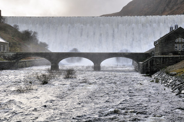 I was not to be disappointed - here's Caban Coch dam....  ....impersonating Niagara! 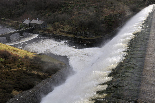 View from above, looking down, as it were.... Moving on to Claerwen, a huge reservoir up a side valley: 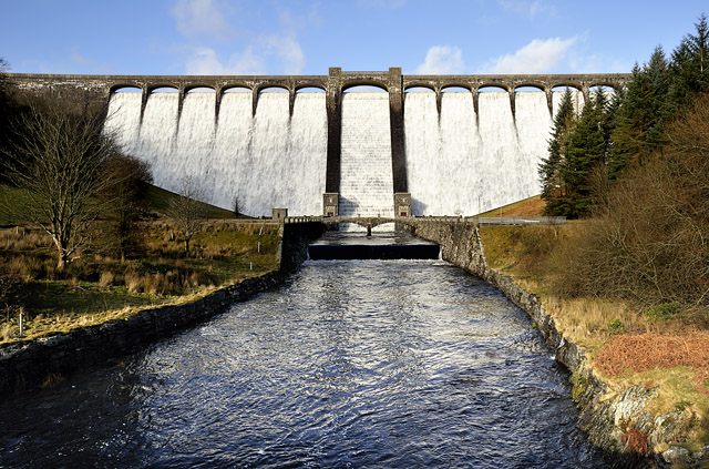 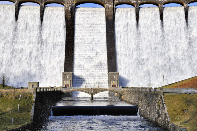 On up the Elan Valley, I rounded a bend and found this huge Western Hemlock that had blown over. Almost certainly a victim of the previous Saturday's windstorm (the rootball was unweathered and there have been no other severe storms recently), this thing was huge! My jeep for scale! 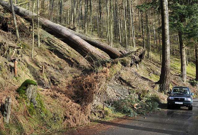 Up on the moorlands above the reservoirs, moor-grass adorned fences where the winds had torn it from the hillside..... 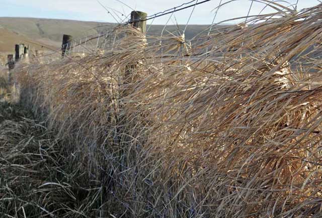 Sunday 25th saw another chance of some good convection early in the morning, so I arrived at Borth not long after sunrise: 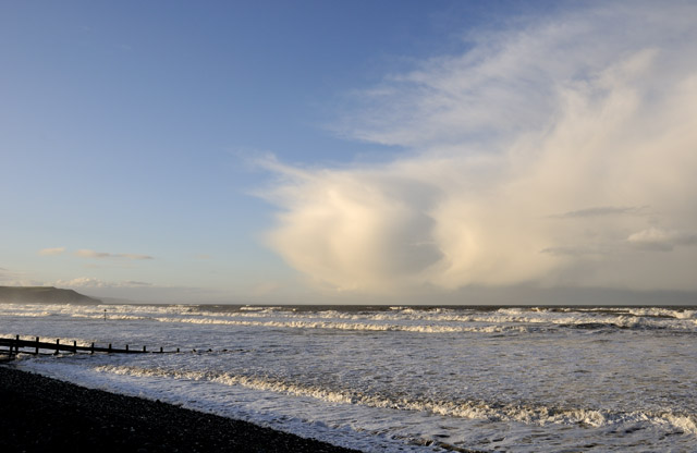 The distant bank of cumulonimbus clouds were heading this way..... 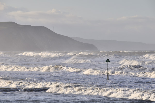 Telephoto of the powerful surf... 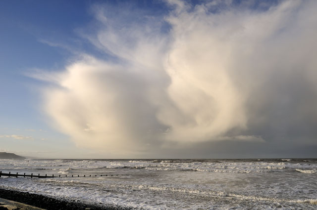 As the clouds neared, precipitation shafts appeared - snow at that height, lit up by the low-angle sunlight....  First shot with the Tokina ultra-wide as the decaying showers came over, giving just a little rain in their death-throes.... 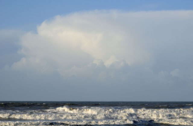 Behind, another line of cells was moving in but light conditions had deteriorated and the winds backed southerly, steering the cells up through the Irish Sea. Before leaving, I took this unattractive but interesting shot showing a Kelvin-Helmholtz wave-cloud on the upper LHS of the anvil that dominates the view here. All in all a productive spell of weather and an enjoyable experience in learning a new skill, a learning curve that will last for quite some time, I suspect! Looks as though things will settle down now, with colder dryer conditions on the cards as we head into February. Boy, am I looking forward to Spring! |
|
BACK TO WEATHER-BLOG MENU New! Fine Art Prints & digital images for sale- Welsh Weather & Dyfi Valley landscapes Slide-Library - Click HERE |