In search of big snows.....
BACK
TO WEATHER-BLOG MENU
New!
Fine Art Prints & digital images for sale-
Welsh Weather
& Dyfi Valley landscapes Slide-Library - Click HERE
| It's
January 3rd 2010 and we are now into the third week of the cold spell -
the second successive end-of-year one, although so far the estuary has
not frozen over, as it did in early January 2009. December 2009 was a pretty cold month - indeed, it was the coldest December since 1996. We get so used to a run of milder winters and then a cold spell brings forth utter chaos, although so far Machynlleth has not itself fared too badly. Snowfalls like that pictured below, on December 19th, have occurred periodically, making driving and walking both somewhat slippery activities, but so far no major problems down here, although with the cold set to continue for the foreseeable future, a bigger fall of snow cannot be ruled out..... 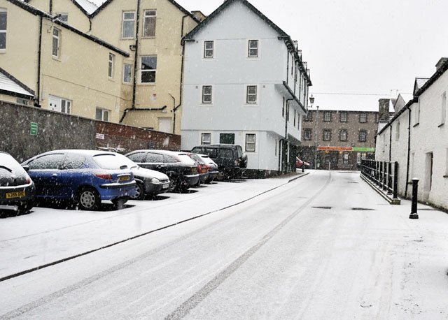 Heavier falls of snow occurred over the hills in December - this late afternoon shot was on the 22nd.... 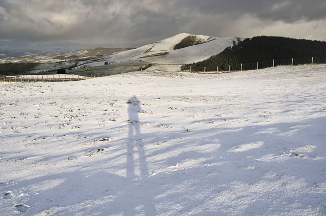 ...but many people were able to get the Christmas break over with before the really big snows came. On the 29th, an active low pressure system moved in from the SW of the UK and stalled as it ran into the block of cold air situated across the country, creating what meteorologists refer to as a "battleground" setup. Essentially this involves mild moist air pushing up from the SW, but getting undercut by the cold air in place. If the mild air wins the battle it can clear the cold air right out of the way. But if, as often happens, it stalls, then the moisture falls out as rain, sleet and snow and can do so for 48 hours or more. Such setups can be notoriously difficult to call. Temperature differences of as little as 1C can dictate whether the precipitation falls as rain or snow. Rain in such situations can be a complete nightmare where it falls onto frozen ground. It freezes on contact resulting in extensive sheets of black ice. Prior to this - on December 23rd - there were tremendous problems caused by freezing rain in southern England with dozens of road accidents reported especially in the Southampton-Bournemouth district. By the 29th, a general concensus was reached that higher ground would see very heavy snow with totals of 30cm+ expected, whilst lighter snow, sleet and rain were expected lower down. The hills of East Wales were expected to receive the most snow. For what felt like several bitter days, rain and sleet fell in Machynlleth, accompanied by a chill northeasterly wind, which did not ease up until New Years' Day. That morning, skies cleared at last and satellite imagery revealed the extent of the snow: 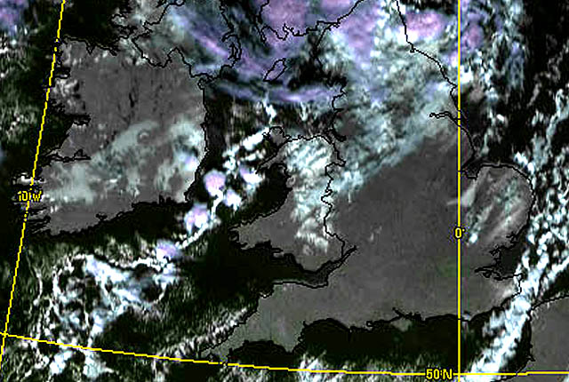 Wondering exactly what had happened over the hills, I set out mid-morning, driving up to the 220m contour just below the snowline, with a view to walking to the top of the mountain road, at 520m and just over a couple of miles away. Immediately after passing the snowline, it started to get deeper and deeper. This was where the snowplough had given up: 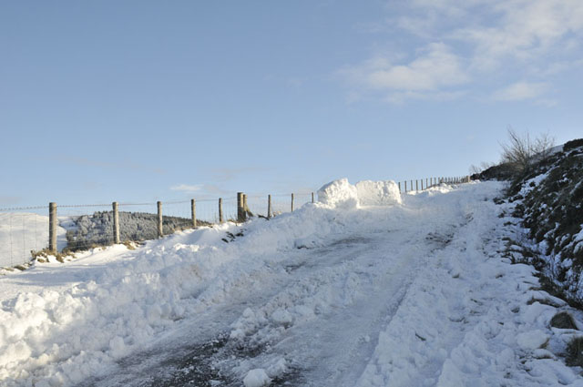 Walking on I came to the flat shoulder that passes Bacheiddon lead mine. This is a notably exposed spot and the road had almost been blown clear of snow, leaving sheets of hard ice behind... 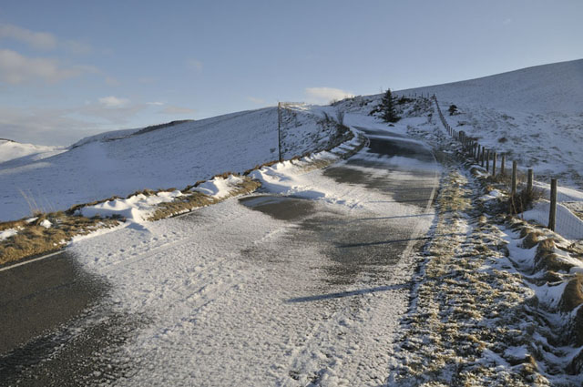 Above, the road climbs more steeply and is in a bit of a hollow. Here, it was well drifted-up.... 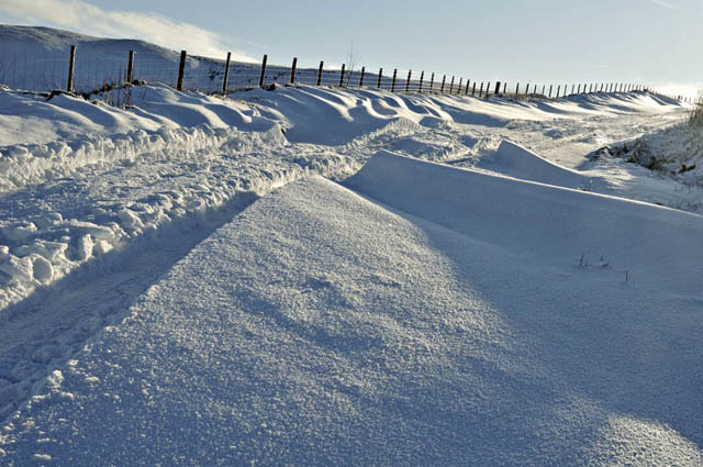 The surface of the drifted snow sparkled vividly. This is due to the presence of what is referred to as surface-hoar...... 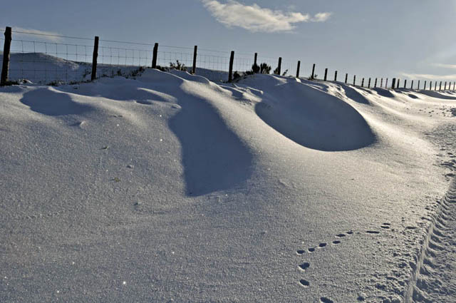 ....here's a close-up. 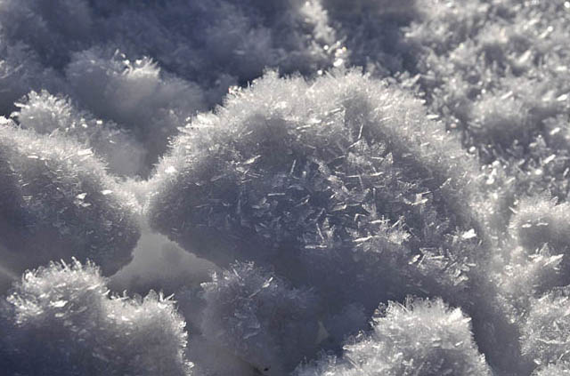 So, how does surface hoar form and why is it important? In clear conditions, lying snow, either in the shade or at night-time, radiates out heat and as a consequence, its surface becomes very cold. Water vapour from the air above the snow can then condense onto the surface of the snow. Often, moister air will "pool" in certain places - hollows, valleys etc - and these spots will be especially prone to hoar. Hoar also needs calmish conditions in which to form - too much wind and the crystals will break and be blown away. A very light breeze is perfect as it will gently bring a continuous flow of moist air over the snow, resulting in heavy hoar development with crystals to 5mm+ as in the photo above. Surface hoar is important because, if buried by subsequent snowfall, it creates a thin but extremely weak layer within the snowpack. This in turn makes avalanches far more likely to occur, in which all the snow above the hoar layer can break away and start sliding. Mountaineers and skiers dig test-pits to check for the presence of such layers when assessing the level of avalanche-risk in a mountain range, but such thin layers can often be difficult to detect. Therefore, surface hoar represents a considerable potential problem to hillgoers. Further up the road, evidence was present for a brief freezing rain event that had occurred at some point within the battleground of mild and cold air: 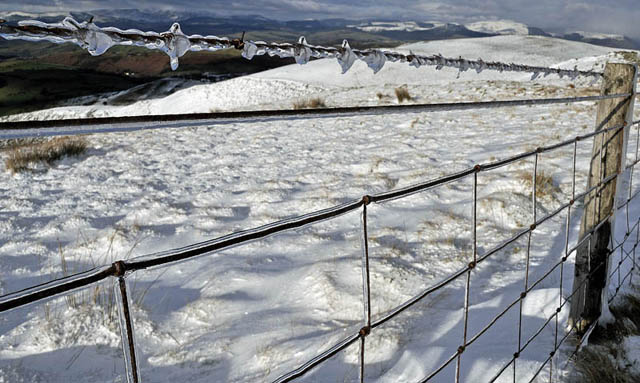 From this point, the view back down to Machynlleth was particularly good, with a snowy Tarrenhendre as the backdrop..... 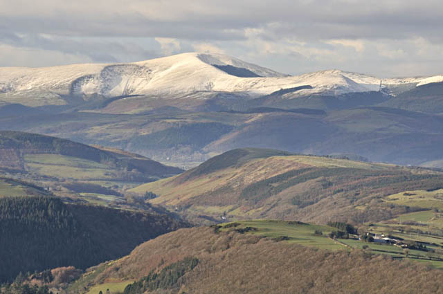 Machynlleth is a bit hard to spot - but here's a zoom-in! The green scaffold-netting around the Clocktower (it is being restored) is clearly visible now! 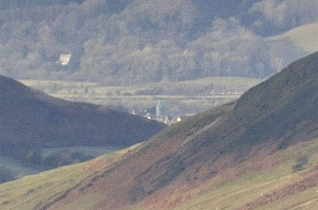 Towards the upper part of the mountain-road, the snow was much, much deeper, with ruts dug by the wheels of a tractor in excess of 80cm deep in places. This will likely need a JCB to clear it.... 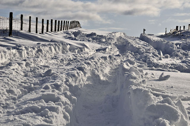 In places, the ablation of lying snow by blowing spindrift in the easterly gales was much in evidence. At the height of the blizzard, conditions up here must have been horrendous! 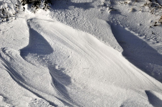 And finally, the top was reached! 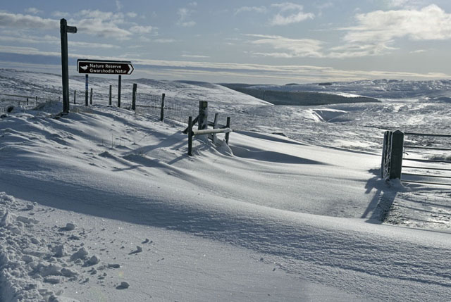 Here's the view to the SW. Plynlimon dominates the horizon, while to the R a frozen Glaslyn can be seen. A pristine Winter landscape and well worth the walk to see! 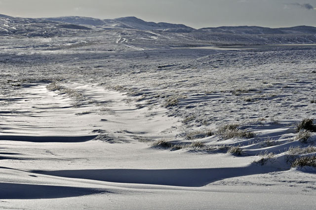 As the sun started to sink in the SW, the light dramatically improved for the view northwards, and at the same time the clouds started to break up, affording superb views of the Snowdonia mountains. This is the Arans, up above Dinas Mawddwy at the head of the Dyfi Valley..... 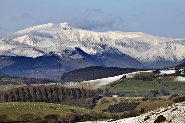 ....while this is Cadair Idris. 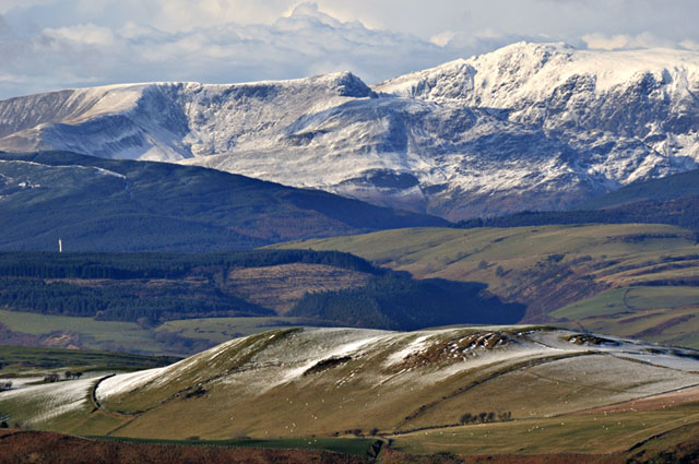 Over the NW horizon, a cluster of cumulonimbus anvils started rolling in, heralding a fresh fall of snow.... 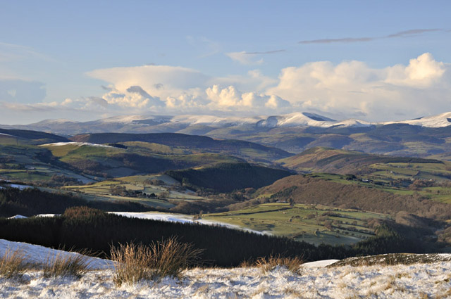 Not long after getting back down to Machynlleth, the skies darkened and snow started to fall in copious amounts, giving a couple of centimetres in a matter of minutes - and presumably adding a fresh layer onto the surface hoar up there. Since then, several more showery troughs have moved through, giving rain and sleet down here, but doubtless snow for the hills. That avalanche risk must be getting very real now.... |
|
BACK TO WEATHER-BLOG MENU New! Fine Art Prints & digital images for sale- Welsh Weather & Dyfi Valley landscapes Slide-Library - Click HERE |