BACK
TO
WEATHER-BLOG
MENU
New!
Fine
Art
Prints
&
digital
images
for
sale-
Welsh Weather
& Dyfi Valley landscapes Slide-Library - Click HERE
| This
post
has
a
flooding
theme,
as
the
first
half of January 2011 saw the
Atlantic take the weather over with conviction. Gone was the prolonged,
numbing cold of December, to be replaced with overnight minima of more
than 10C, gales and rain. Cheap on the heating-bills but incredibly
damp and, for some, a bit more serious than that. Perhaps this was an omen - at sunset on January 6th, sun and clouds conspired together to produce a rather plausible imitation of an incoming Independence Day spaceship! 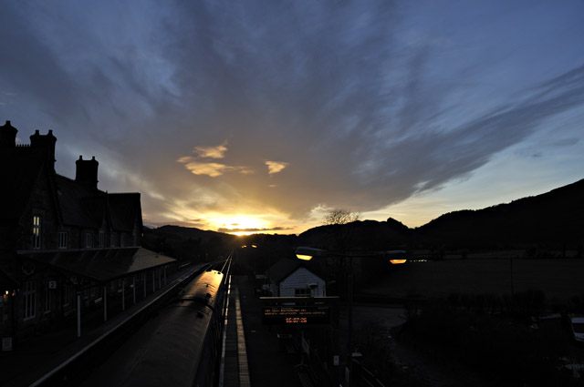 The weather set-up during the second week of January was a classic "warm conveyor" - that's a long-fetch warm south-westerly airflow with its roots down towards the tropics, bringing with it stacks of moisture. This is illustrated vividly below with the January 12-13 midnight atmospheric sounding (taken with a weather-balloon) from Camborne in Cornwall. Notice how close together the two heavy black lines are: these are air temperature and dewpoint with height. If a sounding has the dewpoint line way over to the left of temperature, it means the air is relatively dry. In this case, the two lines run pretty much together up to the 450 millibar height, at over 6000m (~20,000 feet). This means that the air is almost completely saturated from ground level for an awful long way up. That in turn means lots of potential rain: the value "PWAT" (precipitable water) at the bottom of the column at the RHS of the diagram is very high for January at 28.82. It means that if a mass of air was lifted from near ground level to the tropopause, 28.82mm of rain would fall out of it. Not only that, but the unidirectional strong winds (arrows to the R of the diagram) would keep replacing the air and its moisture, so that an awful lot of rain would result - hence the term "conveyor". 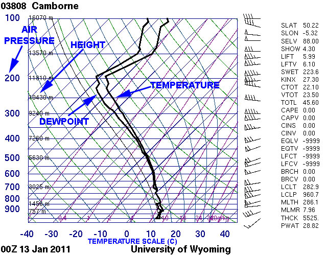 Incidentally, the tropopause is easy to spot on soundings. It is the point at which the temperature and dewpoint-lines abruptly change direction and head rightwards, denoting an increase in temperature with height (the opposite of what occurs lower down). In other words, it's a dirty great temperature-inversion. Here, it is situated at just above the 200 millibar height, at over 11800m above surface, or way above the height of Everest. That's very high for January, a clear indication that this is a warm airmass of tropical origin. The result - in winter - of such a moisture-laden airmass conveyoring its way across the Atlantic and over the UK is days of very low cloudbases and continuous moderate rainfall: the air trundles in and meets the western mountains of Wales, the Lake District and Scotland and is cooled as it is forced to rise over them. That cooling reduces the air's moisture-carrying ability (air can carry an extra 7% of moisture with every extra degree Celsius of warmth), and continuous rain is the result. By the morning of the 13th, a major Dyfi Valley flood was underway. I've illustrated several of these before so this time I thought I'd try to get some different angles. I headed south-west towards Derwenlas: the road was deep underwater shortly beyond there, but I found a few vantage-points en-route; the main channel is somewhere in here: 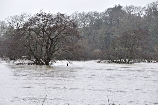 At one of the railway-crossings, the swirling waters were pretty deep!  What does that notice on the gate say? Zooming in - aha! 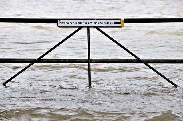 That might sound harsh, but you don't want a train meeting a herd of stray cattle. It has happened... By now the flood-plain was one vast sheet of water, with just the tops of gates poking out above its surface....  To the north of Machynlleth, from the end of the platform at the railway station, I could see blue flashing lights in the distance. It turned out that water had poured down the bank behind the cottages, flooding the one on the end to a depth of about a foot and requiring the evacuation of its elderly resident... 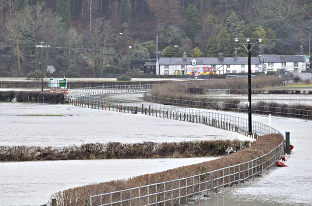 The total from this one event was probably getting on for 100mm, or 4 inches. Warm conveyors are the main cause of significant floods in this area. It is just as well that the hill-snow had all but gone by this date or it would have been a lot worse! Over the following weekend the conveyor persisted with two further instances of flooding. By the 17th it had finally cleared away and I went down to Borth to see if anything interesting had washed ashore in the accompanying gale. It hadn't, but it was a good excuse for a tramp along the shoreline as the sun attempted to emerge from behind the great banks of cloud: 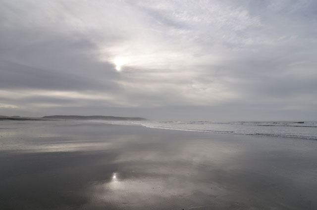 It briefly broke through, giving the surf a mercury-like appearance: 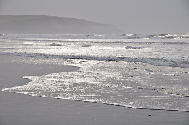 On this occasion, all the ebbing tide left behind was masses of foam!  High pressure then quickly built across the UK, giving clear, crisp days and cold frosty nights, though nothing like the deep-cold of December. On the 20th I had a couple of spare hours in the afternoon, so I headed over to Clarach, to walk to Wallog and back via the excellent Ceredigion Coastal Footpath. The light was rather diffuse, especially out to sea where a few fog-patches were present, but it was a large tide so the feature I wanted to look at would be well-exposed at low water. I'd been inspired to write about it by recently reading Alastair McIntosh's excellent book, "Hell and High Water", in one chapter of which he takes an in-depth look at the Flood Legends from around the world. More about that below, but I'd heartily recommend the thoughtfully-written book to all. If you Google the title, it comes up on the first page of results at Amazon and at the author's own website. Anyway, back to the storyline: On reaching the cliff-tops, this was the view to the north: 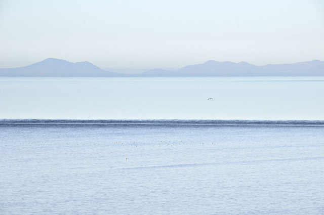 Despite the calm conditions, some underwater feature is clearly disturbing the ebbing tide. To get a handle on what it might be, here's a shot of the old Admiralty chart that adorns one of my walls: 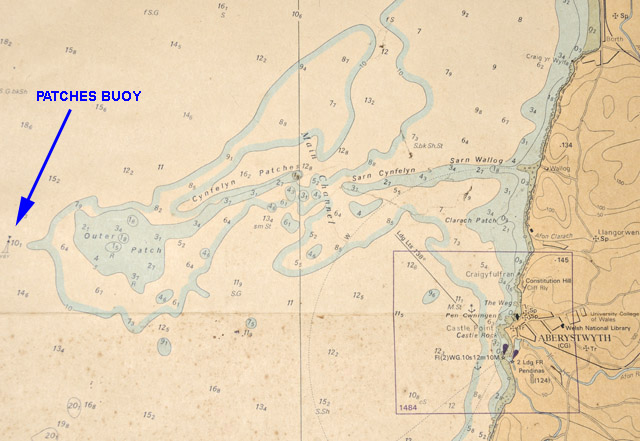
The chart shows that, in the main, the depths (numbers in italic) at low tide in this part of Cardigan Bay are around 12-14m, but jutting out from the coast is a narrow belt of shallower ground in which depths are often just 1-3m. This feature is called Sarn Cynfelyn, or locally "The Causeway". Nearing Wallog, its landward part came into view:  It does look like a causeway of sorts.... 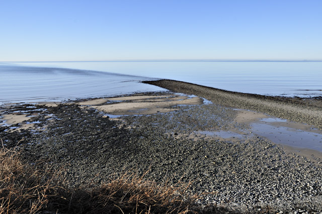 Here it is from Wallog, with the old limekiln in the foreground - the easiest way to get agricultural lime in years gone by was to bring the limestone in by boat and burn it at the drop-off point. There isn't any outcropping limestone as such in this part of Wales. 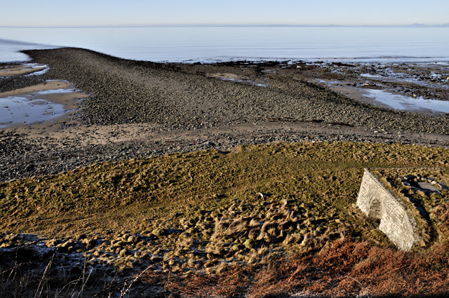 From Wallog, the coast path winds its way steeply up the high clifftops on its way to Borth. Aberdyfi is the town in the distance....  I left the path and headed seaward towards the high water mark, with Sarn Cynfelyn stretching out ahead. The tidal disturbance was still visible although it would soon be slack water.... 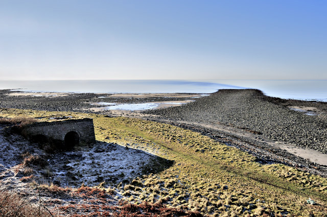 Out onto the Sarn: 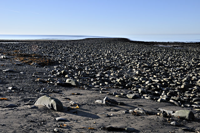 So what is it? Well, if you have ever been on a glacier, you'll have noticed that on either side there are belts of rocky debris - lateral moraines that, snowplough-like, the glacier has pushed aside in its slow downhill progress. That's what this is - it dates back to the last Ice-Age when valley-glaciers from the Welsh mountains pushed out across the lowland plain to merge with the main Irish Sea Glacier. The boulders are all of local rocks from the nearby hills.... 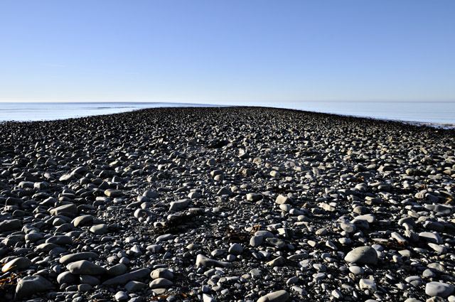 Towards the end on a big low tide like this, the kelp-zone, underwater most of the time, is entered. Further out to sea, this gives way to coralline red seaweeds. I know every mile of the Sarn well, having fished it from Aberystwyth-based boats for over 25 years. It holds a wide variety of reef-dwelling fish, the main attraction being the tasty black bream that can be caught in the summer months. As well as being a great area for recreational angling, the reef is a mainstay of the local lobster and-crab-potting industry. 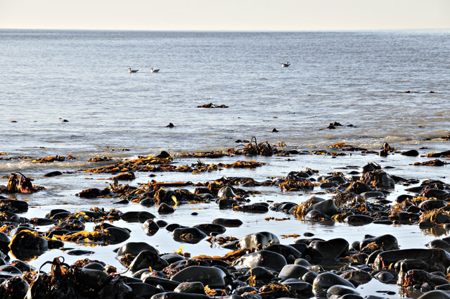 This was as far as I could go - but as the image shows, it clearly continues way into the distance, where some shallow fog lingers to blur the horizon....  Google Earth provides a useful zoom-out at this point: 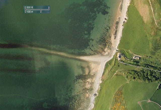 The light looking back inland was a little better. Here are the high cliffs northward with Borth on the far left: 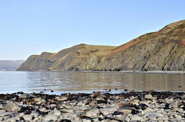 This is the view looking back east towards Wallog. The house is a noted landmark, visible for several miles out to sea - so long as nobody paints it green! 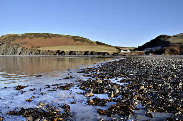 To the south, part of Aberystwyth is visible, with the Castle and War Memorial standing out.... 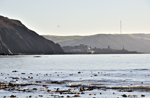 The view westwards is best appreciated by returning to the cliff-top. Sarn Cynfelyn's end is marked by the large Patches Buoy, a navigational aid to prevent larger boats running into trouble on its shallows. 6.5 nautical miles out from Aberystwyth, it's just visible in the image below: 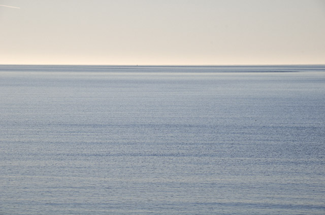 Here is a clearer view obtained by digital cropping. Beyond the Buoy there are sandbanks, and then in another mile or two another extensive but deeper-water area of boulder-reef, which we simply call the "Big Rough"! 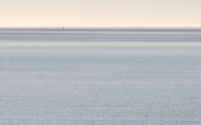 Finally, here is a retrospective on the return journey. The group of distant mountains on the RHS is the Snowdon Horseshoe, with Tywyn visible across the Bay:  At the time of the formation of Sarn Cynfelyn, all of this was land. At the height of the last glaciation, sea levels were about 120m lower than at present and, as the chart shows above, that's more than 100m below much of Cardigan Bay. The entire Bay would have been a low-lying plain. Interestingly, coastal West Wales has its very own Flood Legend, which goes as follows: Cantre'r Gwaelod (also known as Cantref Gwaelod or Cantref y Gwaelod) translates into English as the Lowland Hundred. It is the legendary sunken kingdom that is said to have long ago occupied a tract of fertile land in what is now Cardigan Bay. Cantre'r Gwaelod's capital was Caer Wyddno, seat of the ruler Gwyddno Garanhir. The land is usually described as being defended from the sea by a dyke, complete with sluice-gates, managed by one Seithennin, who is often described as a bit of a party-animal. One one drunken and stormy night, the gates were neglected and as the tide rose, so the sea swept in, ruining the land. That there are Flood Legends from so many parts of the planet is a feature suggestive of a common event experienced by many cultures, and a eustatic (= global) rise in sea level is a very neat solution. The diagram below (reference 1 below) depicts what happened. The first thing that catches the eye is that the rise was not smooth, but had periods when it was very rapid indeed, such as Meltwater Pulse 1A, during which the sea rose some 20m in a period variously estimated to be between 200 and 500 years. It also shows that the rise tailed off about 7000 years ago, which would have been in the late Mesolithic or Middle Stone Age, that lasted from 10,000 to 6000 years before present or 8000-4000 BC. 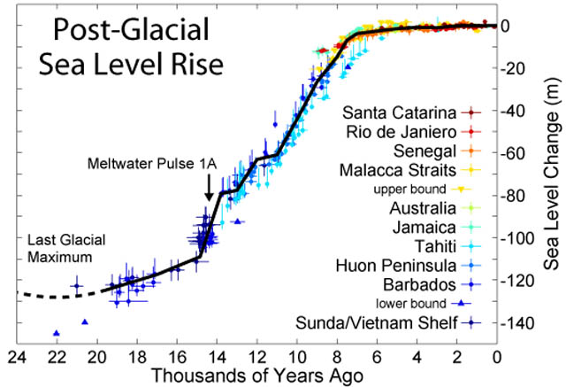 Further back in time, peat samples dredged up from the floor of Cardigan Bay 18.5m below present sea-level have yielded a date of 8740+/- 100 years before present, or 6740BC, which is again within the Mesolithic. This we can fix on the diagram by outlining a simple rectangular marquee in Photoshop: 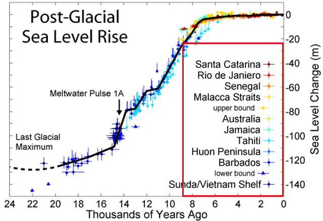 It suggests that sea-levels back then were just over 20m lower than at present. Significant areas of Cardigan Bay would still have been low-lying land. From a post a couple of years back, here is a description of this time: The environment was populated by pine, birch and alder woodland inhabited by wild boar, wild cattle (aurochs), red and roe deer. The life of Mesolithic Britons seems to have been a complex picture of part-nomad, part-seasonal occupier and possibly in some areas in some cases, permanent occupier, with attendant land and food source management under favourable environmental conditions. Increasing population and the need for reliable sources of food led to a transition to agriculture, ushering in the Neolithic age. They also had the final 20m of post-glacial sealevel rise to contend with! Is the tale of Cantre'r Gwaelod an account of this slow but steady inundation of a great fertile plain over a couple of millennia? The more fertile it had been, the greater the loss, if one equates fertile ground to food and shelter. Just how far back does the oral tradition go? Science seeks its answers via empirical observation, but in some cases that is not entirely possible. On the one hand, we have a old flood legend, quite specific to this area, embellished no doubt through time but there anyway; on the other we have the hard evidence for at least the more inshore parts of Cardigan Bay having been land during the Mesolithic and having been subsequently inundated. Will the two threads ever be joined? Walk out along Sarn Cynfelyn, despite it being a glacial moraine and not a road, on a quiet, still winter's afternoon while the waves gently sway the kelp-fronds, and you are sent momentarily back down through the ages to contemplate such things. References: 1) Fleming, Kevin, Paul Johnston, Dan Zwartz, Yusuke Yokoyama, Kurt Lambeck and John Chappell (1998). "Refining the eustatic sea-level curve since the Last Glacial Maximum using far- and intermediate-field sites". Earth and Planetary Science Letters 163 (1-4): 327-342. doi:10.1016/S0012-821X(98)00198-8 |
|
BACK TO WEATHER-BLOG MENU New! Fine Art Prints & digital images for sale- Welsh Weather & Dyfi Valley landscapes Slide-Library - Click HERE |