BACK TO WEATHER-BLOG MENU
New! Fine Art Prints & digital images for sale-
Welsh Weather & Dyfi Valley landscapes Slide-Library - Click HERE
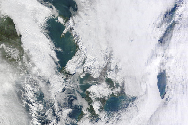
By mid-morning, conditions were glorious and, it being winter, I just had to get out for a look around and catch some sunshine! I headed down to Ynyslas, to be greeted with this on the approach-road:
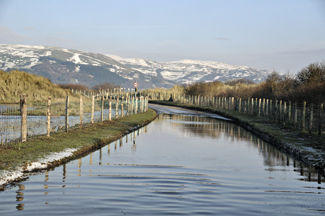
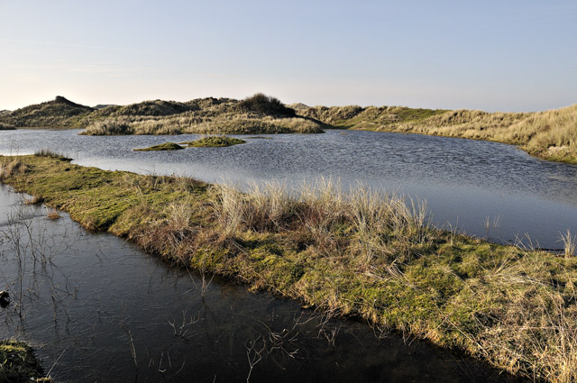
It just goes to show how high the water-table is at the moment. Below is a view into the dunes - all low-lying areas are under deep water....
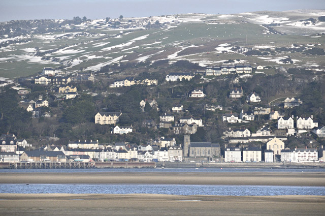
Looking across the estuary to Aberdyfi, the thaw was setting in well at lower levels but there were still plenty of big drifts on the hill above....
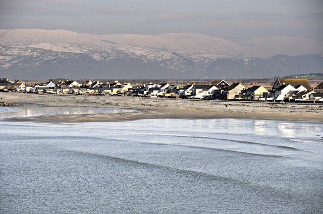
From Borth, the Tarennau were visible, but not clearly, with plenty of haze still hanging about...
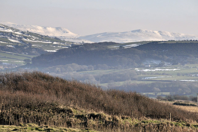
Inland from Borth, the hills above Talybont (which is behind the wooded hill in the middle of the photo) still carried plenty of snow...
Thinking to get a closer, and hopefully clearer, shot of the Tarennau, I stopped off at Glandyfi and walked down the estuary a bit, passing the boat used by the netters who still fish for salmon here the traditional way in season...
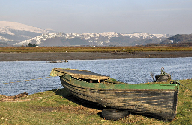
I was quite pleased with this shot, the estuary leading into the snowy backdrop. Getting closer to the hills had certainly cut through some of the haze. Doing the traverse of the ridge in such conditions would be an arduous slog - it put me in mind of Xmas eve 2010 and our snow-plod up Tarrenhendre, featured elsewhere on here, with a likely similar or greater depth of snow on this occasion....
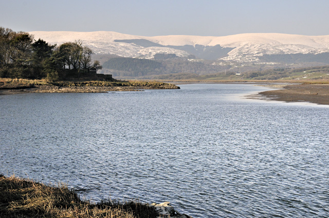
Looking back to a shadow-cloaked Glandyfi - it doesn't get too much sunshine at this time of year. The large new cutting and elevated section of the A487 - the big Glandyfi Bends roadworks - dominate the view. This has been a sizable job and it is ongoing at the time of writing though it's taking shape well. The bends were a well-known local bottleneck, usually OK but with occasional snarl-ups when large vehicles met at an awkward bit. The rock has been broken out by diggers equipped with peckers and the better stone recovered and used for facing on the cutting-wall, which seems pretty sensible...

As the final days of January were entered, the Atlantic depressions finally broke through with a vengeance and the temperature shot up. On the night of January 26th, a most unusual thing happened: the warm sector of one low pressure system destabilised like a hot summer plume, resulting in a mass-outbreak of thunderstorms. Machynlleth got a spectacular lightshow mid-evening and a friend out walking his dog at Dinas Mawddwy was given a bit of a start when lightning struck a telegraph pole just 50 metres away! The plot below shows lightning strike locations on the night in question:
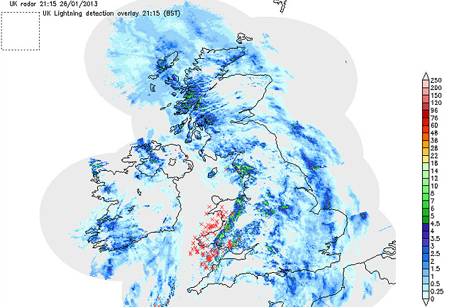
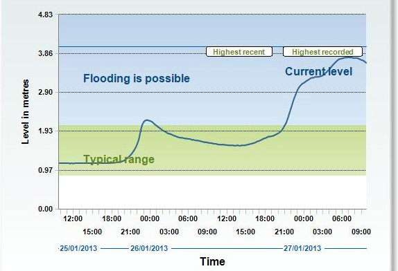
The reason for this thundery event was that the air contained in the warm sector was of tropical origin - it had traveled up from a long way to the SW. In a process known as isentropic upgliding, it then over-rode the cold air over Wales, the lifting raising it to a convectively unstable altitude. Rapid convective storm development then followed. The torrential rain that the storm-band produced was responsible for the rapid rise of the Dyfi towards the RHS of the graph below, which is a river-gauge readout from the Environment Agency. The gauge is situated at Dyfi Bridge. By midnight, the rain (plus much snow-melt) had put the river in flood....
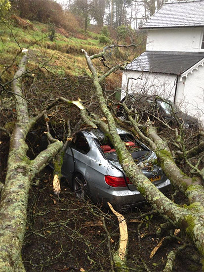
More problems came on the afternoon of January 28th, with severe gales affecting much of Wales: gusts of 70-85mph were recorded. The winds were strong enough in Machynlleth to bring down a few trees and large branches, one such incident flattening a friend's sports-car. Photo by Ben Robinson - the unfortunate owner of this now ex-car.
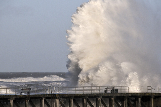
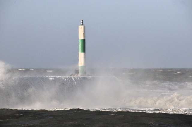
Gales, torrential rain and flooding continued all week, with the roads into Machynlleth being closed from time to time. I didn't bother to take any photos - last month's entry is chocker with flooding images - but focused on something else: the huge swell that was battering the coast. Checking the surfing website, Magic Seaweed, with its excellent swell forecast, I managed to find a neat coincidence for January 31st: a double-figure swell height, a high spring tide, fairly clear conditions and high water mid-morning, ideal for light, and an onshore gale. I headed down to Aberystwyth, arriving an hour before high tide. Within moments I had got the shot below. I had a good feeling about this.....
On the south side of Aberystwyth Harbour there are a series of excellent vantage-points that may be used to shoot from inside a vehicle. This may sound lazy, but the main reason to do so is that the air will be absolutely full of driving salty spray, which will quickly plaster a camera and lens. Careful positioning of the vehicle with respect to the wind gives a lot of protection from this unwanted side-effect. The use of a zoom-lens is essential in such conditions as the vantage-points are set back a little from the action, but the advantage is that one location can cover several key wave-breaks. However, other drivers seemed keen to get up close and personal:
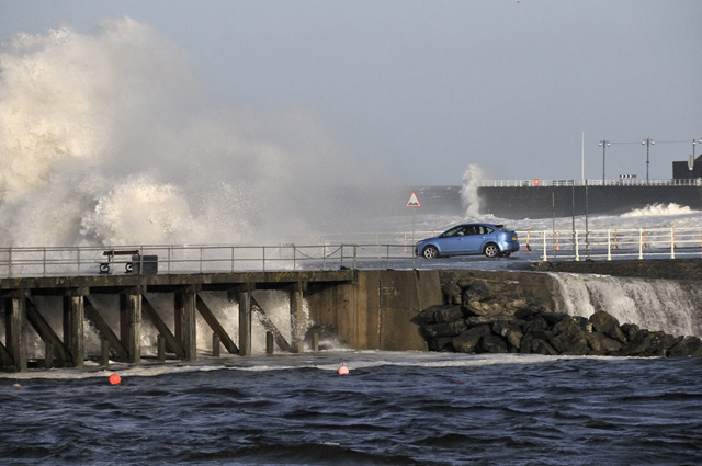
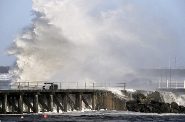
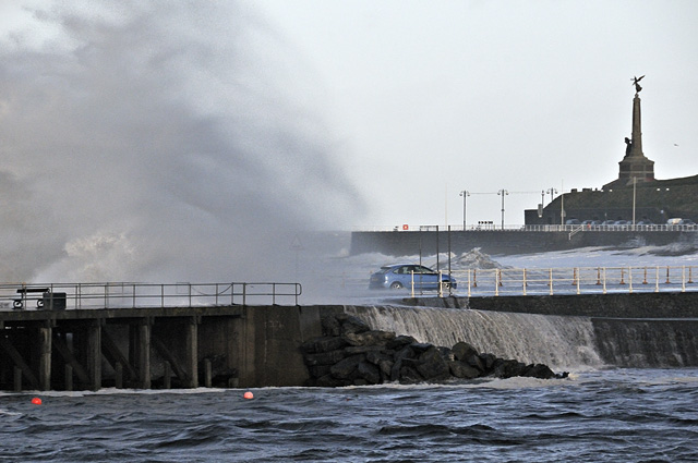
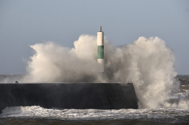
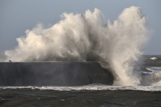
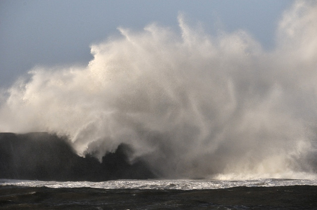
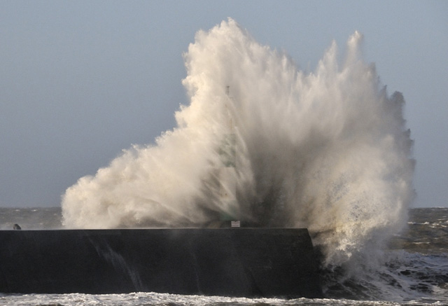
I switched my attention to the popular sea-angling venue, the Stone Jetty. This was getting hit by some superb watery explosions! Images were all shot at high shutter-speeds to freeze the motion to an extent.
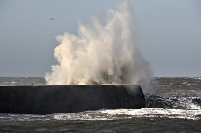
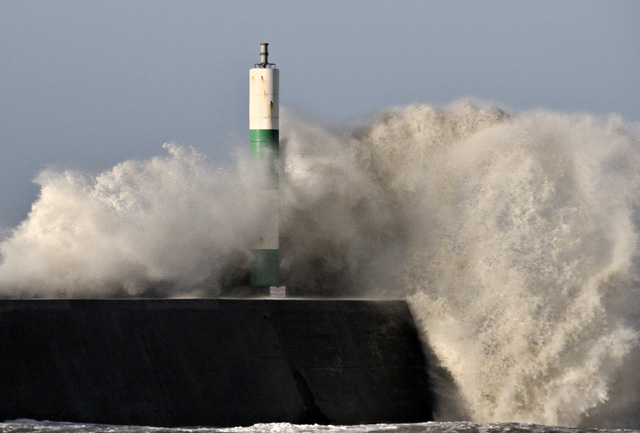

The following is a sequence of four showing the impact of one single wave:
This was neat:
Back to the right and another car-driver got a bit too close:


All in all a great morning's photography and enjoyment of the forces of Nature!
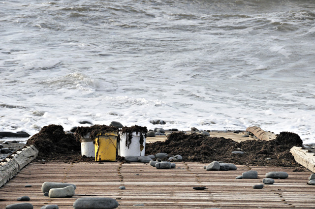
Seas that rough also tear out weed from the various underwater reefs in the area and pulverise it, dumping it on the beaches as conditions calm down. Down at Borth, huge quantities were present, as this shot from February 6th shows:

I thought to helpfully clear the lifeboat slipway, but having filled all the containers (this was load number 2, collected in a hurry before the afternoon high tide swamped it), I had hardly put a dent into it. I mentioned its availability on Facebook so hopefully other gardeners will head down and grab some of this free, natural fertiliser....
All sorts of species mixed together here, full of useful minerals...
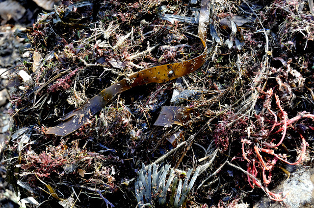
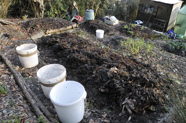
As an experiment this year, I'm going to plant the vegetable-beds through this thick, 4-6 inch seaweed mulch which now covers all beds (this photo is a few weeks old). There are two methods - either simply plant in the soil beneath the mulch or make a hole through it, fill that with soil and plant into it. Seaweed not only fertilises and lightens soil: it helps retain moisture (though if we see another summer like 2012 that won't be necessary!) and it seems to deter slugs. It also attracts worms - the 4-week old weed in my compost heap is crawling with them - and experience shows that it acts as a composting accelerant. All good things. I'll report on how successful (or not!) this technique proves to be later in the year - it's still some time before things need to be planted.
The seesaw continues into the rest of February: on Sunday 10th, a low pressure system slides SE over the UK, pulling in cold air on its northern side bringing with it the risk of a widespread heavy snow event, but it is critically dependent on a number of factors: for this location, not far above sea-level, the question of whether it will be rain, sleet or snow is a tricky one at this point in time. Thereafter, the unsettled pattern appears set to continue, although yesterday when spreading weed on the garden there was a definite feel of spring being just around the corner, which of course it is, starting in meteorological terms on March 1st. Looking forward to that, for certain!
BACK TO WEATHER-BLOG MENU
New! Fine Art Prints & digital images for sale-
Welsh Weather & Dyfi Valley landscapes Slide-Library - Click HERE