BACK
TO WEATHER-BLOG MENU
New!
Fine Art Prints & digital images for sale-
Welsh Weather
& Dyfi Valley landscapes Slide-Library - Click HERE
| From
late August into September, a few days of relatively settled weather
permitted some overdue jobs in the garden before unsettled conditions
returned to keep moisture levels up and allow the continued fruiting of
edible fungi. This entry features both, plus a bit of palaeoclimate and
Jurassic geology, the results of a walk at one of my favourite spots -
Tonfanau beach. The potato-harvest was done on Bank Holiday Monday, when the weather, in a most untraditional manner, steadily improved! The variety I grew this year was Cara - following a bit of blight in 2009 I was keen to select one with strong resistance. It paid off and a good yield resulted. 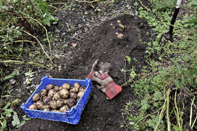 Following that, while the trays of potatoes were drying in the sunshine, I had a session of open warfare on the creeping buttercup that was threatening to take over several areas. Most "weeds" I compost but this is a tough critter - so I converted it into potash instead! The dense smoke and green leaves made for some unusual photographs...  As I sat tending the fire, the traffic built up at Dyfi Bridge, where the three-way lights were not coping with the sheer volume of folk on the move. It was backed up from the lights all the way to Machynlleth and stayed that way for much of the day. Thankfully the repairs have now been completed and things are back to normal. Jams like this are an uncommon sight around here.... 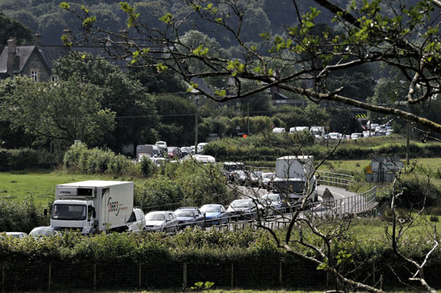 Brief settled conditions allowed for a bit of fishing but the mostly rough August has left the fish very scattered. The shot below was taken at Borth one morning at sunrise..... night tides are best as the beach is still fairly busy this time of year. 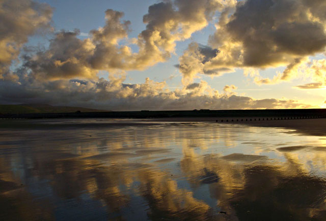 One day I persuaded a couple of mates to share the fuel cost and we tried Bardsey Sound for mackerel and pollack. We caught both, but not in numbers. The sea was a bit cloudy even here where it is normally gin-clear - a testament to August's unsettled conditions. There was an amazing double-sundog to finish the day off, though - shot with the aperture stopped down to the max: 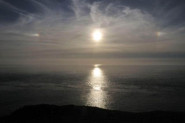 On the 6th I travelled to Dolgellau to have a meeting about some work in October - about time too! We went for a quick recce to one of the sites where we would be bringing students - Glasdir copper mine. The Forestry Commission have done an excellent job of clear-felling and laying paths around the remains of the old mine-buildings where the ore was crushed and the copper-bearing sulphides recovered. Naturally, with all that activity, the ground hereabouts is heavily contaminated by copper, as one would expect. What I didn't expect was this: 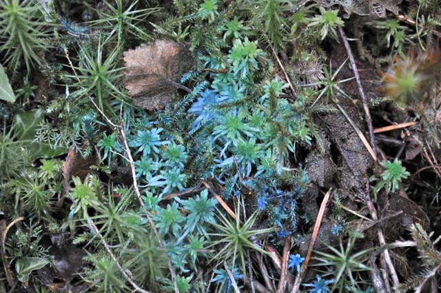 Briefly thinking someone had been messing about with paint, I looked around and it was everywhere, including some inaccessible places. The photo below shows a similarly-coloured Cladonia: 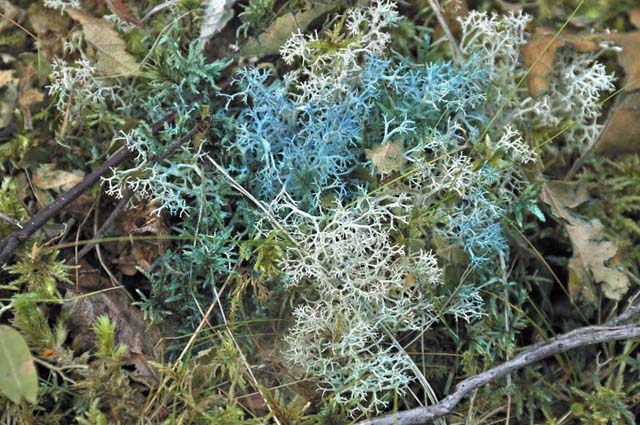 I guess the groundwaters hereabouts contain a lot of copper and these mosses and lichens take it up, but in dry conditions evaporation concentrates the copper to the extent that it becomes visible. It will be in the form of one of the copper salts - like the hydrated sulphate chalcanthite or the basic sulphate langite. Analysis will reveal its nature: if chalcanthite then the colour will presumably have gone by the October field-trip, what with all this rain - the mineral being soluble in water. On Sunday 12th I made the most of a sunny afternoon and went for a good walk at Tonfanau, to the north of Tywyn on the Cardigan Bay coast. This is a quiet, peaceful section of the Cardigan Bay Coast, presumably because access involves a bit of a walk. The footpath brings one out through a gate onto the beach close to the outfall of Afon Dysinni: 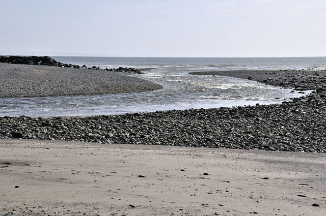 As I turned northwards along the beach, a Bar-Tailed Godwit trotted out of the shingle and headed for the sea: 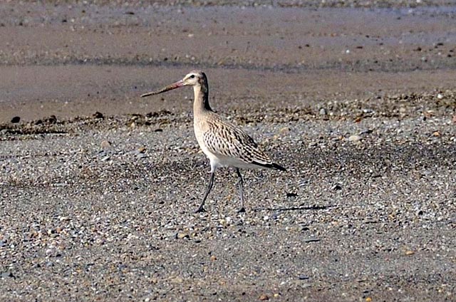 It soon saw me and sprinted off across the beach:  Tonfanau was an important military camp during World War 2 and the coastal hinterland is dotted with semi-derelict buildings and concrete roadways. The cliffs are made of soft, easily-eroded glacial and fluvioglacial drift and are retreating rapidly in the face of coastal erosion and sea-level rise. On the beach are strewn waterworn bits of former buildings amongst the natural boulders....  The low cliffs are of great geological interest. There are two varieties of drift here: a lower one derived from the glaciers that came down from the Welsh Mountains and an upper one derived from the great glacier that ran down the Irish Sea, a portion of which pushed through a low gap on the Lleyn Peninsula and passed close to this place... 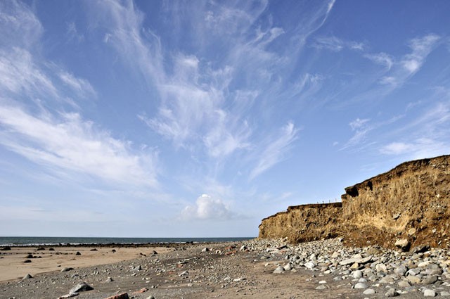 The section also reveals cryoturbation structures - slumping and other deformation, formed during permafrost conditions.  How do we know that Irish Sea ice passed close to this place? The clue lies in the clasts - the blocks, up to car-size, of stone that the ice transported and left here. Many are of local rocks from the nearby mountains such as this block of sedimentary rock from the Cambrian Period:  Or this block of volcanic rock, of probable Ordovician age - Ordovician volcanics are of widespread occurrence in the hills of North Wales.... 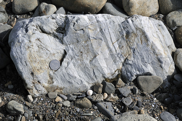 But in places one finds blocks of this stuff:  This is much softer shelly limestone of Jurassic age, here crowded with the remains of bivalves and with a few fragments of fossil wood, too... 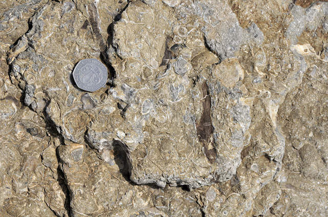 In this shot, there is a larger, thick-shelled bivalve (L) and the calcite guard of a belemnite (R). 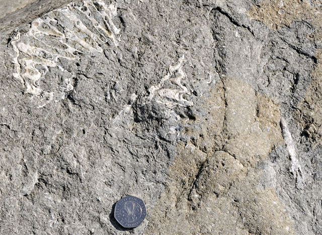 There are currently no outcrops of Jurassic rocks at surface in North Wales, which is mostly made up of much older Palaeozoic strata. However, the existence of an offshore sedimentary basin in Cardigan Bay was predicted years ago and confirmed by boreholes here and at Mochras, up the coast (see references). The first borehole, at Mochras, proved not only the presence of much younger rocks but in addition the thickest sequence of Lower Jurassic (Liassic) rocks anywhere in the UK. At Mochras and at Tonfanau, the coast juts out just far enough for the land to extend west of the massive, N-S system of geological faults that make up the eastern margin of the Cardigan Bay Basin. The diagram below shows a section through the rocks in the Mochras area (from reference 1):  Since the time of the drilling of the Mochras Borehole, research has confirmed the existence of Jurassic and other young rocks beneath the seabed throughout much of Cardigan Bay and St George's Channel, forming a series of interconnected sedimentary basins. The erosion and transport of the limestone blocks, from somewhere now out to sea, is considered to have taken place as the Irish Sea ice moved through, at the height of the last glaciation: 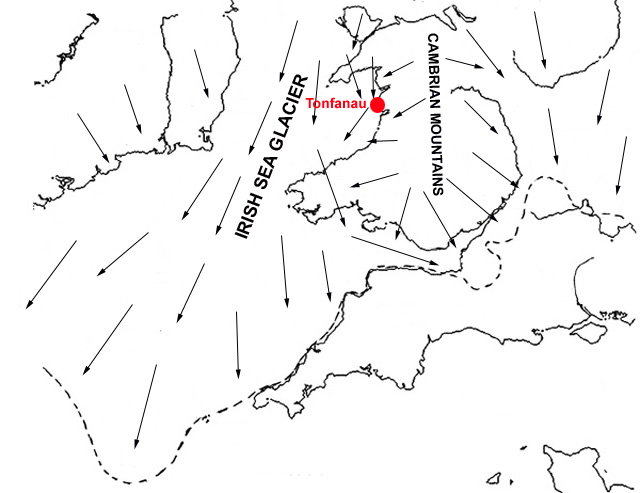 Glacial ice ploughs up bedrock as a farmer ploughs up soil - it is an extremely efficient agent of erosion. The diagram above, taken and redrawn from Wikipedia's Irish Sea Glacier entry, is a representation of the geography of the Welsh Mountain Ice-Cap and the Irish Sea Glacier at the last glacial maximum. The arrows depict the flow-direction of the ice and the dotted line marks the southerly limit to the ice-front. Sea-levels at the time were over 100 metres lower than those of the present day, so in Cardigan Bay, most of which is today less than 40 metres deep, the ice would have been grounded i.e. it was moving directly over the rock, tearing it up as it went along. Some of it ended up dumped along the coast at Tonfanau, where it is eroding out of the soft cliffs as sharp-edged blocks that are then rounded-off by wave erosion. Fascinating stuff! On my return I stopped to grab an ultrawide shot of the cirrus radiating out from the northern horizon, with some of the ruined wartime buildings in the foreground:  The weather steadily went downhill after that - on Monday 13th and Tuesday 14th it felt as though it had not got light properly and rain set in and continued through most of the period. By Tuesday afternoon, when the rain cleared away southeastwards, the Dyfi had burst its banks and the A487 out of Machynlleth was closed to all but larger vehicles: 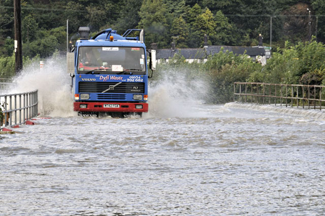 On the 15th, light showers persisted but I needed to stock up in Nature's larder. In a nearby very soggy wood, the Chanterelles were in reasonable numbers...  ...as were Hedgehog Fungus - with a similar and arguably better flavour! 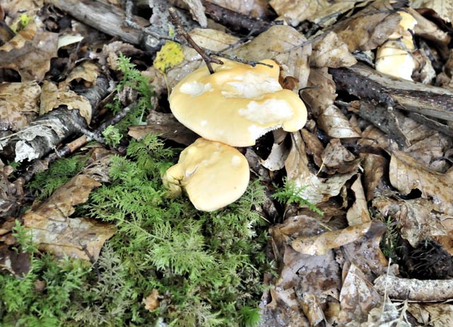 Here's a shot of the undersides of both. The Chanterelle does not have gills - it has ridges - and the Hedgehog, like its namesake, has spines. This makes them relatively easy to identify - with a bit of practice. It is essential to know what you are doing when gathering wild food, as a mistake can be fatal!  Here's a typical haul - Chanterelles and two species of Hedgehogs! 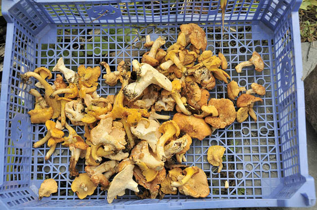 It's getting noticeably cooler at night now - I lit my first log fire for ages last night, although coming down with the cold that is circulating vigourously through the local community has not helped in that department. Way out in the Atlantic, Hurricanes Igor and Julia are trundling along but the long-range model output is extremely variable run-to-run on the topic of what they will do once they morph into extratropical depressions as they recurve away from North America. Some runs have brough heavy rain and gales to the UK, others stick it under a large area of high pressure. However, we are talking about T+200 hours, and weatherwise I tend to take anything beyond about T+120 with a healthy pinch of salt! In other words, we'll see! References 1. Holford, S.P., Green, P.F. and Turner, J.P. 2005: Palaeothermal and compaction studies in the Mochras borehole (NW Wales) reveal early Cretaceous and Neogene exhumation and argue against regional Palaeogene uplift in the southern Irish Sea. Journal of the Geological Society; September 2005; v. 162; no. 5; p. 829-840; DOI: 10.1144/0016-764904-118 2. Woodland, A.W. (ed.) 1971. The Llanbedr (Mochras Farm) Borehole. Report of the Institute of Geological Sciences, 71/18. |
|
BACK TO WEATHER-BLOG MENU New! Fine Art Prints & digital images for sale- Welsh Weather & Dyfi Valley landscapes Slide-Library - Click HERE |