BACK TO WEATHER-BLOG MENU
New! Fine Art Prints & digital images for sale-
Welsh Weather & Dyfi Valley landscapes Slide-Library - Click HERE
It's November 6th and time for a pause in a busy period to update the blog. Life has been quite hectic of late, having written and illustrated a book over several weeks of intensive work - a veritable download of the brain! I have found a publisher willing to take it on and we will get started on that early next year. It's not about Welsh weather - that one's still in the pipeline: more next year when things firm up and I'll be working hard to market it and hopefully earn a few quid for my efforts.
It was also high time to sort out the winter firewood. Having a beer with a local farmer one evening, he mentioned a fallen branch that I would be welcome to remove. Arriving on-site I saw it was a bit bigger than I had imagined!
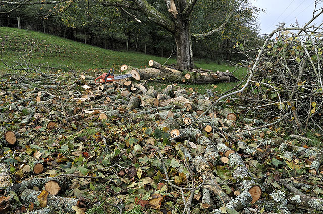
Although green, it had been down a few weeks and as it's sycamore it seasons quite quickly. Most of it's cut and split now and I am nearly out of stacking-space! Thus the winter can now do as it pleases: it can even do as headlined in the Daily Express, although the only thing remotely close to any of that guff so far was the ice on my car first thing this morning! First frost of the season here (some areas had one a few weeks ago): the sou-westerlies have been firmly in charge in recent weeks.
The weather here may have been rather unsettled but not particularly interesting of late, until November 3rd came along with an unstable southerly airflow and an impressive amount of deep-layer wind-shear. Unstable southerlies have in the past given rise to significant tornadoes so the day was receiving a lot of attention; TORRO had a Tornado Watch issued for much of the southern UK and, having figured that low cloudbases might be problematic over the hills, I opted for a coastal watch, heading down to Borth around midday when the radar indicated storms moving up from South Wales. It proved to be a good call on this occasion....
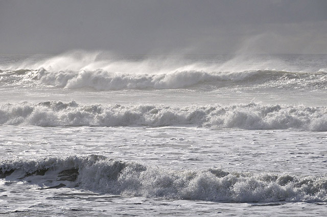
Upon arrival some messy storms dominated the sky and the big swell rolling in was more interesting! Surprised the local surfers were not in evidence.
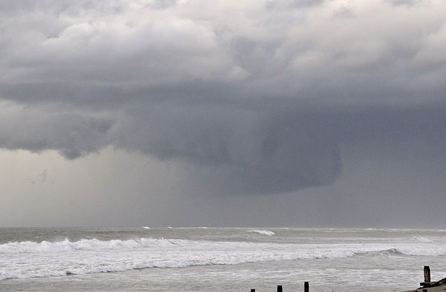
Towards 1400 I noted a rain-free updraught base (L) was moving into the vicinity:
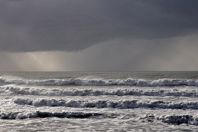
My interest took off when part of the cloudbase lowered a little with a little tail of cloud off its LHS. This looked to be a developing wall-cloud.
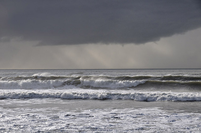
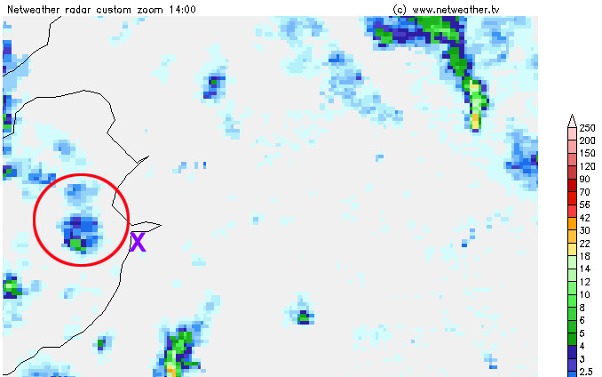
Here's the radar at this point with the storm circled and a purple X marking my position:
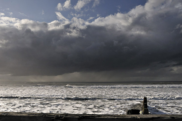
This image shows the updraught (L) and the area from which rain was falling (R):
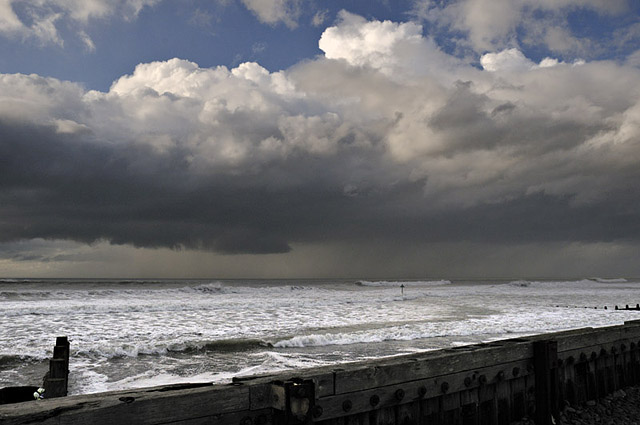
As the storm developed, the wall-cloud became more pronounced and the cloud-tops became visible to the R, with an anvil beginning to form:
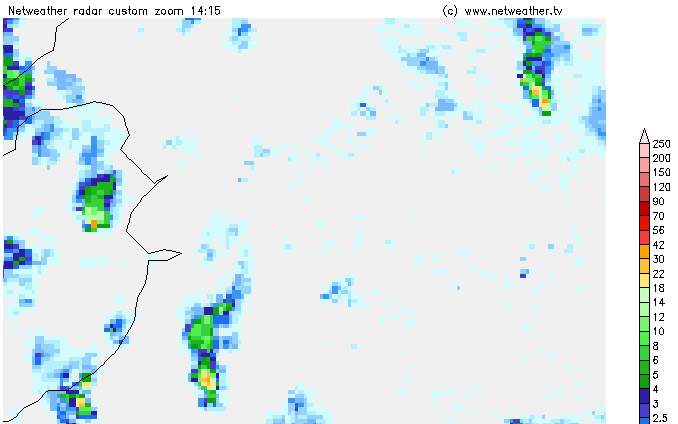
Here's the 1415 radar, showing the heaviest precipitation right at the back of the storm (orange pixel) and it getting lighter and lighter to the north (green then blue pixels) where, due to the the wind-shear, it is streaming off downwind:
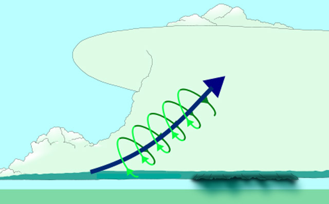
This diagram (thanks to Wikipedia) shows what can occur in a high-shear environment. Firstly the updraught flows diagonally from the rain-free base (L) to the cloud-top (R), from which the precipitation (downdraught) falls. This separation of the updraught and downdraught allows the storm to be much longer-lived than ordinary convective cells which choke themselves fairly quickly - although in multicell storms - the commonest type - multiple cells are popping up and decaying all the time, so the cluster itself can last a long time. The diagram also shows the updraught having a corkscrew shape - this is a diagram of a supercell storm - in which the updraught is rotating from cloud-base to the cloud's upper regions, in what is known as a mesocyclone.
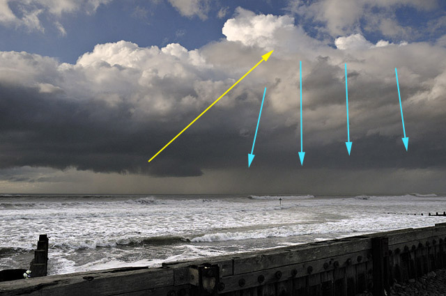
In this annotated image, the updraught is marked by a yellow arrow from the rain-free base towards the cloud-top; the blue arrows mark the downdraught area where rain can be seen pouring from the cloudbase:
The following are pairs of zoomed-out/zoomed-in images taken at the same time over some twenty minutes. In the first pair, the anvil R is further developed and the wall-cloud has lowered a bit further:
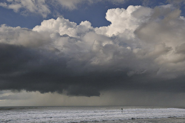
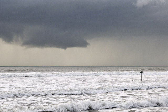
By now, I could clearly see the wall-cloud was rotating, so we have certainly got a mesocyclone in the lower part of the updraught:
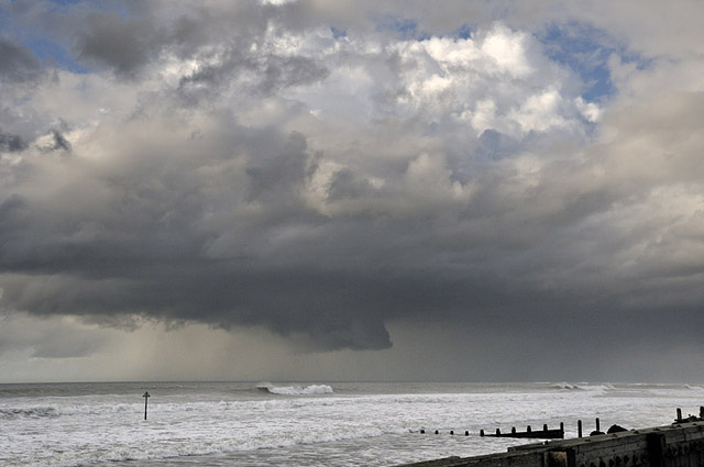
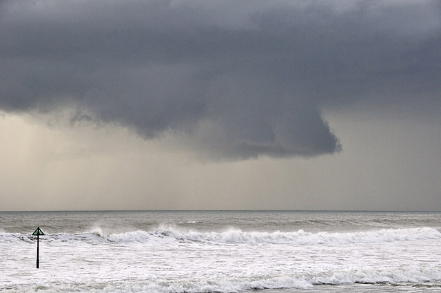
In these two images, precipitation can be seen coming back down behind the rotating wall-cloud and partially obscuring its rear as it wraps around in the circulation - this is known as the rear flank downdraught, often abbreviated to RFD. The extra lift provided by the rain-cooled air diving beneath the ambient air can assist in tornado development at this stage - mesocyclones produce the strongest tornadoes of all, so I watched intently - but nothing of such a nature happened on this occasion. I'm not complaining, in any case. But look how low the wall-cloud is now - it's halfway down to the sea!
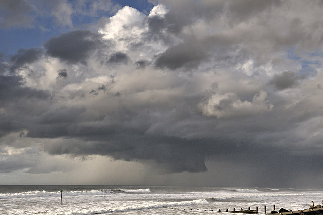
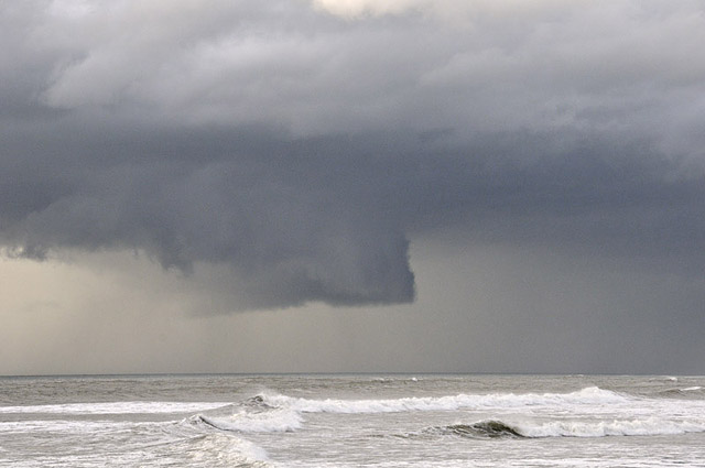
Here is the final shot - the precipitation is wrapping right around the wall-cloud now, partially obscuring it from sight:
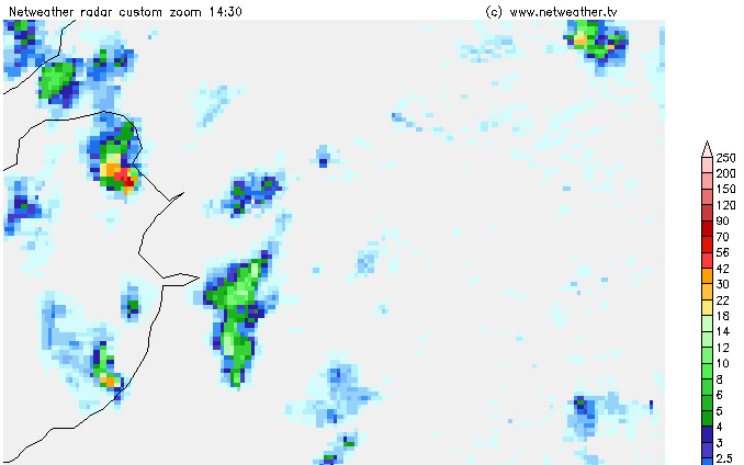
By 1430, it had tracked off northward and was shortly afterwards lost behind the precipitation. The radar tells the rest of the tale: look how, in the 1430 image the storm has exploded into life and is producing precipitation at over 50mm/hr as its core approaches Harlech - that's some deluge!
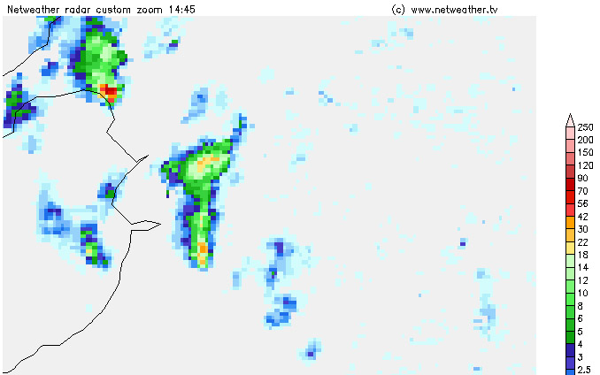
Here, it is crossing the coast near Porthmadog. There was thunder up there at this point.
Here, it is tracking across western Snowdonia; it kept going strongly until it reached the coast near Bangor at 1530 GMT, when it quickly fell apart over Liverpool Bay.
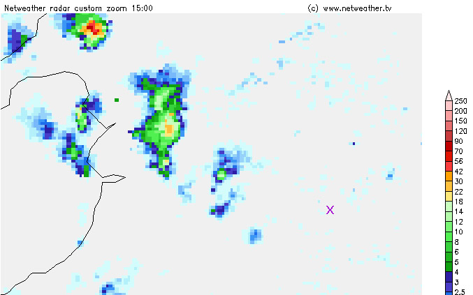
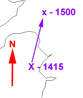
Here's the storm's track from 1515-1500. Given that the steering-flow was southerly, this storm seems to have been a "right-mover" - i.e. it moved to the right of the general flow, although this may just have been down to a local synoptic veering of the steering-flow. Right-moving is a feature often exhibited by supercells. Certainly in terms of visual structure this storm had many features of a supercell: it was a long-lived single-celled storm that rapidly became intense; it had a strongly tilted updraught plus a mesocyclone marked by a large rotating wall-cloud with RFD development. Lots of boxes ticked there - but we would need something we don't yet have for Cardigan Bay - Doppler radar - which accurately maps out air-currents within storms to confirm it 100%. Hence the post title - "probable supercell", as opposed to "definite".
Whatever the name, it was certainly a cracking little storm!
Fetching up from the south was another storm, this one rather skinny in comparison but still quite photogenic:
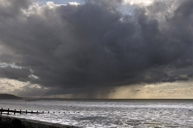
Whilst inland, over the Cambrian Mountains, a multicell cluster passed by:
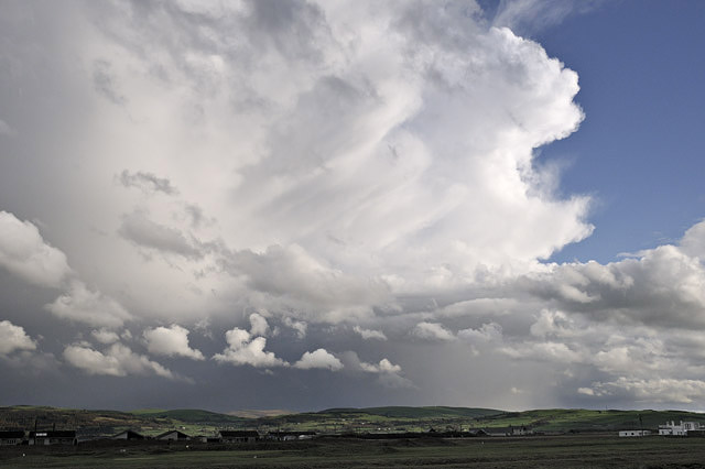
The hard-edged anvil with some mammatus hinted at fairly intense activity:
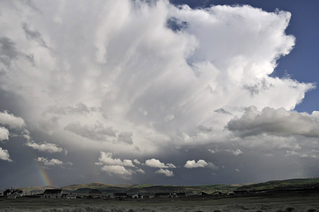
....and had the sun been on the houses at Ynyslas too this would have been a cracking shot!
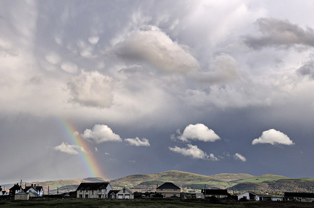
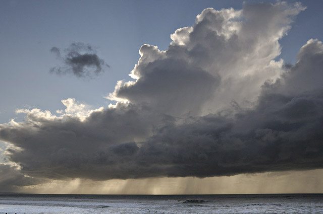
The final image from November 3rd shows the skinny shower out to sea with the rainfall fizzling out - again the diagonal updraught features strongly in the highly-sheared environment. Hell of a day, all in all!
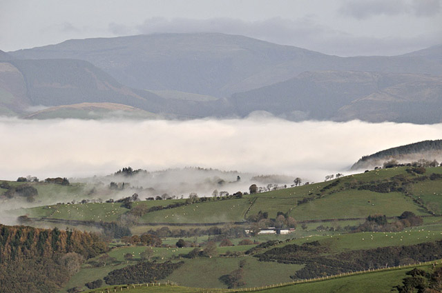
On November 5th I woke to a damp, foggy morning, which was a potential pain as I had a commissioned photo-shoot arranged at a business in the valley and fog was the last thing I wanted. Examining satellite images showed clear skies over the Welsh uplands, though, so I thought I'd pop up the Machynlleth-Llanidloes mountain-road to see how deep the fog-layer was. It proved to be less than 200m deep, but the effect was interesting - it filled the valley like a glacier!
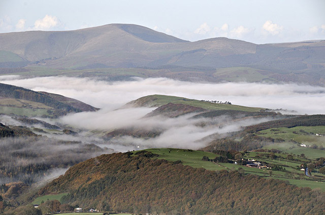
Machynlleth is entirely hidden by the fog-blanket beyond the notch on the L, where the Dulas Valley meets the Dyfi Valley:
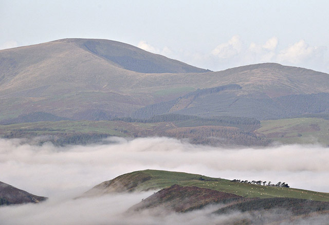
Here's a shot looking up the Dyfi Valley past Cemmaes to Dinas Mawddwy, with the Arans beyond with a little high-level hill-fog of their own:
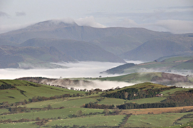
Looking down the mountain road, Tarrenhendre in the background:
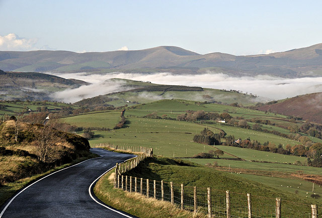
A view straight across the Dyfi Valley with Dyfi Forest beyond:
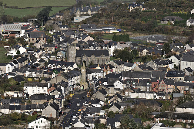
And, after it cleared: Machynlleth in the bright autumn sunshine.
The high pressure ridge bringing the fog and frost will be a transient feature, sadly. Later this coming week, the Sou-Westerlies will be back. More soon.....
BACK TO WEATHER-BLOG MENU
New! Fine Art Prints & digital images for sale-
Welsh Weather & Dyfi Valley landscapes Slide-Library - Click HERE