BACK
TO WEATHER-BLOG MENU
New!
Fine Art Prints & digital images for sale-
Welsh Weather
& Dyfi Valley landscapes Slide-Library - Click HERE
Early April
saw me travelling over to Essex following the death, after a longish
illness, of my dear Brother-in-law, Martin Waite. To say that he was a
man of many talents would be an understatement, and I shall simply say
that I will evermore miss going for a pint and a good natter with him
to the Black Buoy, his favourite pub in the small estuary-side town of
Wivenhoe, where they lived together for many happy years.
The
camera came along too, of course, as in between other things there were
constitutional walks that needed to be taken, including an unexpected
opportunity to visit somewhere new and witness at first hand the rapid
erosion of the Eastern coastline of the UK. More on that below.
Wivenhoe
itself is a beautiful, interesting old shipbuilding town with a great
waterfront, some of which retains its old and interesting feeling: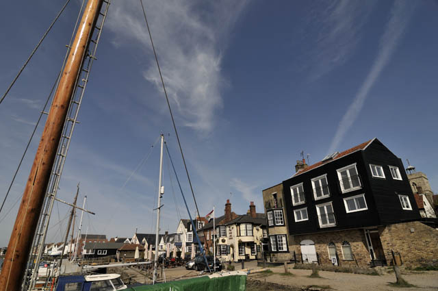 ...with the more modern aspect of the Colne Barrage downstream, and the gravel and sand-pits:  ....and upstream, the "tidier" bit, which seems far less interesting to me! 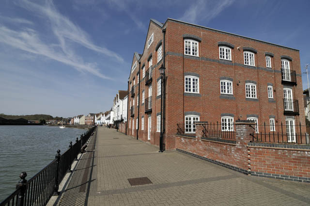 The opportunity to visit Walton-on-the-Naze on April 7th coincided with a clearing sky and, in due course, excellent photographic light. North of the seaside town, The Naze is a cliff-bounded spit of land that points north, petering out in the mass of tidal creeks south of Harwich. The cliffs themselves face the North Sea: 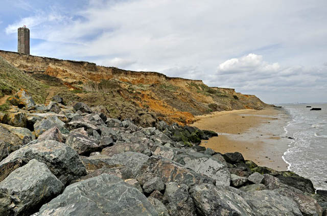 The cliffs and foreshore at The Naze consist of sticky, soft grey London Clay, capped with the brightly-coloured Red Crag, a sandy deposit rich in marine shells. A quick look back through time might help here in order to visualise what was going on. The London Clay was deposited in Eocene times, about 50 million years ago, or 15 million years after the dinosaurs became extinct. The environmental theme was one of an extremely warm climate and no polar ice-caps, and high sea-levels that covered a lot of SE England. During the remainder of the Cenozoic era (consisting, oldest first, of the Palaeocene, Eocene, Oligocene, Miocene, Pliocene, Pleistocene and Holocene epochs), the global climate gradually cooled, culminating in the great ice-ages of the Pleistocene, the last one of which only ended 11,700 years ago at the start of the Holocene epoch, in which we exist. With the cooling there came falls in sea-level, but the shelly fossils show that the Red Crag, belonging to the Piacenzian (formerly Waltonian) stage of the Pliocene epoch (1.8-3 million years old) was deposited under marine conditions. The Red Crag presents, to the geologist, evidence of a shallowing-upward sequence from subtidal marine sands to intertidal sand flat deposition.Indeed, these strata trace the climatic deterioration that led finally to the onset of glaciation in the British Isles. Along the cliff-tops there is direct evidence for the bitter cold that followed, in the form of structures attributed to permafrost. The image below shows strong cross-bedding, tilted structures that are deposits from bedforms, such as ripples or dunes: they indicate to the geologist that the depositional environment contained a flowing fluid (in most cases, water or wind). Thus, cross-bedding where the sediments are deposited by water is indicative of currents at work - such as rivers, estuarine and tidal/subtidal environments. 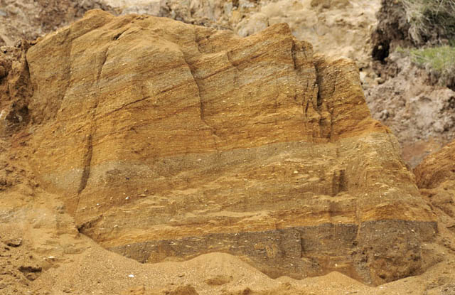 The question of whether this environment was marine or non-marine is neatly answered by the presence of bands of fossil sea-shells: 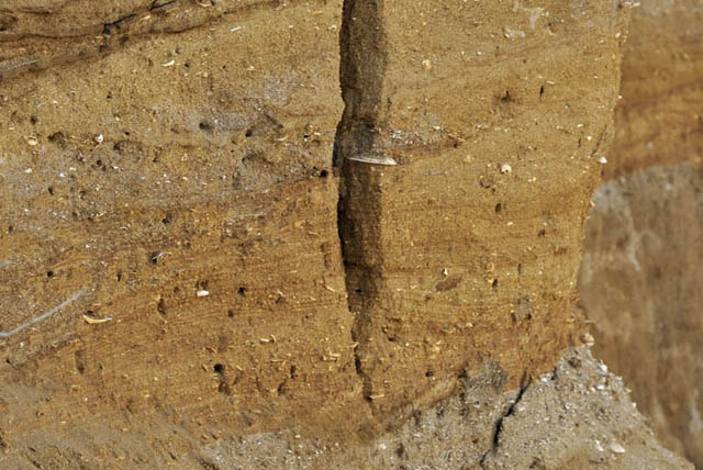 The commonest of them is the cockle, Glycimeris, still around today. Their iron-stained shells wash out of the fairly soft Red Crag and end up on the beach, mixed up with modern seashells, shingle and the shark teeth, from the London Clay, that attract fossil-hunters daily:  But, for anybody with an interest in climate change today, it is the incredible erosion that fascinates: 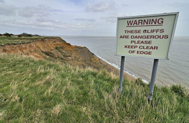 The Naze Tower was built in 1720, as a navigational aid. They sited it about a kilometre inland: it is now less than 50m from the edge of the cliffs! Pill-boxes from World War 2 stick up out of the sea, uncovering as the tide goes out. These combine to illustrate just how rapid the erosion is.... 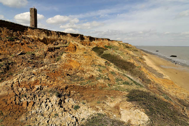 ...it is estimated to average 2m per year. The image below is of the same landslipped area, looking down and R to the vantage point where I shot the image above... 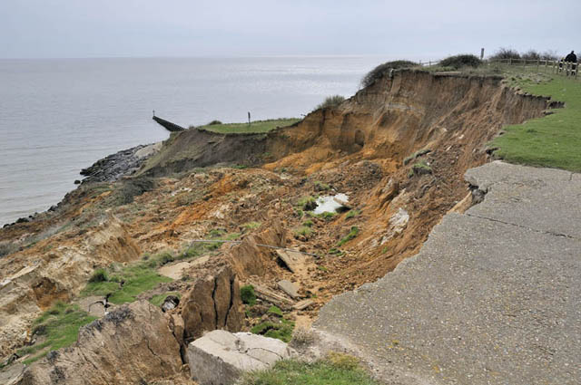 Landslipping takes several forms. A common feature is deep rotational slip, where sliding occurs at the watery junction between the permeable Red Crag and the impermeable London Clay below. The image below shows the surface expression of this process, with sections of land slumped, tilted backwards and separated by deep open fissures: 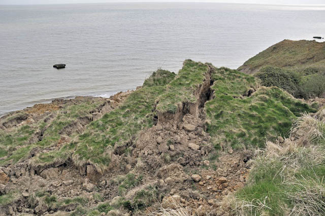 Rainwater causes the slipped material to liquefy, resulting in mudflows that sprawl on down to the beach, but storms quickly erode this material and spread it up the beach, leaving further cliff ready to collapse: 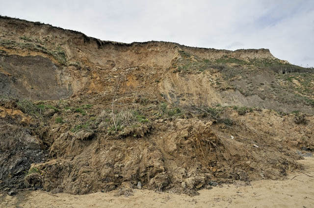 The surfaces of the mudflows become temporarily colonised by plants such as Coltsfoot:  Evidence for lost land - look at this water-pipe! 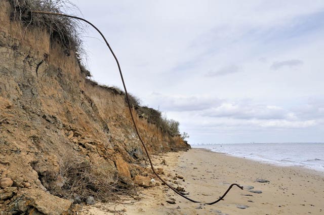 Southward - towards Walton - the coast is relatively stable, thanks to the concrete sea-defences and groynes. But these, too, are eroding: it is just that the rate is much, much slower. But can the entire coast be protected in this way in the face of the land's natural sinking and sea-level rise due to climate change? This is something that is a major topic of debate in the east of England. Can Nature ever be completely stopped? That is the question. 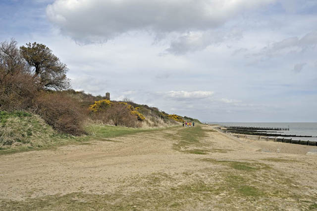 It is easy to imagine how the already impressive 2m/year erosion rate will accelerate if some of the projected sea-level rises generated by climate models do occur as forecast. I left Walton-on-the-Naze wondering just what it might look like in a hundred years' time.......... |
|
BACK TO WEATHER-BLOG MENU New! Fine Art Prints & digital images for sale- Welsh Weather & Dyfi Valley landscapes Slide-Library - Click HERE |