BACK
TO WEATHER-BLOG MENU
New!
Fine Art Prints & digital images for sale-
Welsh Weather
& Dyfi Valley landscapes Slide-Library - Click HERE
Two days
after the May Bank Holiday weekend and it's back to business as usual,
with the rain falling incessantly past my window and the Met Office
radar looking like a pizza containing too much food colouring to be
safe for human consumption! This page features a set of
shots from the only decent storm-intercept, on May 16th, one of the
images from which was published in the Guardian the following week - a
nice result indeed!
In
a month that can sometimes provide some great thunderstorm activity,
that was that - I'm not alone in this frustration, mind, as several
teams of UK storm-chasers are currently out on the Great Plains of the
USA and finding it difficult to encounter anything really spectacular.
It's a risk you have to take when booking a chasing holiday, a costly
trip when everything is added up (it's one activity I can't afford to
get involved in) - if synoptic patterns are not spot-on then the
chances of seeing supercells or tornadoes will be radically diminished.
Here's hoping they all manage to target some decent activity! So, back
to home and May 16th:
Mid-May saw a large area of low pressure sitting just to the west of Ireland, with fronts and showery troughs circulating around its centre, placing Wales under a south-westerly airflow. At this time of year, such a setup is typically poor for storm photography, because although the air may be very moist, it reaches the Welsh coast having travelled over the Irish Sea - which is only just recovering from its seasonal minimum temperature that is reached at the end of Winter.
In early Winter, cold air flowing over the warm sea is very unstable in convective terms: by May the reverse is the case - you typically have warm air flowing over a cold sea, creating what is essentially a stable atmosphere. Showers and storms then only form and persist when an additional forcing mechanism is present, such as a trough of low pressure. Inland, it is a different picture as showers are triggered by diurnal heating and then track NE and grow into thunderstorms as they cross East Wales and England: however, in a strong SW airflow, chasing these is practically impossible as they zoom away over the horizon in no time at all! Thus is was a bit of a bonus to get the images below!
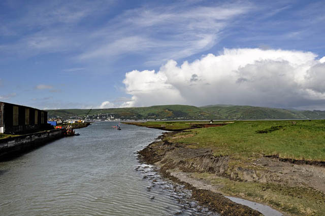 On the afternoon of the 16th, the radar looked sufficiently lively to justify sticking a fiver's worth of diesel into the tank and heading down to the coast. At Aberleri, where the Leri estuary flows out to join the much larger Dyfi before it reaches the sea, one cumulonimbus was seen to be disappearing over the hills beyond Aberdyfi.... 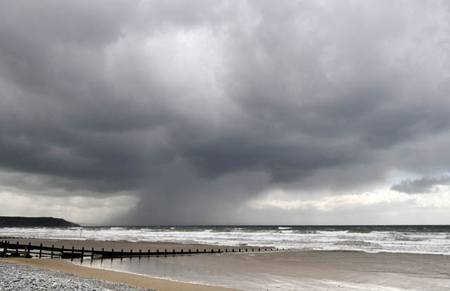 ....whilst at Borth, a strong squall was heading on behind. This image illustrates how brisk the midlevel airflow was: the cloud producing this squall is moving along so quickly that the precipitation falling from it appears to be trailing behind. The airflow at cloud-level is a lot faster than at lower levels: on top of that, cold air is descending rapidly with the precipitation and fanning out as it reaches the sea, as typically occurs with squally showers. When this arrived, there was a minute or two of violent rain and hail and the gusty winds rocked my vehicle from side to side... 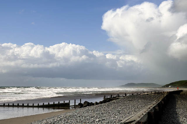 ...and then it was all over, the sun came out and the winds dropped back again to a mere force 7!  Things looked a bit quiet after that so I wandered home, catching this unusual flattened rainbow en-route, near Derwenlas. After a bite to eat and some time online, the situation appeared to be improving again, so a second late afternoon/early evening intercept was on....  ...encouraged on the way back to the coast by these mammatus clouds over Glandyfi..... 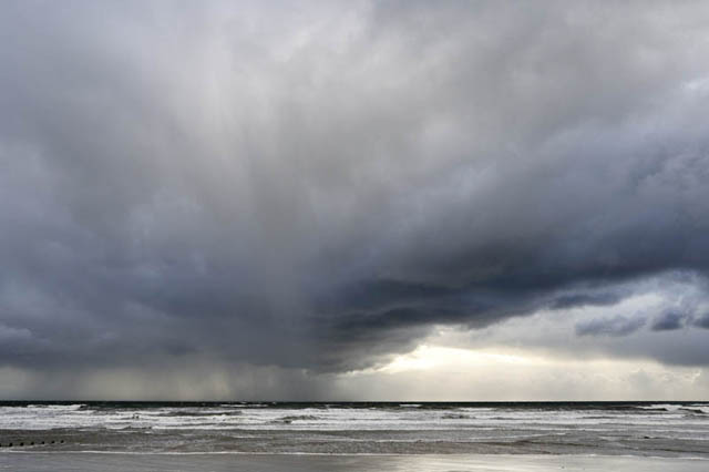 By late afternoon, the light's always better, so even moderate showers can provide an interesting subject....  Wide-angle shot......  As the final shower passed in advance of a more organised frontal rainband out west, there were hints of mammatus forming, so I moved inland a bit to get the right perspective of the rear of the cloud. Mammatus can develop very quickly to a spectacular degree - it is formed by pockets of moist air descending from beneath a storm-cloud's anvil, so that the rate of descent of that air often dictates what will happen next. At Aberleri, which seemed the obvious target spot to get a good view of the mammatus clouds retreating over the hills to the NNE, there's a rough parking-place I use when collecting bait. I pulled in and waited for the scene to unfold, and had rather a nice surprise.... 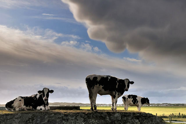 The mammatus developed beautifully and look what I had as a foreground! The meteorological term "mammatus" is derived from the Latin for udders - how appropriate! 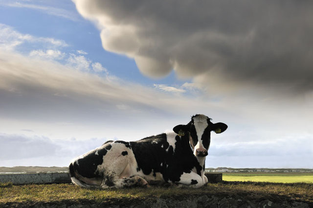 The standing heifers clomped off as I approached closer, leaving this seated cow contemplating my antics, unaware that it was being as perfect a model as I was likely to get! I was very pleased with this one, which appeared in the Guardian a few days later.... 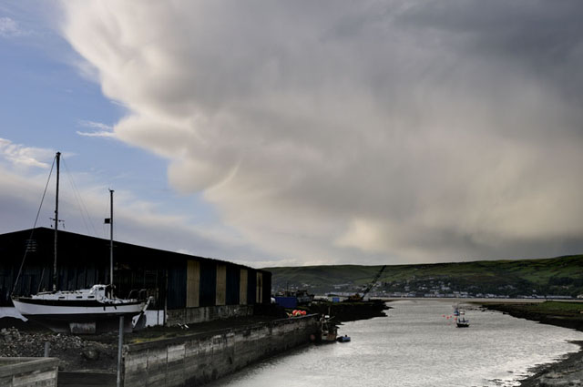 The whole lot continued to move on northeastwards. This was the shot I had planned to take - nowhere near as nice as the pair with the cattle! 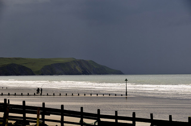 The showery theme continued for a few more days but nothing exciting resulted. This was the only shot that I liked, showing a big squall moving up from the SW but looking particularly mean with the sun still out on the beach. The anglers packing up told me they thought a thunderstorm was coming - not far wrong there! 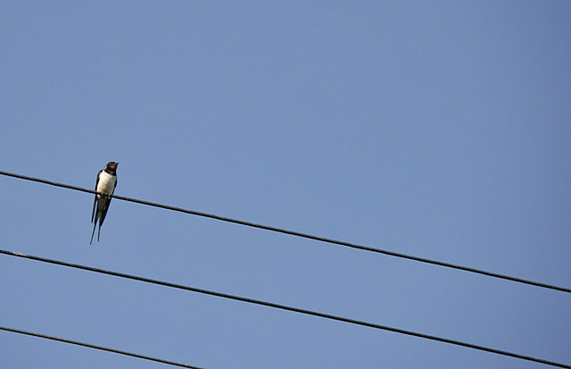 It's a fact of photographic life that "nice days" are often difficult for distinctive landscape work, despite the number of postcards you see showing places under cloudless skies and bright warm sunshine! Such things are anathema to obsessive stormscape types like me. Bank Holiday weekend came along with wall-to-wall sunshine, which was a good thing as I had family visiting. On the Sunday, a trip to Ynyslas Dunes was mooted... 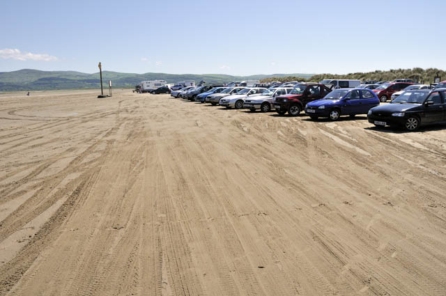 ....several hundred people seemed to have had the same idea! There must have been over 400 cars parked-up on the sands - luckily most people were staying close to them, so the dunes wouldn't be too crowded.... 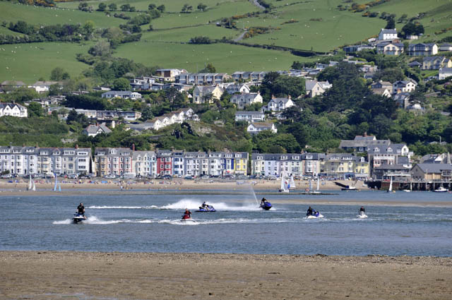 ....it was far from peaceful with this lot going round and round frantically! When is the silent jetski going to be invented? If you haven't heard one, they sound like demented bumble-bees, only higher-pitched and much, much louder. I'm all for personal freedom, but does it have to involve destroying everybody else's peace and quiet? I hate the bloody things! We beat a retreat to the path through the dunes... 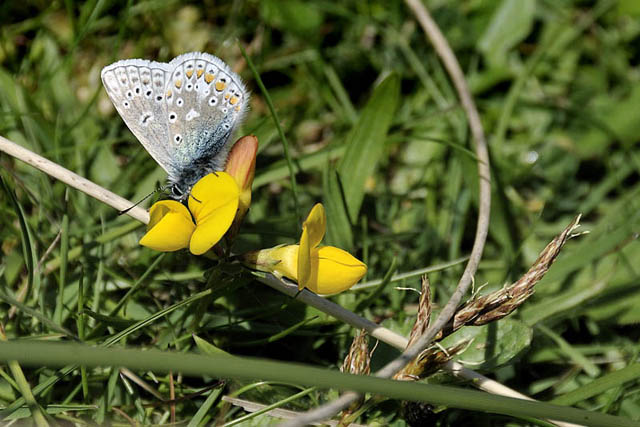 The place was alive with flowers and butterflies - there were many Common Blues flying around in ones, twos and threes, feeding on the bright yellow flowers of bird's foot trefoil....  The "slacks" - hollows between old stable dunes, are havens for fauna and flora. The grass is kept short by grazing rabbits and is studded with orchids and many other beautiful wildflowers. No wonder the place is a National Nature Reserve and a SSSI.... 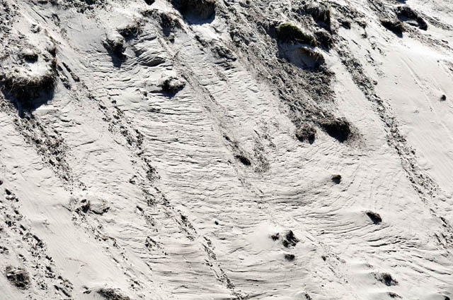 The light was too harsh for landscape photography, so I concentrated on textures and details. I quite liked the above shot, taken on the seaward side of the dunes, where wind-erosion is interspersed with lines of footprints.... 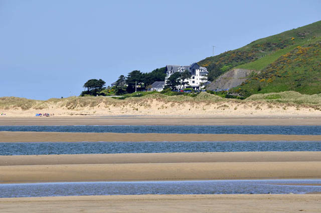 Out by the Estuary mouth, this shot across the sand-bars and channels to the Trefeddian Hotel sort-of worked - but I have a problem with unbroken blue sky on most occasions! 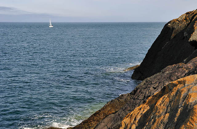 On Bank Holiday Monday I decided to leave the madding crowds behind and went up to Bardsey Sound first thing in the morning, for steep, sun-warmed rock, gin-clear water and the possibility of a fish or three.... 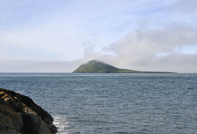 Another effect of cold seas at this time of year is sea-fogs: when warm moist air is advected over the cold sea its moisture condenses. Here, a warm airmass is just about to engulf Bardsey.... 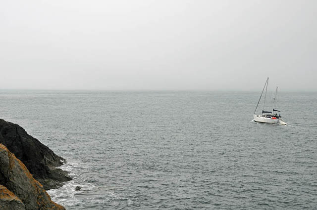 .....just like that! It came in as a wall of fog, extinguishing the sunshine and dropping the temperature several degrees in minutes.... 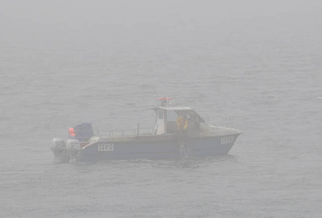 Visibility dropped rapidly - this lobster-potter, hauling up his fleet, was less than 100m away! 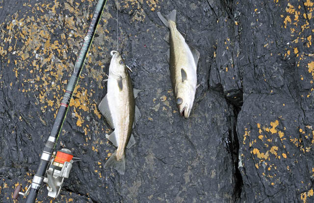 These rock-platforms are strenuous but technically easy to reach in dry conditions: once wet, however, the rock (and especially the dark areas) becomes lethally greasy. I had studied the charts carefully prior to heading out and the weather looked to stay definitely dry until about 1300: after that there was a low risk of showery rain. The problem was obvious - due to the fog, I would not be able to see the rain coming if there was going to be any, so rather than getting in a slippery pickle, I left at lunch-time. Pity as some nice fish were being caught - these are pollack, which taste excellent when filleted and hot-smoked with oak. They are both very dead, by the way - if I'm keeping a fish for the table it gets dispatched immediately upon landing - before unhooking, taking photos or anything else. Meanwhile the rain continues to fall relentlessly. It's market-day in Machynlleth so there will be throngs of umbrella-wielding stall-browsers - a potentially dangerous situation about which I wrote the following ditty a few years ago: On a midwinter
Wednesday
Wind-flung drizzle spiralling Over flapping canvas tops Of brave traders' stalls On Maengwyn Street's Handbag battle-ground Where recklessly I ventured To emerge Nursing the contusions Of a thousand umbrella-spokes Just another Victim of Market Forces..... More soon!
|
|
BACK TO WEATHER-BLOG MENU New! Fine Art Prints & digital images for sale- Welsh Weather & Dyfi Valley landscapes Slide-Library - Click HERE |