BACK
TO WEATHER-BLOG MENU
New!
Fine Art Prints & digital images for sale-
Welsh Weather
& Dyfi Valley landscapes Slide-Library - Click HERE
| Into
mid-May and not an awful lot to report on the weather front, apart from
the very dry April and the prolonged cool to cold conditions that have
continued right up to the present, of which I have attempted an
explanation further down this page. The snowy late winter theme continued right up to Easter this year, with snow-showers adding to the already present cover. I caught one of the showers running across the Dyfi Estuary at Glandyfi one late March afternoon, with the Tarrennau ridge in the background and the railway bridge in the foreground, making for a nice image: 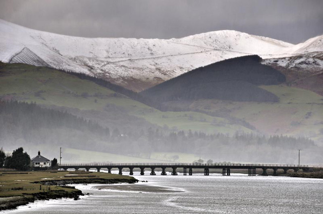 Later the same afternoon I was in Borth and the skies were clearing so I went to the upper part of the village to grab a couple of shots, showing the almost-deserted beach despite the sunshine, and the wintry scene beyond: 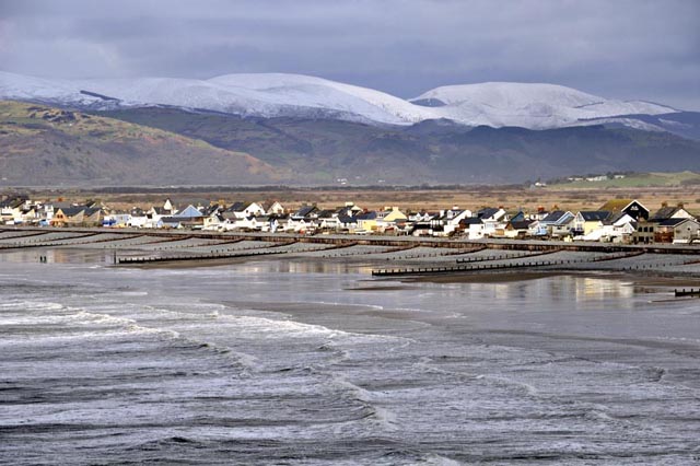 Trum-Gelli, the Estuary and Borth: I waited some time for the sunlight to make an appearance on the snowfields! 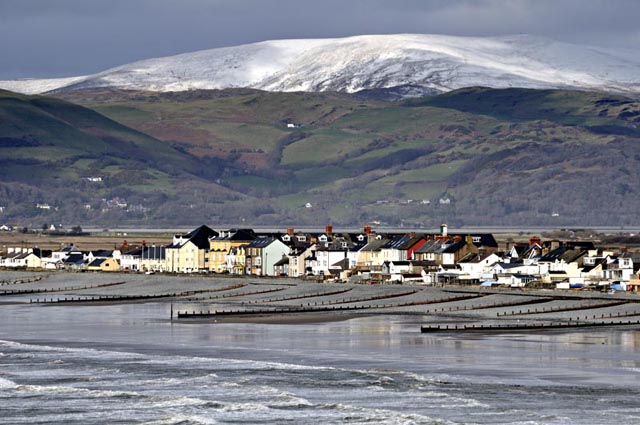 On Easter Saturday, this was the view from the top of the Machynlleth-Llanidloes mountain road with Plynlimon and Glaslyn and the winding track into the wilderness. This is Plynlimon's best aspect by far..... 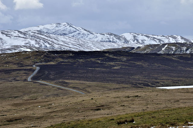 April normally brings in the fishing season on the local beaches, but this year the chilly weather has meant a very slow start, with conditions feeling more like an endurance-test at times..... 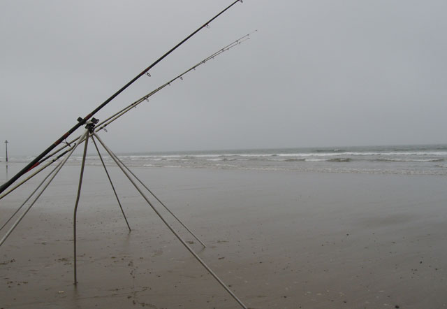 This was the only worthwhile fish caught all month! Turbot of eating size are not abundant on our coast, but most Aprils see a few. I guess the cold weather has kept the sandeels out in deeper water: these little fish bring in the predators, but if they stay away when cold nights chill the sand over low tide, then so will those fish that hunt them....  On May Day Monday, I went up to the rock-ledges on Bardsey Sound to see if any mackerel had arrived yet - in warmer years I've caught them in April. Not this year - just a few small pollack were caught from this normally productive tidal rip... 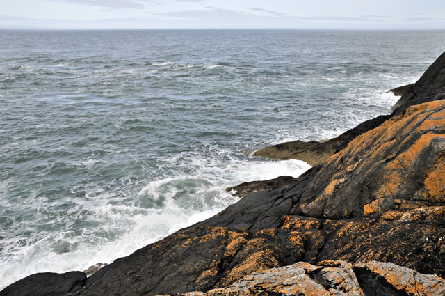 Plenty of wildlife to watch though, as ever.... 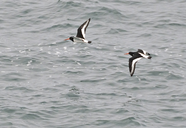 Had I grabbed the camera immediately I could have had some lovely shots as 30+ Bottlenosed Dolphins came through close to low tide in three pods - I was close to the water reeling in my lure while the camera was stashed in a niche 30ft above me. By the time I'd got up there, the third pod was getting further away. Lesson learned for next time! 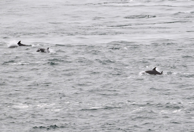 So, into May and we have just seen a week of cold to cool days and very chilly nights with ground-frosts reported in quite a few parts of the UK. What's going on? It's all down to the pressure-patterns at the moment (and not the Iceland eruption - nothing's occurred on a big enough scale so far, thankfully!). The map below shows a typical Atlantic pattern, with low pressure over the North Atlantic (red "L"s) and the Azores High sending a high pressure ridge up across continental Europe (the red "H"s). Now, because the winds around a high pressure anticyclone blow clockwise, high pressure to our south and south-west gives us sou-westerly winds, bringing up air from the tropical Atlantic - mild and moist in other words (red arrows), or if the high pressure over Europe expands up over the UK, warm and dry. In most years, this pattern dominates our weather. 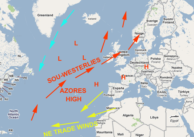 However: the map below shows what has been going on this Spring. High pressure ridging south from Greenland has created a persistent "block" to the usual pattern, allowing warm air to push north into western Greenland but also allowing cold air to flood south over us from the depths of the Arctic, and in place of the Azores High there are small areas of low pressure that work their way up into the Mediterranean area, giving heavy thundery downpours in that region. 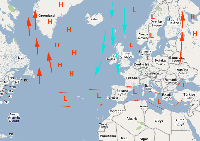 So how does all that show up on weather-charts? Here is an air thickness chart for the N Atlantic and Europe for May 10th: 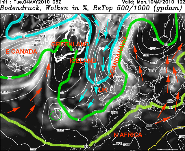 The chart shows what looks a bit like a yin-yang symbol, with low pressure over E Canada and high pressure over Greenland and the N Atlantic then low pressure again over Scandanavia. Mild 546+ DAM air (green line, red arrows) is thus pushing up around the W flank of the Greenland High, whilst chilly sub-528 DAM air (pale blue line & arrows) is coming out of the Arctic and straight down the Greenland High's eastern flank, pushing down into the UK. The result? Western Greenland gets mild whilst we shiver! So what does "thickness" mean? I'll try to explain. Thickness is a way of illustrating how warm or cold the air is in the lower part of the atmosphere. The chart is plotted using the thickness - or depth - between the 1000 millibar pressure level - i.e. close to sea level, and the 500 millibar pressure level. The height of the 500 mb level above the surface varies depending upon how warm or cold the air: in a bitterly cold polar airmass over Greenland, the 500 mb level may be as low as 5000m, whereas over hot equatorial areas it might be as high as 5800m. Hot air expands; cold air contracts - creating these differing values. The resulting charts map out the airmasses by lines (called isopleths) joining places with equal thickness values. Thickness is measured in tens of metres - or decametres, abbreviated to DAM. Traditionally, a number of key isopleth lines are plotted: 510 DAM (plotted dark blue - none present on the above chart), 528 DAM (light blue on the chart), 546 DAM (mid-green on the chart), 564 DAM (yellow-green on the chart) and 582 DAM (yellow-orange, SE corner of the chart). So how do these values translate into reality on the ground? Sub-510 DAM air is rarely present over the UK in a harsh winter and brings extreme cold. 510-528 DAM air is intermittently present over the UK in all but the milder winters. Its presence on forecasts charts hints at an airmass cold enough to give snowfall, although it should not be used as a detailed snow forecasting tool. 528-546 DAM and 546-564 DAM airmasses are typically found over the UK all year round, with an emphasis on 528-546 in winter and 546-564 in summer. Airmasses thicker than 564 DAM air indicate a heatwave and are restricted to the summer months. 582 plus DAM air is found only in the hottest areas of the planet. Such blocked pressure patterns, once established, can be slow to shift, as we have witnessed during this often chilly Spring. However, this coming week, there are signs of a more typical pattern returning, which will relieve a lot of gardeners! The Tywyn Sea Defences project is coming towards completion. On a day with rather poor, glaring light I happened to be in the town and grabbed a few images: 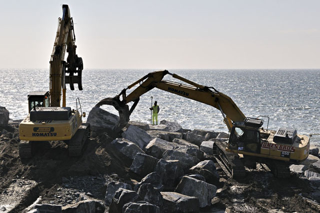 These show the main Breakwater being completed. These huge boulders are carefully slotted into position using the grab, the result being a tightly-spaced rock armour exterior....  This general shot - despite the glare - shows the structure almost in full. I'll post a better image when I get one... 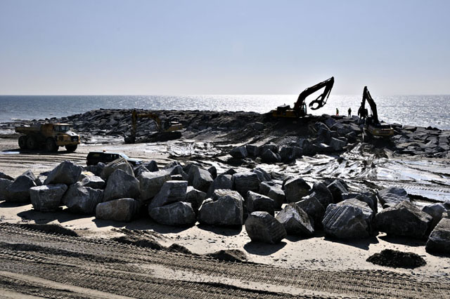 Despite the cold and dry, non-gardener-friendly April, the veg garden is coming along with shallots, onions and weeds all showing in good numbers! 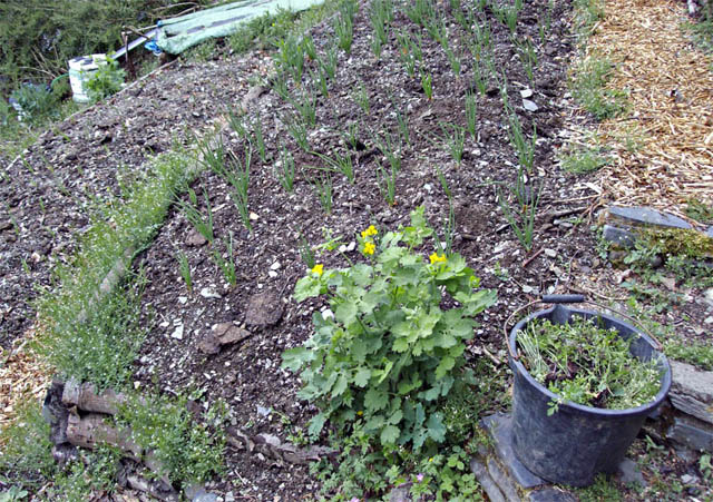 Interesting point: the one broccoli plant (below) with a straight stem (as seedlings they were mostly comprehensively trashed by a cat who regarded their seed tray as a litter-tray) has grown to a mighty height with huge leaves - but little else. I've hardly had a thing off it. Compare it to the next image: 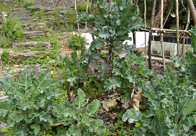 One of the scrawny little ones, three sharp bends in its stem where it was trampled as a seedling - and it has been firing these shoots out for weeks now! Only a guess - it this productivity a natural response to stress? 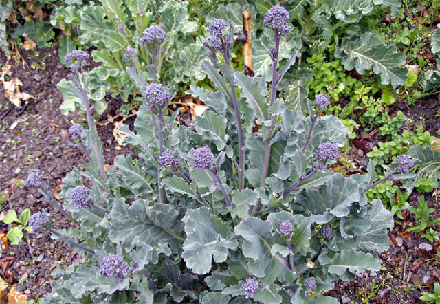 One corner, where the soil is very thin, I have left to see what comes up naturally: lots of foxgloves which will be a great attractor for the bees, plus some wild garlic and various other herbs... 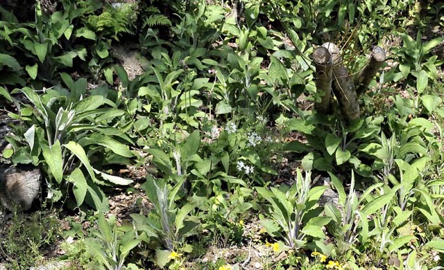 But this is what it's all about! 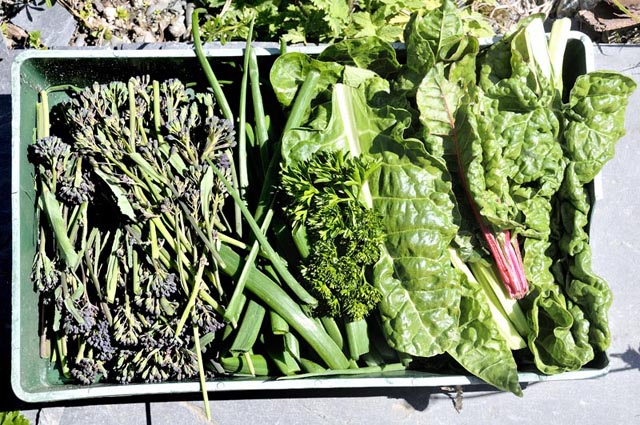 Here's another garden I have started on, a bit too late for this year really but in these two beds I have planted seed potatoes. The deep couch-grass is going to be difficult to keep at bay, but the soil's good underneath and the turves make useful bed-boundary walls. 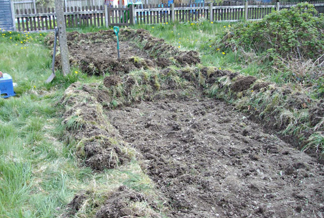 And that was Spring 2010! Slow, cold and often dry, but always with the feeling that warmer times are getting closer and closer, and hopefully too some decent storm-clouds to get to grips with - I can't remember the exact date of the last decent thunderstorm here, it's been that long! |
|
BACK TO WEATHER-BLOG MENU New! Fine Art Prints & digital images for sale- Welsh Weather & Dyfi Valley landscapes Slide-Library - Click HERE |