BACK TO WEATHER-BLOG MENU
New! Fine Art Prints & digital images for sale-
Welsh Weather & Dyfi Valley landscapes Slide-Library - Click HERE
The synoptic situation is illustrated in the two charts below. The top one shows surface air pressure and the bottom one the position of the Polar Jetstream. What is amazing in the top chart is the strength of the blocking high pressure over Greenland, at 1065mb. The block extends well out towards Scandinavia. The jetstream chart shows the Polar Jet to be well south of its usual position (a familiar theme in recent years?), diving through Iberia into the Mediterranean countries. This time last year it was well to the north of the UK, giving shorts-and-t-shirts weather. This year? Everything is in the 'wrong' place. Problems began as a deep area of low pressure approached the western UK, bringing moisture in copious quantities - enough to cause serious flooding and deadly landslides in the SW, accompanied by strengthening south-east winds. On the night of Thursday 21st, a gale was rising here in Machynlleth. Then, as the fronts nudged north-east they met the dense cold air resident over the rest of the country and ground to a halt. The rain turned readily to snow and the south-easterly gale guaranteed drifting: the persistence of the snowfall, from the 22nd through to the 24th, ensured plenty of the white stuff for the wind to get to work on. The result, for some - mayhem.
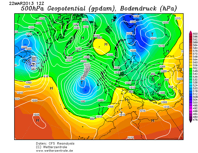
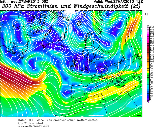
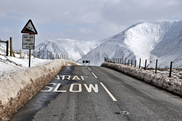
On the morning of the 23rd, with a pause in the snowfall, I thought to get out and have a look around. Normally I head up the Mountain Road to photograph the drifts, but on this occasion the fierce and bitterly cold winds put me off. On checking the travel news and seeing that the A470 - a main north-south route through Wales - had reopened, I decided to take the justifiably lazy option to head up to its nearby high-point, the Bwlch between Dinas Mawddwy and Dolgellau, beloved stamping-ground of low-flying military aircraft photographers. On the windward side things looked fine, if somewhat Arctic:
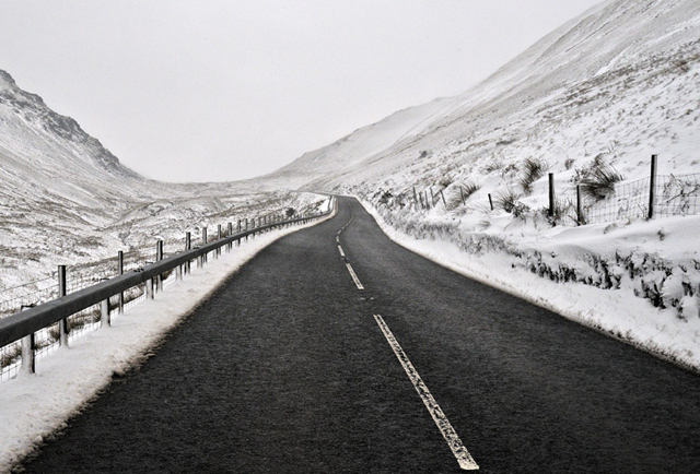
Just below the summit - at only 370m above sea-level - there is a steep and sharp bend - almost but not quite a hairpin. Rounding this, the jeep was rocked from behind by a blast of wind that gave an idea of the conditions above. I reached the summit layby and pulled in to the narrow recess created by snowploughs in order to survey the scene ahead. The wind was screaming by - it was the sort of wind that can wrench a car-door off if opened into it carelessly. Spindrift was whipping down the hillside in great spiralling clouds, blasting across the road and reducing the visibility. I shot this from my wound-down window:
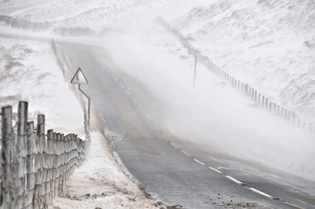
Further down on the Dolgellau side the situation was much worse - the winds having a longer fetch down the hillside were picking up more and more snow. Looking ahead the visibility was about to do a vanishing act:
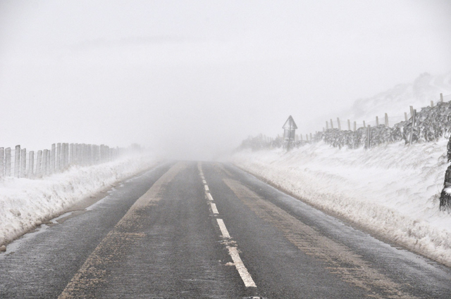
Snow was getting rammed into every nook and cranny. I estimated the winds to be at least a steady 60mph, with gusts much higher.
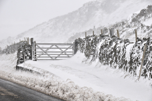
I passed a snowplough coming the other way, but it was obvious that the driver would have to keep at it all day, as the drifts kept spreading out over the road:
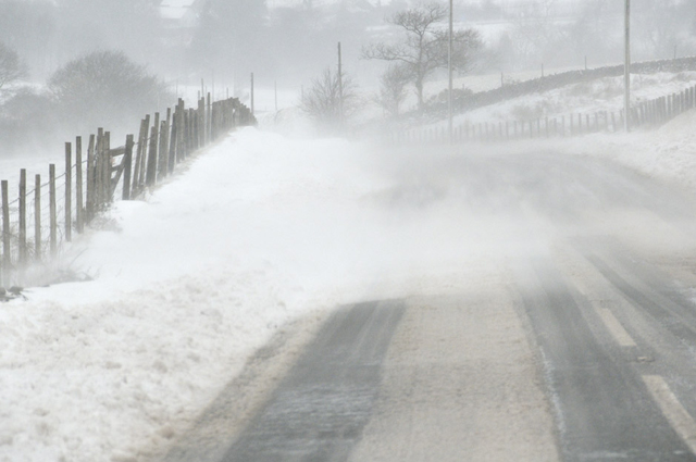
The shot below is a retrospect after blindly crawling through this section - I could barely see a few metres past the front of my bonnet....
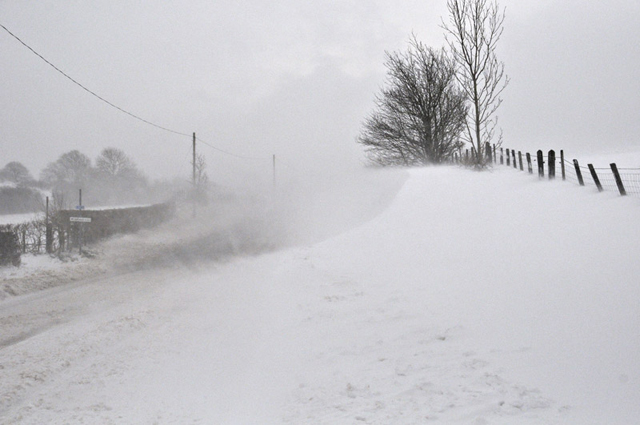
Conditions varied over just a few tens of metres - it was all down to where the winds were getting through:
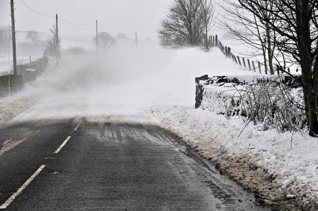
Heading out west I was below the snowline again in Dolgellau and came round the coast to head back inland towards Tal-y-llyn. The western aspect of Cadair Idris was hidden in spindrift - it was not snowing at the time so all of this is wind-blown. Not a day to be on the hill!
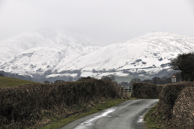
A choppy Tal-y-llyn...
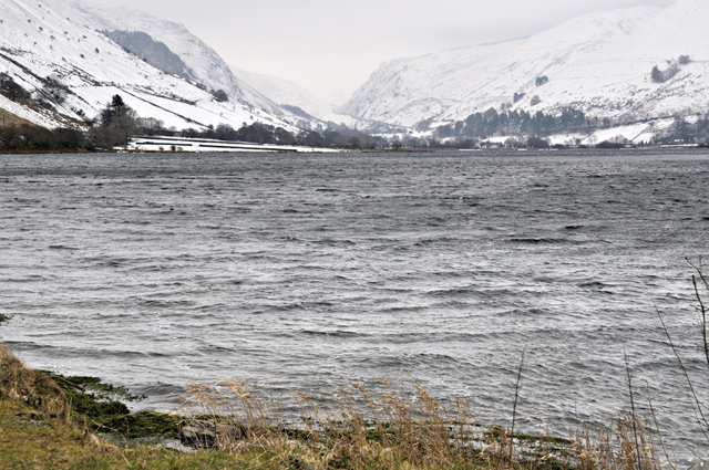
In areas sheltered from the savage winds, the snow had stuck to everything - these conifers on a west-facing slope were photographed opposite the Braich-goch hotel in Corris:
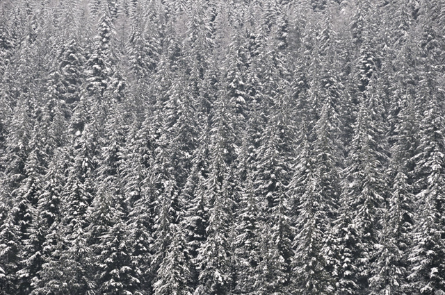
By the 25th, clearing skies prompted a second look-around. Here's the south side of Cadair Idris from the top of Corris, with spindrift still being whipped up by the wind, though not to such an extent as two days earlier:
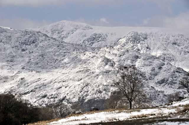
Cadair's eastern side presents a rugged sight from the A470....
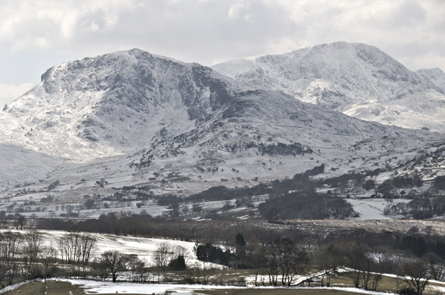
On the road up to the Bwlch, conditions had improved a great deal:
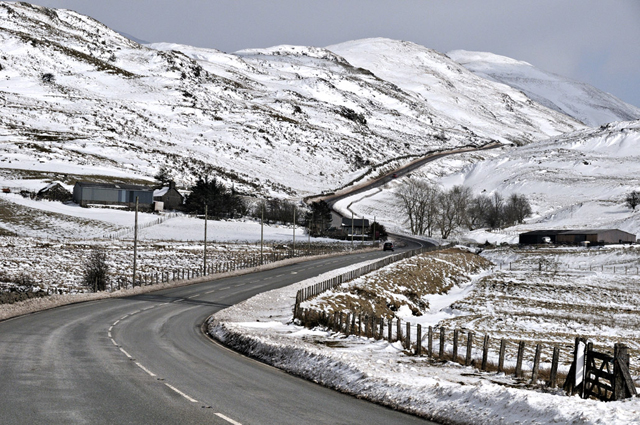
The NW-facing lee-slope above the road showed the drifting to perfection with every hollow and break in slope marked by banked-out snow and exposed areas blasted almost clear:
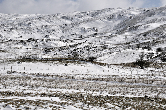
Very heavy accumulations were present on Maesglasau, here seen from the Bwlch summit:
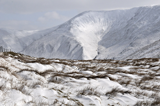
...and here from just off the road. Avalanche warnings had been issued for Snowdonia: thick accumulations like this can lead to serious slope instability, especially if its bonding to layers below is poor, as reported by some climbers in North Wales who had dug test-pits to examine the snow-profile. This blizzard had deposited thick snow atop existing cover.
Another view of the east side of Cadair Idris, perhaps with somewhat better foreground....
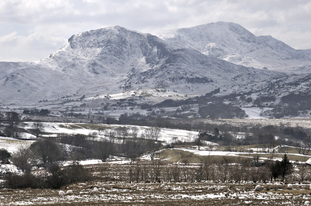
I was literally on the edge of the worst affected area here. To my north and east were communities that were still cut-off, some without power, by drifts exceeding 6m in height. One family reported having to burn furniture to keep warm and Mountain Rescue led another couple to safety having been trapped in their car for over 18 hours near Bala. NE Wales suffered the worst conditions in decades.
Up the A470 to sunny Porthmadog and here's the view of Afon Glaslyn, the Moelwyns and Cnicht from the by-pass:
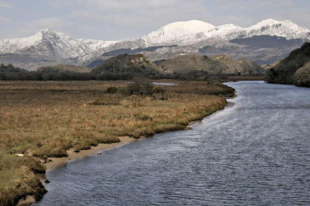
Cnicht is particularly impressive from this direction - oddly, when climbing it, it feels steep but nowhere nearly as exposed as distant views would suggest. The 'Matterhorn of Wales' nickname strictly applies to the latter!
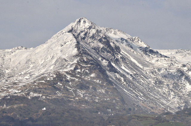
Snowdon was absolutely plastered in snow. Reports indicated 60cm of snow generally and drifts to over 2m. Snowdon summit - Yr Wyddfa is the correct name - L and Lliwedd R.
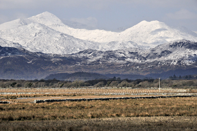
Here's a telephoto. The ridge that descends steeply R from Yr Wyddfa is taken by the Watkin Path, popular with tourists in summer. In winter it is seriously dangerous at times, the consequences of a slip having been fatal to a number of people over the years. I vividly recall coming down it with two friends in similar conditions in about 1979, carefully picking our way down the icy slopes using axes and crampons. Just near where the slope eases, we met a lone woman coming up, dressed casually with, as footwear, pink plastic wellies! We insisted she turn back, a considerate gesture given the conditions, but that was met with considerable resentment. Despite the remonstrations she was eventually persuaded to do the right thing. It's quite possible we saved her life!

Heading back south, I stopped to capture these amazing iceforms near Maentwrog, where vegetation had gotten ice-glazed beneath an overhang from which water was constantly dripping.
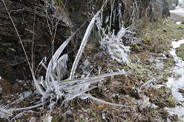
Nature beats anything when it comes to artwork!
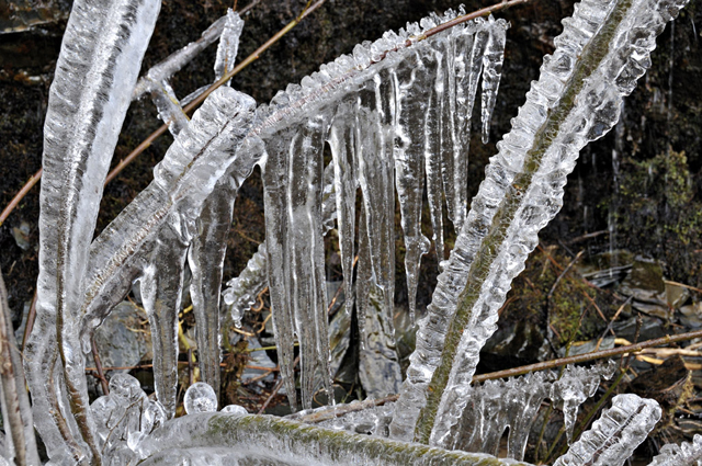
Just south of Llyn Trawsfynydd, this was the view across to the Rhinogs, where not so long back I had been hopping from rock to rock in blazing sunshine:

The snow neatly picking-out the terraced landforms provided by the thick sandstones of the Rhinog Grits:

Cadair Idris is a spectacular mountain from most directions, but none quite as impressive as its northern aspect, seen here from the road from Llanelltyd to Bontddu:
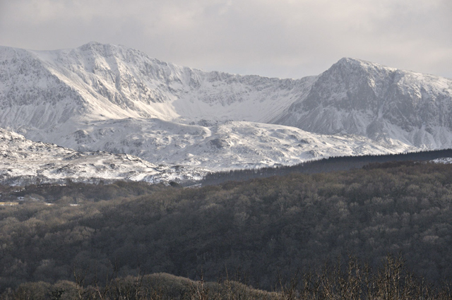
Zoomed-in it looks particularly impressive. I'm not alone in thinking of Cadair Idris as one of the most beautiful mountains anywhere in the UK.
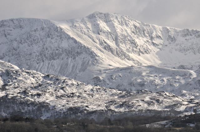
Here's a wideangle showing its whole northern side:

Snow transforms landscapes, making the usual appear totally alien yet alluring. There is a certain satisfaction in climbing a mountain, properly equipped, in such conditions. The way the landscape is transformed is a completely absorbing thing, as even urban non-mountaineers - and especially children - can testify. I used to love it as a kid: the walk to school across what was normally just fields and a park became the crossing of a great, pristine wilderness, the neatly-arranged paths and beds with their orderly and irritating straight lines, the litter and dog shit all gone.
But there's another side to a severe March blizzard. Please spare a thought for the hill-farming folk in all areas affected by the worst conditions. It's lambing-time for many, normally a time of flat-out hard work in nondescript weather but this year they are facing a disaster. Farmers in North Wales' hill-country in many cases have no idea how many of their sheep have survived this storm. Where snowdrifts have buried fields, stone walls and fences, over hundreds or thousands of acres, a desperate race against time has been going on. I have heard accounts of sheep being unearthed from drifts with newborn but dead lambs frozen to the ground. The ewes can survive a few days buried in the snow normally, but in the late stages of pregnancy their ability to do so is much reduced and of course the lambs do not stand a chance. How many they manage to locate and dig out is by no means a known known right now, but for those unlocated, time is running out. Update 29/03/13: on top of that, farmers totally snowed-in are struggling to even get to their flocks and last night I was informed of several instances in which the rooves of busy lambing-barns have collapsed under the weight of snow.
The image below was sent to me by a correspondent, Neville Fox, taken by his neighbour Maya Bimson, up at Dylife. This is bad but compared to NE Wales, where drifts up to six times this depth formed, one can appreciate the seriousness of the situation. Neville reports sheep frozen to death up around Dylife so what the final toll will be further north is anybody's guess. Digging dead sheep and lambs from deep snowdrifts must be akin to seeing your best handiwork disintegrating before your eyes. White death has been stalking the fields of spring this year.

Will conditions let up? Slowly, I think. Current model output indicates that the block will lose its intensity in the coming weeks: that should allow milder air to move in during the first half of next month. Plus of course, even if the models are wrong on that count, the sunshine becomes increasingly warm as we go further into spring so even with air from a cold source, the sun gets to work and warms things up more and more. At lower levels here, the slopes are taking on a streaked appearance with just the deeper drifts left. At height it will take more time, but thaws can shift an awful lot of snow once they get started in earnest. In the meantime, it's a case of throw another log on the fire and heat up the pheasant and root-veg stew once again, something I'd normally be doing in January. This year I'm starting to wonder when the veg-garden can be planted.....
BACK TO WEATHER-BLOG MENU
New! Fine Art Prints & digital images for sale-
Welsh Weather & Dyfi Valley landscapes Slide-Library - Click HERE