BACK
TO WEATHER-BLOG MENU
New!
Fine Art Prints & digital images for sale-
Welsh Weather
& Dyfi Valley landscapes Slide-Library - Click HERE
Late May into
June could best be described as "mixed". This is an awfully polite,
British way of covering a fortnight in which occasional warm sunshine
(if you could get out of a stiff Easterly breeze) has been punctuated
by clammy sea-fogs, thunderstorms, flash-flooding and a twister to
boot. Not that I'm complaining - it has been productive enough in
photographic terms! Easterlies are not much use for the fisherman
though - there's a very old saying: "when the wind's in the East, the
fish bite the least". For some as yet unfathomed reason (there are as
many theories as there are fishermen!), it is a remarkably accurate bit
of country lore.
The
Easterlies were caused by high pressure to the north of the UK and low
pressure over Biscay - a setup that keep things dry, sunny and breezy
or horribly cold and wet with thundery rain, depending on what the
low's up to. The setup gave a sunny start to June followed by the first
wet, thundery interval around the 10th, and then finally the Westerlies
broke through on the 13th, leading in turn to slack low pressure by the
15th, and accompanying convective instability, providing widespread
thunderstorms once again.
May 29th saw another
classic sea-fog setup, with the prelude to the Easterly outbreak seeing
a southeasterly breeze over Wales. Temperatures shot up, pretty much
everywhere except where I had planned to go - Trefor on the N Lleyn
coast: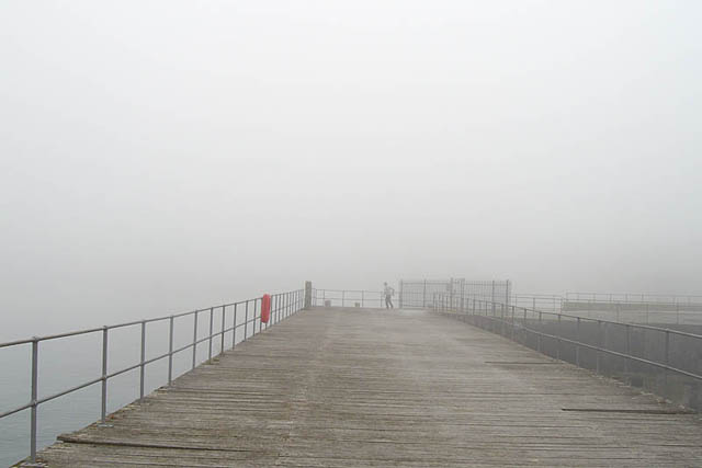 The pier used to be a popular fishing-spot but is now sadly much dilapidated. Warm air was streaming off the land and its contained moisture was condensing immediately upon reaching the cooler seawater of Caernarfon Bay...... 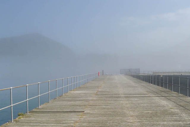 ...so it was decidedly chilly until late afternoon when the fog suddenly cleared. It appears that a much dryer airmass moved in, from the evidence of the abrupt nature of the clearance - from this...  ...to this, in minutes, with the fog retreating N like a wall! Continuing on the fog-theme, June 4th provided some interesting distractions whilst fishing at Ynyslas, opposite Aberdyfi on the S bank of the Dyfi Estuary. We had arrived in blazing hot sunshine in the late morning, but after a couple of hours, a cooler sea-breeze set in from the NW, and some unusual fog began to form, at first barely perceptible: 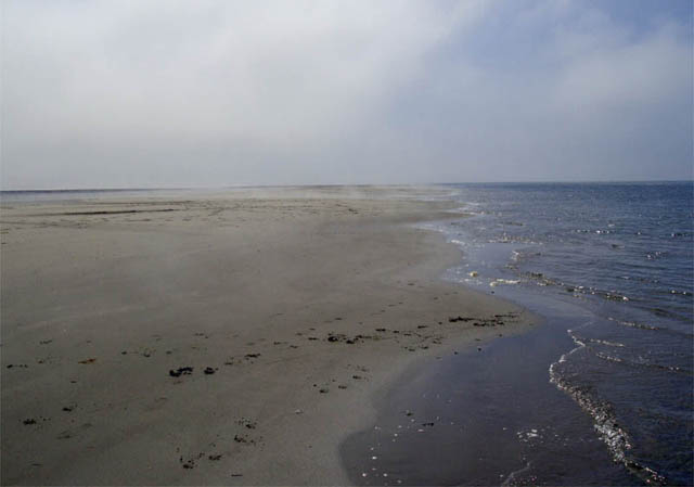 ...but then more obvious... 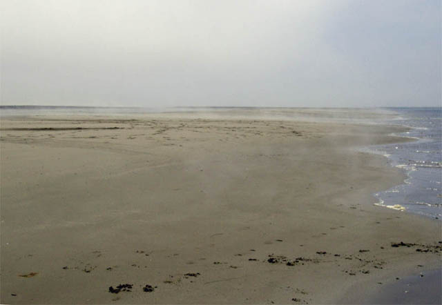 ....and soon after that, classic pea-soup at ground level but with sunlight still streaming in from above: a shot featuring regular fishing buddy Alun and Jess the dog! 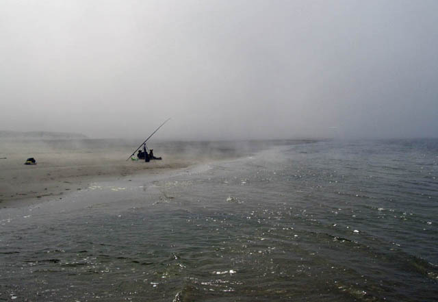 This was not classic sea-fog. Instead, what appeared to be occurring was as follows. The sand was very warm after several hours of direct sunshine, so would have been churning out water vapour. A cold front at surface then moved in, lowering the temperature (this was felt) to the point that the evaporating moisture was able to condense. However, the sand remained warm, so that it was able to evaporate the water within its matrix for some time after the colder air moved in, thereby continuing to generate this low-level fog. This is in a sense the complete opposite to the classic advection-fog that one sees in winter when a pattern-change brings in mild moist air over cold snowfields - there it is the moisture within the airflow that the ground is causing to condense. In this case, the cool airflow was causing the moisture emitted by the warm ground to condense. Onto a sunnier theme now: the Painted Lady Invasion of June 2009. These butterflies are native to North Africa and migrate to Europe every summer. Most years you'll see a few in the UK. But, every few years, a mass-invasion occurs involving millions of them, and 2009 has been such a year. What triggers it? Rainfall in the Atlas Mountains. A rather arid area for a lot of the time, occasional heavy late Winter rains can lead to a profusion of foodplants coming up, in turn leading to a highly successful breeding year. When this occurs the butterflies appear in vast numbers in Europe - and if winds/weather combine favourably, in the UK. I was pondering where to try and document our invasion through the lens when the "Roman Road" at Aberdyfi struck me as a good start. It is a path that runs between the Cambrian Coast railway and the Estuary, and in June is bedecked by a profusion of valerian, ox-eye daisy and other similarly nectar-rich plants:  As hoped-for, the butterflies were present in hundreds, feeding away:  Some in quite a good condition.... 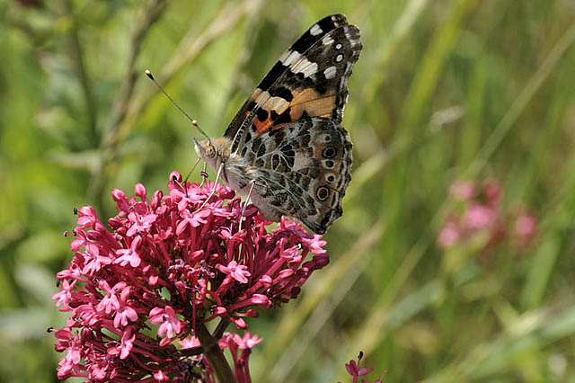 ...but many showing wear and tear - signs of flying thousands of miles through all sorts of weather: 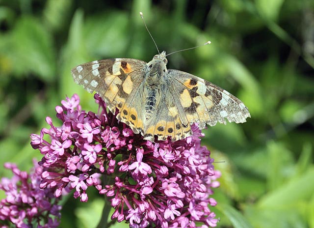 I spent a couple of hours getting a batch of images, during which this turned up for a feed: 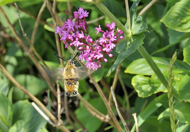 It's a narrow-bordered bee hawkmoth - rare in Wales and thought to be absent from Meirionydd, so a significant sighting according to local specialists. Getting it to keep still (or at least to hover in one position) for more than a millisecond was a tall order! A fantastic example of protective mimicry - a day-flying moth that has evolved to look like a big bumblebee at first glance, to put off predators - clever, eh? The thundery breakdown that followed brought severe weather to some parts of Wales with flash-flooding hitting Newtown on Wednesday June 10th, causing damage to homes and businesses and serious road disruption. Over here, there were late morning thunderstorms that I went to intercept, but conditions were awful for photography, varying from hazy to downright murky:  This storm was decaying as it ran up the coast, seen here from Aberdyfi, whilst in the image below, a heavy thunderstorm further up the valley is partly obscured by a closer shower over the estuary: 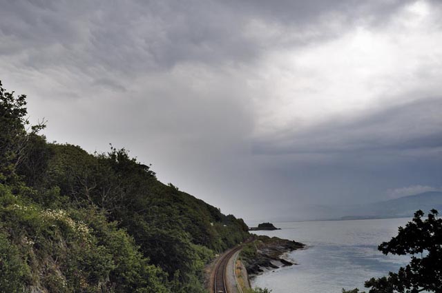 Conditions improved a little into the middle of the month, but June 15th brought a great opportunity for a more serious (and ultimately successful) storm-chase. Slack low pressure lay over the UK, guaranteeing that any storms that formed would be slow-moving and their development would be strongly influenced by local conditions - things such as sea-breezes moving in from the coast, or outflow boundaries - mini-fronts of rain-cooled air surging outwards from decaying storms. These both achieve the same thing as they are both cool and relatively dense: they push under the sun-warmed air and lift it up to where it can freely convect upwards. More importantly, because they are heading in from varying directions, they can generate a good amount of low-level windshear - a useful thing indeed if you are interested in tornadoes.... 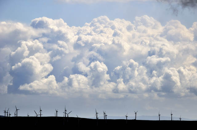 I headed out mid-morning into the hills, where vigorous convection was already underway, as this image shows, looking east from the top of the Machynlleth-Llanidloes mountain road, with the turbines of Trannon windfarm in silhouette. Meanwhile, to my west, an old shower was lurking beyond Plynlimon: this would surely generate a useful outflow boundary. Vigorous convection started up overhead and more so to my southeast (below), so with the remnants of the old shower moving in I jogged SE a few miles to escape the rain.....  ....driving from Staylittle towards Llyn Clywedog, I ran into this funnel-cloud, over the eastern Hafren Forest... 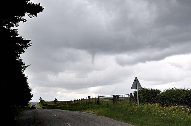 ...you never know how long they are going to last, so I stopped, grabbed a photo or two and then moved closer.... 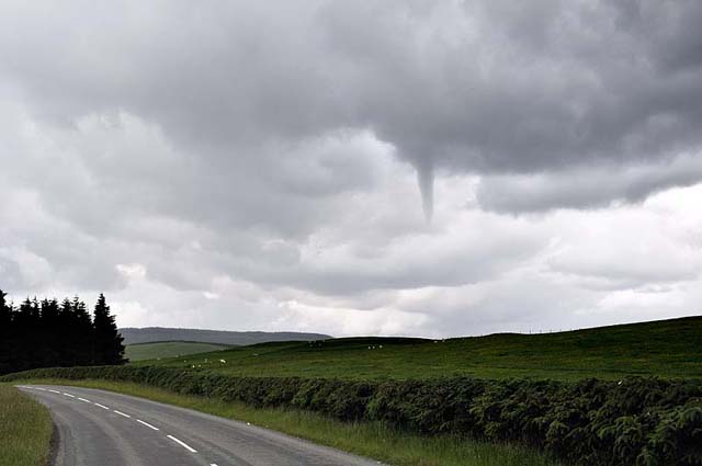 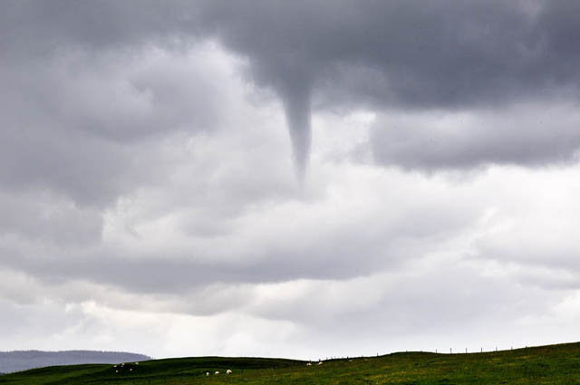 A quick check on the map and I figured I could position myself in its path, with an uninterrupted ground-view in case it touched down, in which case I could also get out of the way quickly N or S! So move #2 was done: by now it had been visible for nearly five minutes. It was raining at this third vantage-point, so I had to dry the skylight filter that I keep on the lens (mostly to protect it), in between shots.... 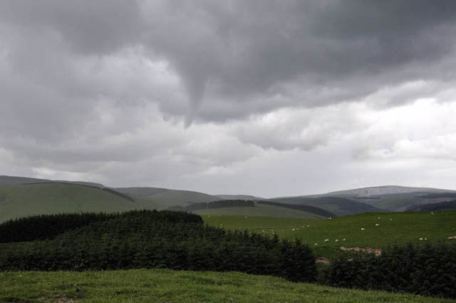 On it came, extending itself downwards a little..... 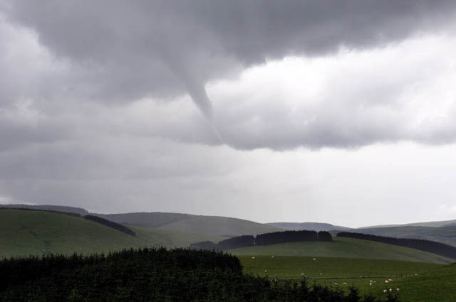 ...getting quite close now - what a beauty! 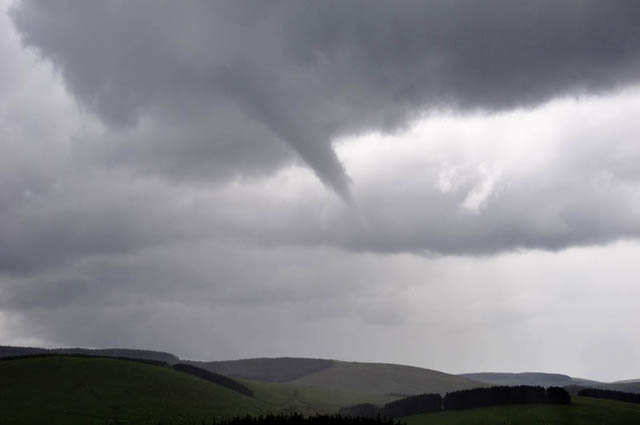 And - just when I was getting confident that a really close encounter might be on the cards.... it roped-out! I'd been watching it for 17 minutes by then. 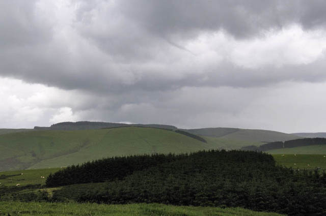 Quite satisfied with this result, I hung around to see if it would reform but rain started to pour down, so I headed back homewards, pausing to watch this clump of towering cumulus building over Cadair Idris. It produced a modest shower, that was all. Low-down on the L you can see the clear sky out west towards the coast - this is where the sea-breeze has moved in. It pushed further east during the afternoon, ensuring a dry end to the day - whereas parts of England saw violent thunderstorms continue well into the evening. Several other funnels were observed in various parts of the UK and heavy hail accompanied some of the storms. 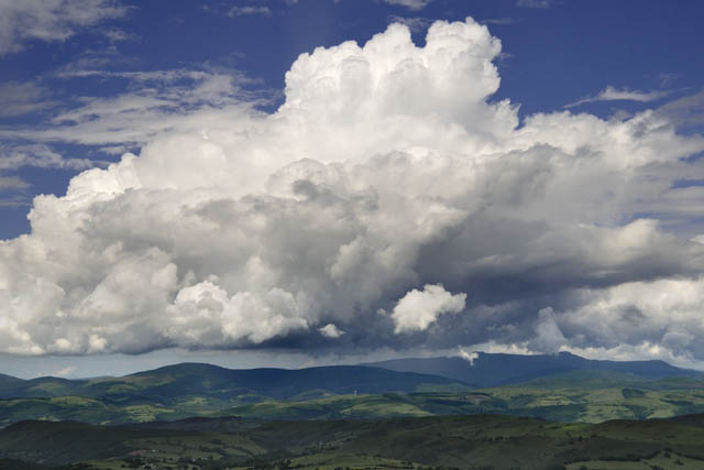 I think that can fairly be called a mixed bag! More soon! |
|
BACK TO WEATHER-BLOG MENU New! Fine Art Prints & digital images for sale- Welsh Weather & Dyfi Valley landscapes Slide-Library - Click HERE |