BACK
TO WEATHER-BLOG MENU
New!
Fine Art Prints & digital images for sale-
Welsh Weather
& Dyfi Valley landscapes Slide-Library - Click HERE
| Recently,
my parents' 50th wedding anniversary passed and to mark it the Mason
clan arranged to rendezvous at Stromness on Orkney on June 12th
for a week's holiday - the furthest I have been from HQ in a very long
time! So this post is dedicated entirely to that trip, in which a
healthy combination of walking, fishing, birdwatching, botanising,
drinking, eating and photography (in no particular order) was indulged
in. What a fantastic place! I just wish it was a little nearer to
Machynlleth! 0330 on the 11th saw me leaving the valley at first light, the aim being to get past the busiest section of the M6 before the busiest time of day - always a good plan - and the journey went so smoothly that by lunchtime I was past Inverness. With the ferry booked from Scrabster at 1900 the following day I had plenty of time to play with, so I struck NW and headed for Ullapool, a place I was familiar with from my voluntary work with the Geological Survey 20 years previously. 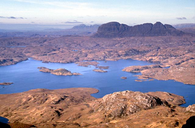 The motivation to head NW was the spectacular landscape, as shown in the above image taken in 1990, when some free time had coincided with fantastic clear weather. The shot was taken from the summit ridge of Stac Pollaidh, looking across to Suilven and Canisp. These mountains clearly appear dark against the lower-lying hummocky landscape. That's because they are made of different rocks: the low-lying areas are composed of Lewisian basement - ancient crystalline rocks over two billion years old, whilst the darker rocks forming the mountains are Torridonian sandstones, which were deposited as alluvial sediments about a billion years ago on the eroded Lewisian surface. Thus, they record the oldest environmental changes preserved anywhere in the UK! Arrival at Ullapool on this occasion gave little incentive to climb any mountains and plenty to head for the town's pubs..... 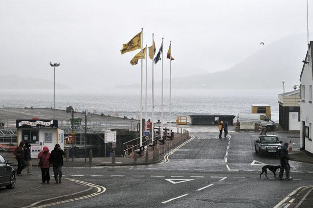 A few pints later and with the tastiest fish and chips I've had in years filling any remaining gaps, an early night was had in anticipation of the improving forecast for the 12th.....  However, the improvement was slow to materialise as this shot of a drizzle-bound Loch Assynt shows! I hung around for a couple of hours and then struck off north towards Scourie... 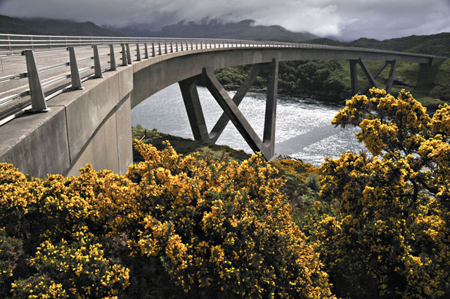 Leaving Assynt, the conditions did improve and the sun was making an appearance by the time I reached the spectacular bridge at Kylesku...  The road to Scourie and on past Loch Laxford reveals spectacular exposures of the Lewisian Basement, such as this one, in numerous road-cuttings. There's a lot going on here: the banded grey gneiss contains dark pods of mafic rock and both are cut by pinkish granitic sheets. It is fair to say that unravelling their highly complex geological history is an ongoing process! 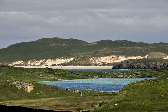 The journey north continued: this was near Durness... 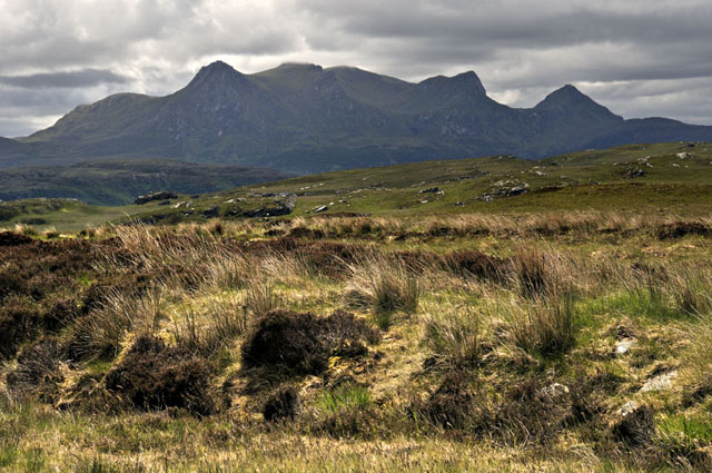 As the road turned east towards Caithness, Ben Loyal's multiple peaks gave a superbly dramatic backdrop... 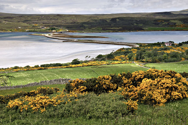 In places, the road wound inland for miles around sea-lochs, whilst in others, such as the Kyle of Tongue, pictured here, it crossed the tidal inlet via a stone block causeway. The drizzle set in once again as I passed into Caithness but at Scrabster it dried up enough to spend an hour fishing on the rocks under the lighthouse, resulting in enough plump dabs for supper the following evening. The crossing of the Pentland Firth was marked by quite a swell, but once closer to the islands this eased off and I spent the time out on the deck astern, taking in the views, despite the awful light for photography.... 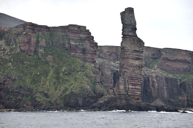 The Old Man of Hoy, a 137-metre high sea-stack, is one of the highlights of the crossing. Geomorphologists reckon it to be only a few hundred years old, connected originally to the cliffs. The march of erosion will eventually see it collapse into the sea, but in time new stacks will form in the same way.... 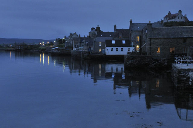 An hour and a half after leaving Scrabster, the ferry docked in Stromness and after a meal I went into the back garden to take in the view! This was about as dark as it would get this far north in mid-June.... And so to the island. Orkney is a living landscape and has been for a very long time. There is an immensely powerful sense of permanence here. The fertile soils, sheltered anchorages and fish-rich waters must all have been important factors: organised settlements go back to 5500 years ago - the late Stone Age or Neolithic era. On the West Coast, there is Skara Brae - a Neolithic village buried beneath sand-dunes until in 1850 a great storm and high tides revealed part of it. The rest was subsequently excavated: 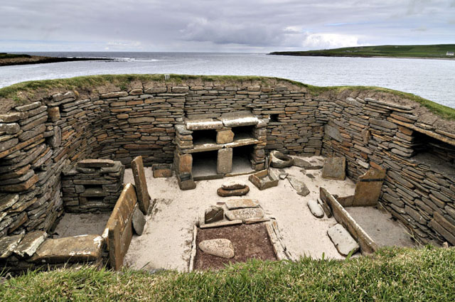 Just one of the buildings revealed from beneath the drifting sands.... 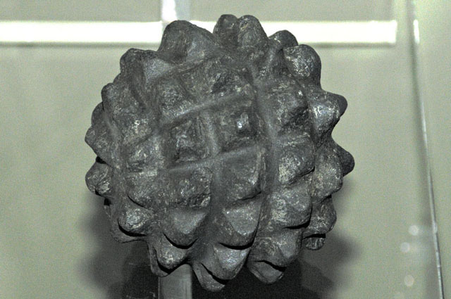 In addition to the superbly-preserved buildings, a wide variety of artifacts were unearthed, including some whose purpose remains a source of speculation! 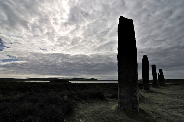 In this part of Orkney, there are features left behind by the Neolithic people almost everywhere you look: standing stones, circles, burial mounds. The largest circle is the Ring of Brodgar which proved a challenging photographic subject with the prevailing light conditions - a stratocumulus deck with the sun breaking through enough to underexpose the scene...  This worked OK - I used
an ultrawide 12-24mm lens, got down on the ground so that the sun was
mostly behind the stone and waited for people to get out of the frame! This worked OK - I used
an ultrawide 12-24mm lens, got down on the ground so that the sun was
mostly behind the stone and waited for people to get out of the frame!The site also offers something of weather-related interest:  Hoping for better light, I got up early one morning and headed out of Stromness as the rising sun lit up the hills on the neighbouring island of Hoy. The car-ferry I travelled on can also be seen in the harbour... 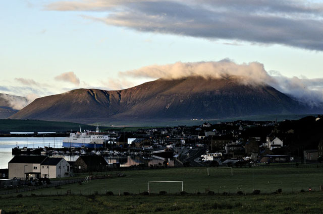 This time I made for the Stones of Stenness, just a few hundred metres away from the Ring of Brodgar, to try for some shots facing east into the rising sun: 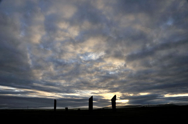 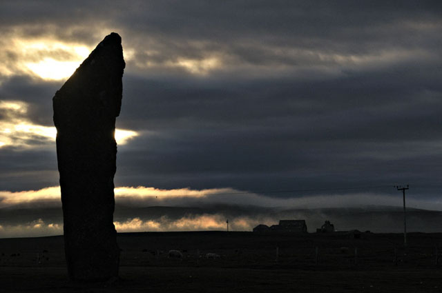 This one worked quite well with the sun lighting up the low, rolling fog-banks. Such a stunning foreground is deserving of many repeat visits to get that eventual special shot, though! Other days were spent exploring the spectacular coast - with or without my fishing-gear! This is the Brough of Birsay - a small island off the NW corner of Mainland and only accessible a few hours either side of low water via a causeway: 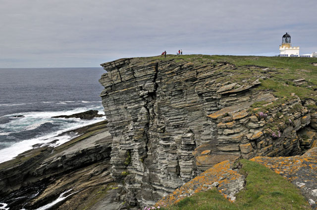 The clifftops were ablaze with thrift, kidney vetch, devil's bit scabious and squills:  The area is a mecca for birdwatchers and along the clifftops embarrassingly long lenses were pointing seawards as skuas and gannets flew by or down to the ledges where puffins, fulmars and a host of other species were lurking. Not being weighted-down with such a gadget, I made do with this oystercatcher stood on the remains of a Viking wall: 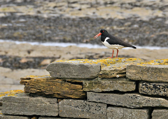 One thing that is an almost constant feature of the western coastline of Orkney is the Atlantic swell, that surges up the slabby sandstone ledges. Another is the superb water clarity and the ice-blues where breaking waves fill the water with air-bubbles. 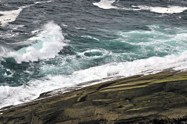 We tarried long here, hoping that we might see some Orcas - they are quite frequently seen here - but not on this occasion! These Bottlenose Dolphins obliged instead..... 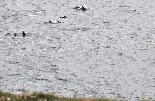 Orkney is known as a windy place but this scene, further down the coast at Yesnaby, was amazing. The soil erosion extends from the edges of these cliffs for up to 50m inland, and is caused by wind-driven spray from breaking waves. This unusual type of erosion only affects the lower cliffs. I'd love to come back here with the camera during a force 11 wind at high tide! 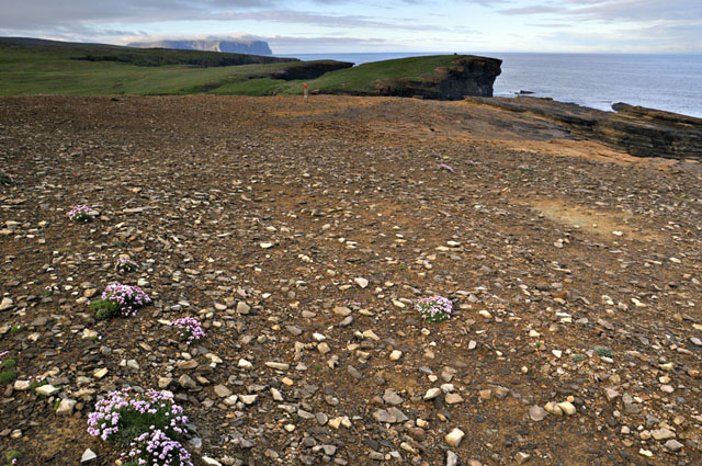 I'll finish off with some general shots of the Orcadian landscape.... 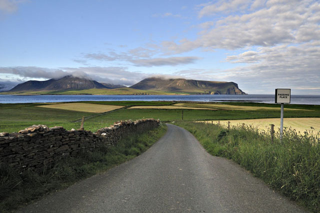 This is to the west of Stromness, looking southwards to Hoy across a patchwork of fields. This is extremely fertile country, especially compared to the NW of Scotland with its acres of rock and peat! Beef and lamb and feed crops are the typical produce, along with bere - a form of barley. The beef and lamb are especially tasty! There is a very high emphasis on using local produce here, something the rest of us will have to get used to in due course as the easily-recoverable oil deposits become scarcer. There's also a very powerful sense of community strength up here: it is said that without this, the smaller communities on the outlying islands simply would not be viable. It is a vision we should aspire to everywhere! 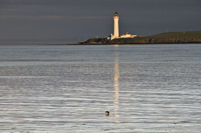 This is looking across the Sound of Hoy from near Ness Point one evening, with an obliging seal in the foreground! With maritime activity being such a major part of Orcadian life, lighthouses and navigational buoys are a frequent sight, especially in the vicinity of the major ports.  Connecting a string of small islands off the southern coast of Mainland are the Churchill Barriers. These blockwork structures carry road causeways and along with the nearby, deliberately-sunken Blockships, they were created in World War 2 in order to prevent U-boat access via the narrow but deep sounds between the islands into the sheltered anchorage of Scapa Flow, where U-47 torpedoed the battleship HMS Royal Oak on 14th October 1939 with the loss of 833 lives. This image shows Barrier 2, a blockship and one of the many wind turbines situated around the island. Renewables are pretty mainstream up here - if you've got it, why not make use of it? 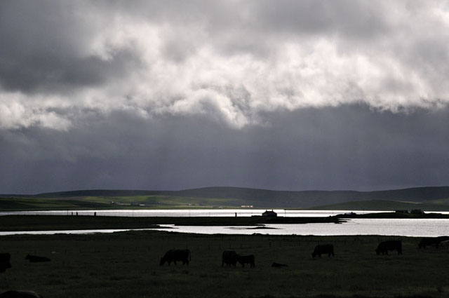 This was taken on the final evening from Maes Howe burial mound looking westwards, and shows the Stones of Stenness and the adjacent lochs. The mound has been excavated and is open for guided tours. Abandoned by its Neolithic builders, it was later entered by the Vikings - who carved runes into the huge stone slabs that line the chamber. All amazing stuff, but the light outside was what blew me away completely! The following morning I was away on the 0630 ferry, and twelve hours or so later was back in the sun-scorched beer garden of my local here in Machynlleth after 577 miles of driving. I was sorry to have to leave these beautiful and fascinating islands so soon. A week just isnt long enough - neither is a lifetime! It was a drizzly start to the day with a cold Nor-westerly wind chasing the ferry back to the Scottish mainland, as the cliffs of Hoy gradually receded into the distance, leaving just memories. I'll be back! |
|
BACK TO WEATHER-BLOG MENU New! Fine Art Prints & digital images for sale- Welsh Weather & Dyfi Valley landscapes Slide-Library - Click HERE |