BACK TO WEATHER-BLOG MENU
New! Fine Art Prints & digital images for sale-
Welsh Weather & Dyfi Valley landscapes Slide-Library - Click HERE
 It's September 10th and autumn arrives in the Dyfi Valley with one of the best
settled spells since late March!
It's September 10th and autumn arrives in the Dyfi Valley with one of the best
settled spells since late March!For anyone living anywhere south of the Great Glen, 2012 has seen a poor summer and the figures bear this out. Met Office data demonstrate that summer 2012 was the second wettest on record (1912 being the wettest, with 384.4mm against 370.7mm this year for the UK in general). It was also one of the dullest June-July-August periods on record, not quite beating the dismal summer of 1987 but nevertheless coming close. Yuck.
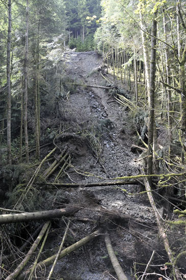
On a rainy note, I was out exploring recently and came upon this landslide on the side of the Llyfnant Valley. This is big - the trees are fully mature conifers. The stream is just visible at the bottom of the image. The die-back of the tree-foliage suggests to me that it is a couple of months old at least and I suspect this is another event from the massive rainfall of June 8th-9th.
The landslide is situated on the RHS of the road that heads up from Glaspwll to the Cwmrhaidr waterfalls. Some trees had been thrust up the bank towards the road, where they had been sawn through in order to get the road reopened. Must have been a hell of a thing to see when it went!
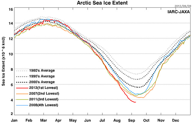
Summer 2012 has also seen an exceptional seasonal sea-ice melt in the Arctic, breaking all records in the post-1979 satellite monitoring period and, according to recent reconstructions, likely unprecedented in at least 1450 years. Although some so-called 'skeptics' have been spreading the word that the late 1930s-early 1940s had "similar" melts, the reality is that 1940 had a strong, for the time, melt. Ice extent fell to ca. 9.8 million sq km against a more usual 10-11 million sq km. This year's minimum extent? It's not been declared yet, but it will likely be between 3.55 and 3.66 million sq km.
Back to Wales, though, and I managed another monthly trip to the SW tip of the Llŷn Peninsula, where the fishing was a bit on the slow side - the rough weather has not helped as it breaks up the shoals of baitfish, which in turn scatters the predators like mackerel and pollack. But the day was a fine one, so I headed up to the top of Mynydd Mawr for a shoot before scrambling down to my rock-ledge. The whole hilltop was ablaze with bell-heather and gorse: this is the view back up the Llŷn......
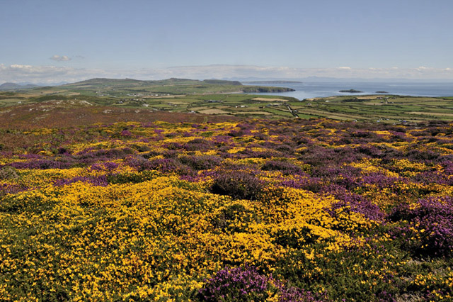
It made a cracking foreground for telephoto shots back across N Cardigan Bay towards the southern Snowdonia mountains, here with Cadair Idris R and the headlands of Penrhyn and, in the background, Trwyn Cilan....
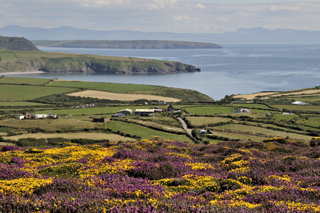
Here slightly zoomed-out - lovely! This has to be one of the most beautiful places on the planet. There were masses of Grayling butterflies flitting amongst the heather, the air was filled with the hum of bees and the choughs soared overhead. Very different from the depths of winter, when the storm-force winds scream across this headland: no wonder the gorse grows so short here!
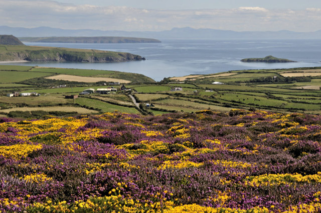
Talking of storms, there have been a few more: late on the evening of August 14th I came back from fishing at Borth and carried on through Machynlleth to watch a bright lightning display, which I suspected to be over Bala - checking when I got home it was located over Liverpool Bay! Says a lot about the benefits of low light-pollution. More lightning over the Dyfi Valley on August 24th and on the 29th conditions were ripe for severe thunderstorms. I headed to the coast, where photographic conditions immediately looked awful! But a big cell rumbled its way NE and was followed by this one - a multicell cluster with clearly powerful updraughts, evidenced by the overshooting of their tops - the two bulges of cloud above the flattish top of the anvil....
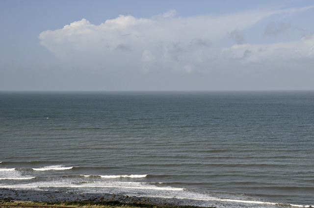
That afternoon at Borth, the light improved a bit and I was pleased with this one, with a developing storm dwarfing the lone angler at the water's edge....
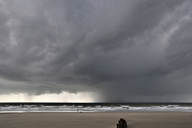
Continuing with Borth, one afternoon's fishing and seaweed-gathering saw this vivid sundog (the sun is out-of-view just to the left)...
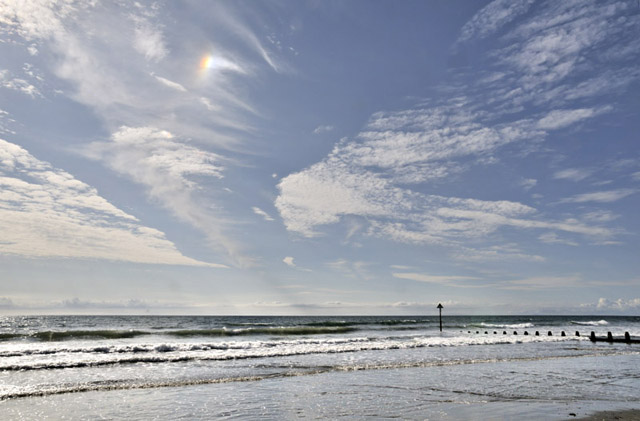
I am using some of the seaweed in an experiment: slug control. Encircling these broccoli plants with masses of the stuff appears to put them off - perhaps they hate the salt - and the seaweed will add nutrients to the soil as it rots down. I'll report on how this pans out long-term!
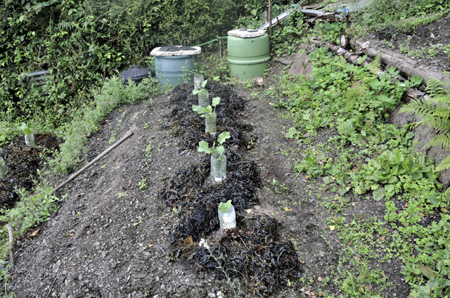
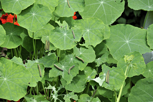
I planted the broccoli a bit late, which encouraged cabbage whites to lay eggs on the expendable nasturtiums that have self-seeded everywhere and - so long as they're not in the way - are left for the bees. This decoy method has proved quite successful: I have had to remove just two batches of eggs from the broccoli, although it is important to check the plants every few days just in case. The caterpillars are pretty brazen, basking in the open all day - and they can afford to be: they develop unpleasant-tasting oils and birds seem to know that they taste disgusting!
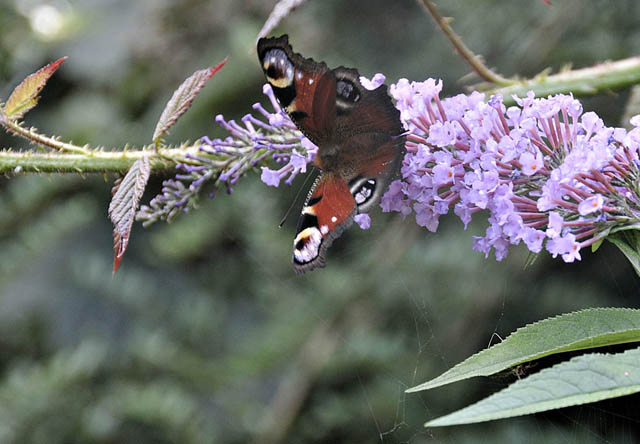
Late August and early September sunshine has seen a sudden appearance of biodiversity in the garden - I guess everything had been hiding away from the awful weather! Comma butterflies are there on any sunny day, as are Peacocks....
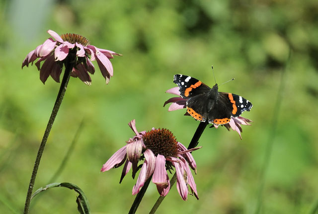
...plus a Painted Lady on one occasion and this Red Admiral on another, feeding on the only flower-stem that the echinacea managed to get past the slugs this year!
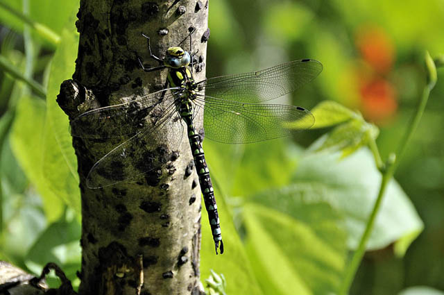
Being close to the river, the garden is patrolled by many dragonflies and damselflies, with this Southern Hawker obligingly keeping still for a shot...
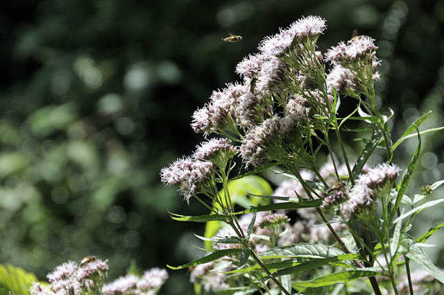
Hoverflies were in abundance on sunny days, especially around this Hemp Agrimony that has self-seeded. They love it and I am delighted to see so many of these beneficial insects. A Holly Blue also visited this flowerhead on several occasions, bringing the butterfly species-list to 10 this year as opposed to 16 in 2011, although the warm early summer helped a lot last year.
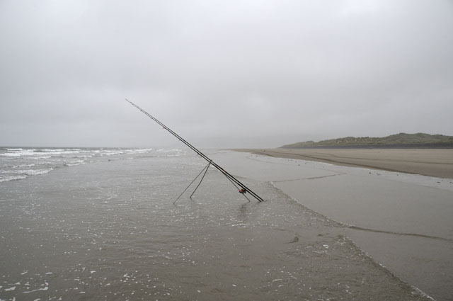
Summer 2012's final day brought the season to an end in typical style...
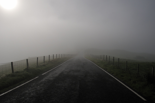
September saw a big improvement in conditions with bucketfuls of warm sunshine. On the morning of the 8th, I awoke to an overcast dawn despite the high pressure and a forecast for another wall-to-wall sunshine day. I checked the first visible satellite image of the day at around 0730 - it showed the cloud confined to the valleys - and just after 0800 set off up to the top of the mountain road, some 8 miles away. As the image below shows, at 350m above sea level, the cloud was dense but with the sun visible, indicating I must be close to the top of the cloud....
...and this was the view from the Wynford Vaughan-Thomas memorial at 450m! Magnificent! Cadair Idris L & Dyfi Forest R. Can you see Yr Wyddfa/Snowdon?
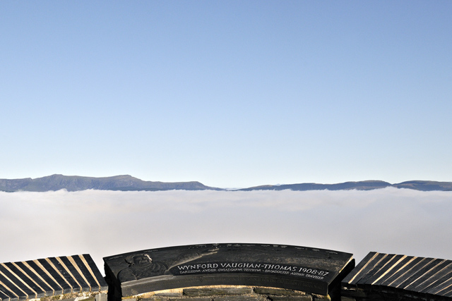
The amazing conditions were due to a strong temperature-inversion at about 430m: in other words at this height there was an abrupt transition from cold air below to warm air above, keeping the cold and moisture penned-in below. Such conditions are not infrequent during calm conditions in autumn: as evening goes into night, the air over the mountains cools differentially and, cold air being dense, it flows down and collects in the valleys whilst at height it remains clear. The boundary can be very sharp. The shot below is a telephoto of the upper Dyfi Valley and the Arans...
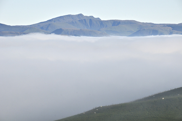
The slight south-westerly breeze running over the stagnant cloudy airmass beneath was working up a few Kelvin-Helmholtz waves in the top of the cloud - one can be seen curling over R of centre. Cadair Idris in the background.
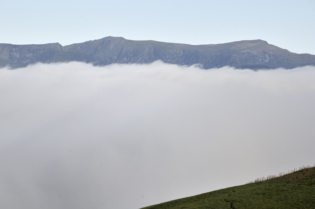
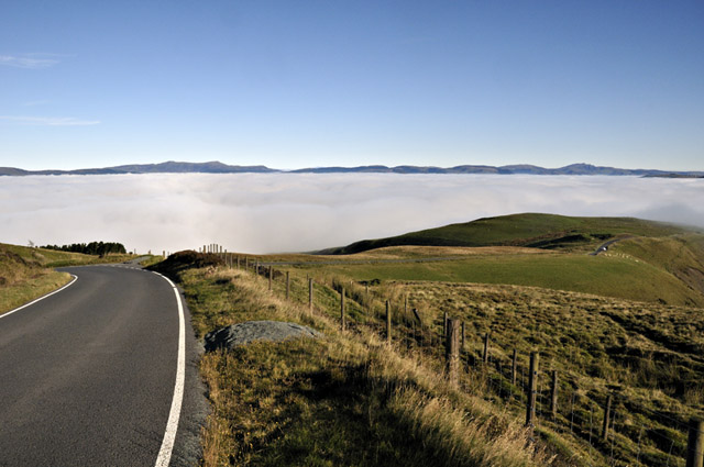
Looking back down the road...
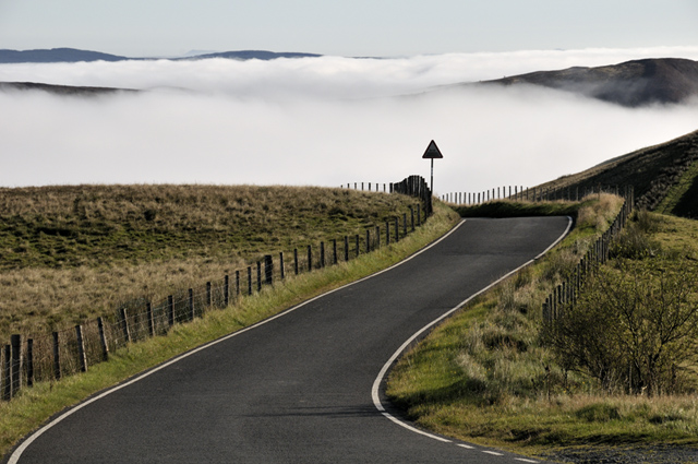
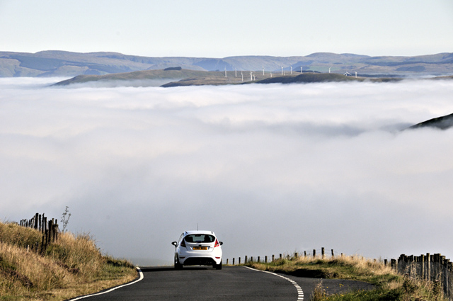
A car descends into the murk, with Mynydd Cemmaes beyond to the north...
To the north-east, the Berwyns in the distance, with the afforested high ground either side of the Twymyn valley in the foreground...
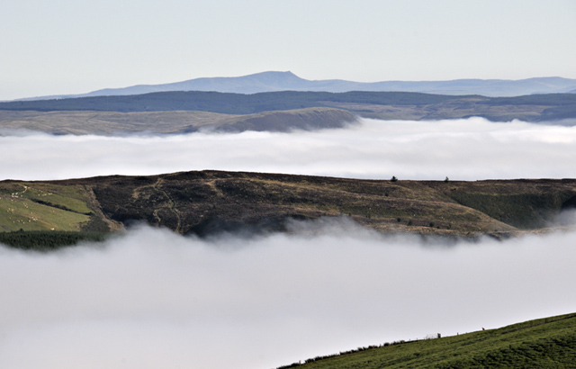
The Arans, the upper Dyfi Valley and Mynydd Cemmaes again from just above the top of the fog...
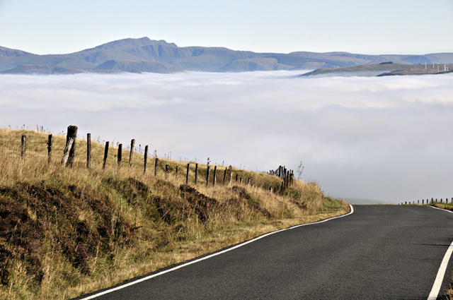
Wideangle of the scene from the top of the pass at 500m ASL....
Dropping back down to 350m, I was back in dense fog, but weak sunlight began to filter through, lighting up the heavy dew on the grass...
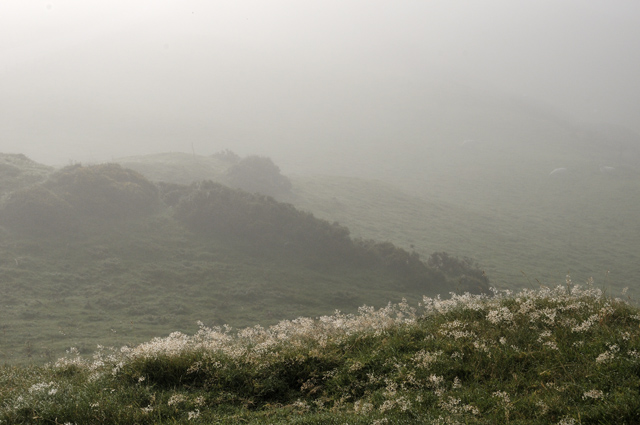
The top of the cloud-bank was descending as the strong sunlight worked at it. I walked to a hilltop by the road and looking in the opposite direction to the sun there was an impressive fog bow. This is a similar phenomenon to a rainbow, but because of the very small size of the water droplets that make up fog (smaller than 0.05 mm), a fog bow has only very weak colours. In many cases, the bow looks white, although some watery reds are visible in this one. Larger water-drops (such as rain) give much stronger colours; in fog, diffraction smears them out.
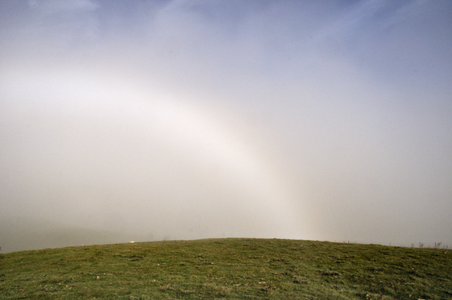
Here's another view...
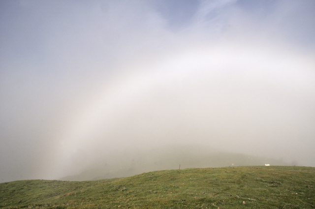
Very close to the top of the fog here, but with the bow still visible and blue sky plus cirrus overhead.
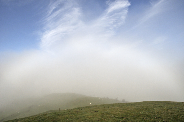
Heading back up above the fog, I noted that its top was becoming less well-defined with parts of it streaming upwards as the sun began to heat the air below...
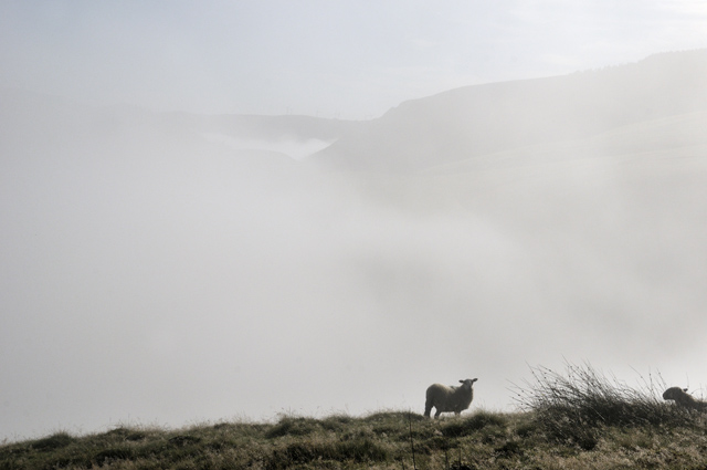
The process became more marked...
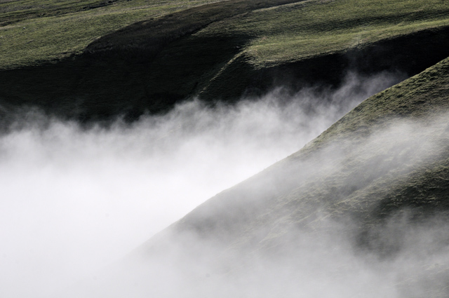
Convection had started to mix-out the two airmasses. In the image below, holes can be seen appearing in the cloud-bank, and cloud can be seen rising above its top, immediately above the road for example, looking a bit like diffuse bonfire-smoke against the blue sky. The inversion is breaking up and is no longer capping-in the air below, which is warming and rising through holes in the cap. Strong capping-inversions can similarly prevent convective storms from developing in summer, but if they break then strong updraughts start to get going and storms can form quickly. Interesting to see the process in action here.
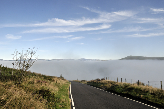
By the time I had descended back down to where I had seen the fog bow, the cloud was breaking up very rapidly, and by the time I arrived back in Machynlleth it had almost entirely gone.
That was a good start to autumn, I thought. Back to unsettled conditions now, though there are signs of more high pressure at times through the coming weeks. After this years' dismal summer, the more of that the better! More soon....
BACK TO WEATHER-BLOG MENU
New! Fine Art Prints & digital images for sale-
Welsh Weather & Dyfi Valley landscapes Slide-Library - Click HERE