BACK TO WEATHER-BLOG MENU
New! Fine Art Prints & digital images for sale-
Welsh Weather & Dyfi Valley landscapes Slide-Library - Click HERE
BRITAIN will roast in the hottest August EVER with temperatures set to hit an unbearable 100F within weeks.
As is almost always the case, the opposite occurred and what had been an excellent summer gave way to less settled conditions. In turn these permitted more chances of storm photography - a rare treat this summer so far but I don't think many will complain about that deficit. With sea temperatures well above normal, and set to stay that way until late autumn, we should see some impressive convective weather from time to time over the coming months, especially when as is often the case we see cold pools of air coming in from the north-west, creating very unstable atmospheric profiles.Having moved out of town to a quasi-rural location, there is much in the immediate vicinity to photograph when the weather is quieter. What was immediately noticeable was the big uptick in biodiversity, some of which I thought to explore by installing a birdfeeder using the same squirrel-proof method as I had used at the veg-garden. Within days it was being visited on a regular basis by these siskins, which soon became used to my outdoor presence:


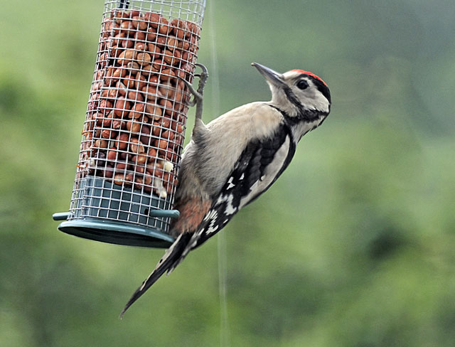
The feeder is rigged so that I can see it hanging there less than ten feet from my desk, which gave some thrilling views as this Greater Spotted Woodpecker and its family turned up, mostly early in the morning. Far more cautious than the siskins, I cleaned the window to an optical finish and then through experimentation managed to find a section of the old glass where distortion was minimal: the shot below was as good as it got. They won't show at all if there is anybody outside.
Forge is surrounded by pasture and both deciduous and coniferous woodland and along the valley-bottom flows Afon Dulas which is flanked by damp-loving plants: in combination this makes for a good variety of insect life. One morning I met with this grasshopper by my door....

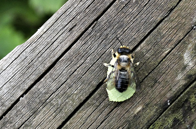
... whilst holes in the wooden fence nearby are home to leaf-cutting bees.
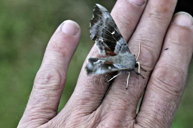
Moths, too, are abundant up here compared to town: the most impressive one to date being this Poplar Hawk that I removed from the house, firing up its wings prior to taking off, which it did moments after the photo was taken.
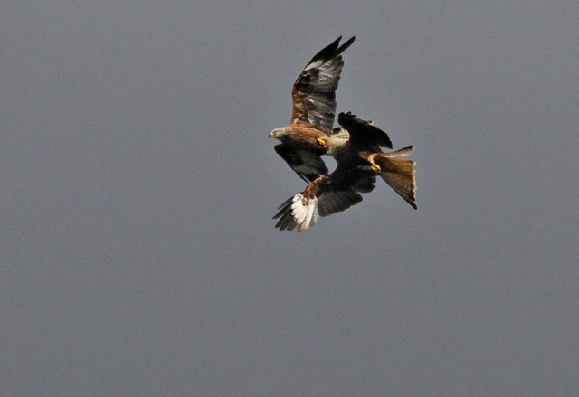
Kites continue to soar overhead, occasionally having mid-air squabbles....
Forge is also on one of the exits from the famous "Mach Loop", stamping ground for avid aviation photographers. Jets come screaming up the valley most days, making a racket (you get used to that after a few years) but more importantly giving me chance to practice fast panning and zooming - which is a lot more difficult to get right than one might think! Starting wide then zooming in whilst panning to follow the target seems to work best, and then you just have to hope that the autofocus doesn't lock onto the edge of a cloud instead. It's an interesting technical exercise....

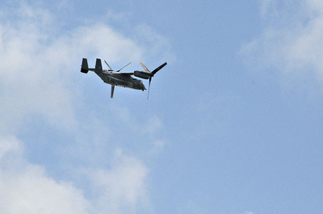
One evening this unusual aircraft - an Osprey - did a couple of rounds of the Loop. Slower-moving, it was a much easier target as it passed twice over the beer-garden at the White Lion in Machynlleth...


Down at the coast, the aftermath of the vicious winter storms continues, with very few mackerel so far - many locals (myself included) think that the damage done to the inshore sand-banks by the giant swells that accompanied many of the storm-systems has led to reduced number of baitfish like sandeels, critically at the time in spring when the mackerel made their initial northward migration. With less food around than usual, the mackerel would have largely moved on. Another thing that has been commented on is the way that the nooks and crannies among the boulders that defend structures like Aberystwyth's stone jetty have been filled up with pebbles, thus depriving many small fish of hidey-holes. Recovery from such habitat-loss will take some time.
Although the waterborne debris that was swept deep into Ynyslas Dunes is still very evident, the butterfly population seems healthy this year with hundreds of Gatekeepers evident...

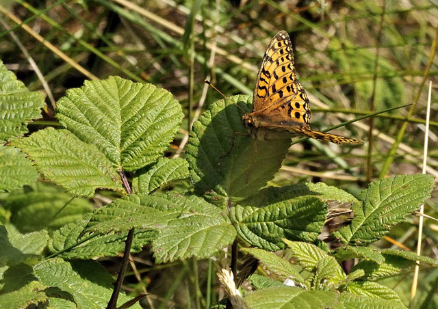
On July 17th I managed an elusive capture at Ynyslas - this Dark Green Fritillary. They may be seen flying at high speed here every July, but for one to actually settle on something for long enough to get anywhere near, even with a telephoto lens, is rare indeed...
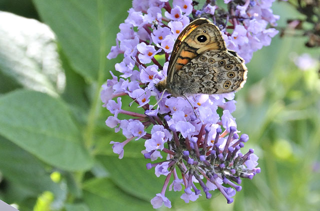
Another sighting was at the veg-garden at the beginning of August, where it was - albeit briefly - feeding on a flower-spike on the buddleia bush - in precisely the spot where it was impossible to photograph! That brings the total butterfly species-count for the garden to 20, which is pretty respectable. On the same afternoon the buddleia was swarming with Peacocks and Red Admirals, Commas were flitting about in pairs, a Holly Blue patrolled the hedges and this Wall Brown, carried away with nectaring, allowed a close approach......
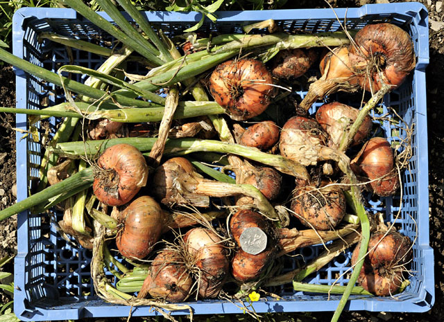
The weather-pattern this year has suited the shallots down to the ground with a pleasing crop harvested on August 3rd. The variety is, as ever, Red Sun. It just seems suited to the conditions here, and although I try a second variety each year not one has come close in terms of productivity.
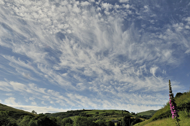
The view up the valley from home is unremarkable compared to many other views around here, but then again I could be looking at a motorway flyover instead - these things are all relative - and on occasion the clouds more than enhance things!
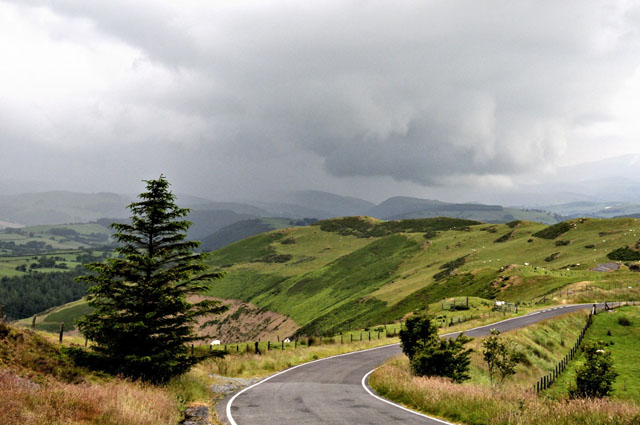
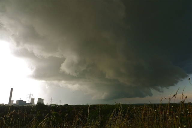
A thundery spell on June 27th brought some heavy downpours to Mid-Wales although a run up to the top of the mountain road just gave me a lot of murk through which occasional thunder could be heard rumbling away. But coming back down, things cleared briefly revealing this wall-cloud, that seemed to spin up along an old gust-front:
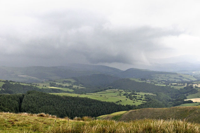
It took up quite a dramatic appearance for a couple of minutes before falling apart again...
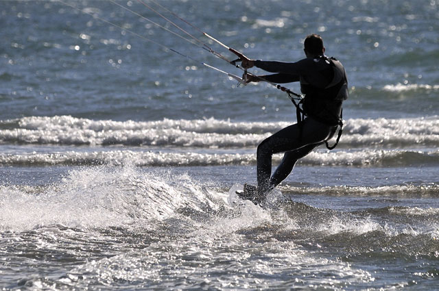
July brought with it the sort of weather that beach-lovers delight in with a good breeze on many days to keep the watersports crows happy!
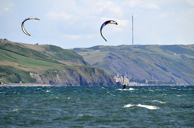
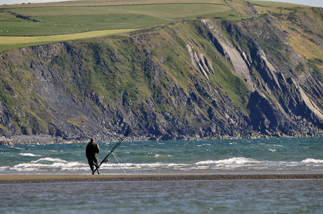
Far from ideal angling conditions but a nice day for it. The angler is fishing from one of the new sandbars along the low tide mark that the storms threw up - they are remarkably persistent and will make planning future sessions challenging!
Elsewhere though there were some remarkable outbreaks of thunderstorms. July 19th began in spectacular style here with a prolonged, pre-dawn lightning display from elevated storms both to my east and west, well worth getting up early for! Later that day, with a Spanish Plume situated over the UK, storms became rooted in the boundary-layer and in the high-shear conditions prevailing, one or more supercells developed over England. A supercell over Oxfordshire shows its long track in the lightning plot below (oldest lightning red, youngest white). Because of the wind-shear, the anvil plumes were blowing off these storms as they developed during the day and tracked north-east: upper level winds were south-easterly, so that Wales was mostly shrouded in anvil-cirrus all day, sharply reducing the chance of much happening for us!

But this photo, taken by Matt Niblett near Didcot in Oxfordshire, says it all: classic supercell! That's quite a rare view for the UK where the exact combination of lots of energy and wind-shear can be hard to find. On July 19th the goods were most certainly delivered for some!
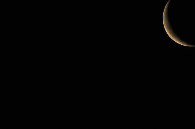
Back home, and with high pressure dominating Wales' weather through much of the rest of July, early mornings were often quite misty, but first thing on the 23rd I managed this shot of the waning moon - New Moon was due on the 26th. Away from the light pollution of town, I'm hoping to explore night-sky photography a bit in the coming months...
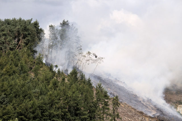
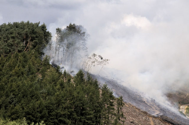
By early August, the undergrowth was tinder-dry in places and this brush-fire broke out one Sunday a little to the east of Machynlleth, here viewed from the road into town:
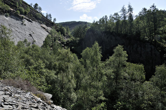
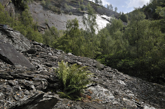
The same weekend saw the 40th anniversary of the Centre for Alternative Technology and being the local geologist I was co-opted into taking small parties around the quarry itself, a bit visitors do not normally get to see. It's a beautiful, peaceful spot, gradually being reclaimed by nature....

Met a few new faces too, including Natalie Bennett, the new Green Party leader, and some familiar ones such as climate scientist Sir John Houghton: all in all a great day out among like-minded people!
Finally, the days leading up to August 10th brought, after so much glorious weather, a real headache for forecasters. A poorly organised tropical disturbance, Bertha, had briefly reached hurricane status before recurving eastwards off the Eastern seaboard of the USA and heading vaguely for the UK. En-route, its remnants - a lot of warm very moist air - became entrapped in a developing Atlantic low-pressure system. The forecast models struggled with this system and its interaction with the jetstream - that would either make it develop strongly or fizzle it out, depending on which side of the jet it would eventually end up.
Sunday August 10th duly arrived and with it a deepening low pressure system that tracked from Cornwall up towards NE England. Torrential rain began the day here, before clearing northwards late morning: elsewhere a vicious squall-line developed across the eastern half of England with hail to 15mm and a couple of tornadoes reported. By the afternoon, winds over Wales had gone into the west and the radar showed showers and thunderstorms crossing the Irish Sea in my general direction, so it was off to the coast for a look. This was the sight that greeted me on arrival:

Storm after storm moved along just offshore to make landfall just south of Aberystwyth - ideal for the photographer not wanting to get caught up in a rain-core with its poor visibility!
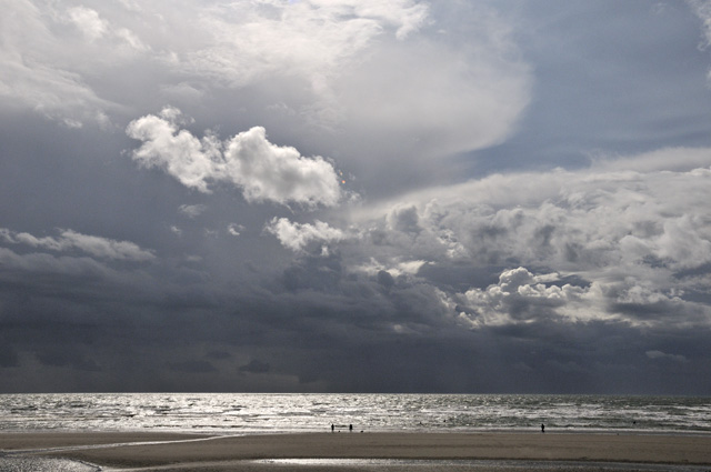
With the sun still high in the sky, excellent light conditions prevailed over the sea, against the solid black backdrop...
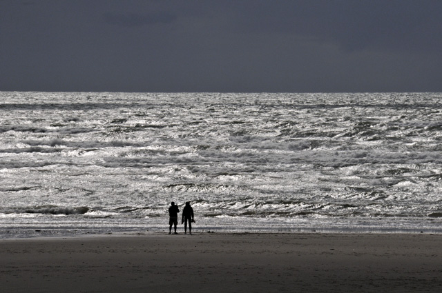
In the middle of this photo, a suspicious lowering has formed along the part-obscured cloudbase - wall-cloud?
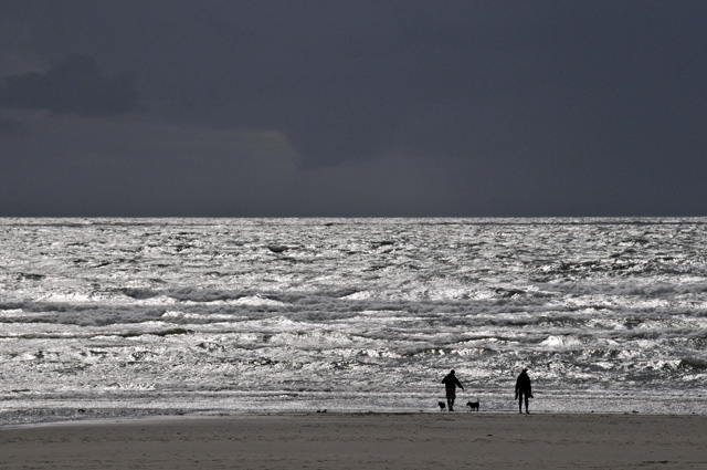
Certainly looks like one in this shot:

The position of the line gradually shifted so that a decaying cell moved overhead. Here it is, retreating inland:
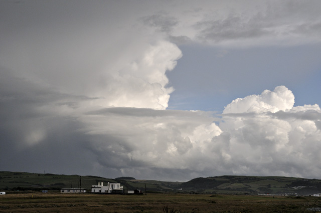
Out over the waves, new convection was springing into life:
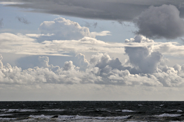
The cell in the background has rapidly gone from a towering cumulus to a fully-fledged cumulonimbus...
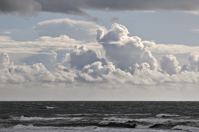
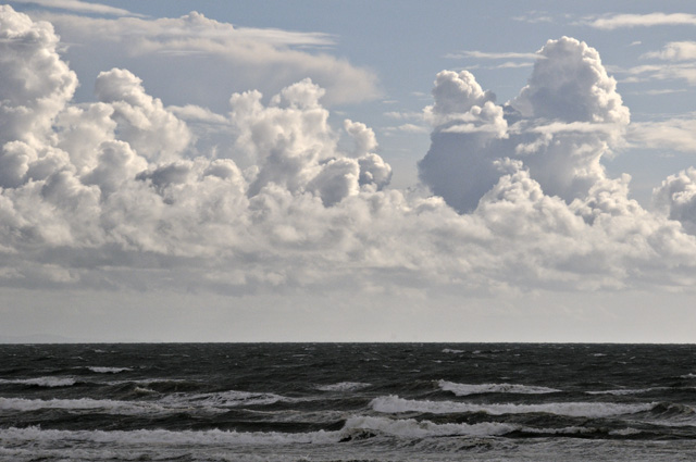
...with an overshooting top - the "peak" of cloud sprouting out of the top of the anvil in this image. New towers going up to the left. However, evening was now approaching with relatively stable air moving in, and the convective activity rapidly waned in strength....
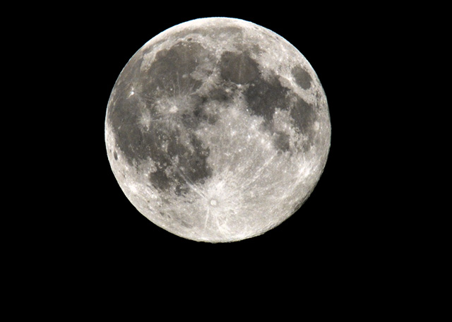
...not that I was complaining though: skies cleared that evening for long enough to get a good view of the biggest full moon of the year, hanging over the head of the valley. I simply shot this by placing the camera on the stone wall that runs up past the house. Bracketing the exposures because it was so bright, I found the one underexposed by a stop to be the best of them, despite using the "moon 11" rule where the aperture is set to f11 and speed and ISO settings are set to be the the same.
On that note, that's it for now. It looks as though the rest of August will have a distinctly autumnal feel to it, but that is ushering in the first chanterelles and field-mushrooms: hopefully too the fishing will improve as tends to at the end of August and as mentioned above the convective storm potential looks especially good this coming season. More soon!
BACK TO WEATHER-BLOG MENU
New! Fine Art Prints & digital images for sale-
Welsh Weather & Dyfi Valley landscapes Slide-Library - Click HERE