BACK TO WEATHER-BLOG MENU
New! Fine Art Prints & digital images for sale-
Welsh Weather & Dyfi Valley landscapes Slide-Library - Click HERE
It's December 15th and what a change a year makes! This time last year we saw a brief mild respite after two weeks of subzero temperatures, snow and ice: a few days later snow a foot deep covered Machynlleth. This year, a brief cold snap has brought hill-snow following a remarkably mild remainder of November, but next week looks pretty average over Wales with some days exceeding that and hitting double figures; similar conditions seem likely in the run-up to Christmas.
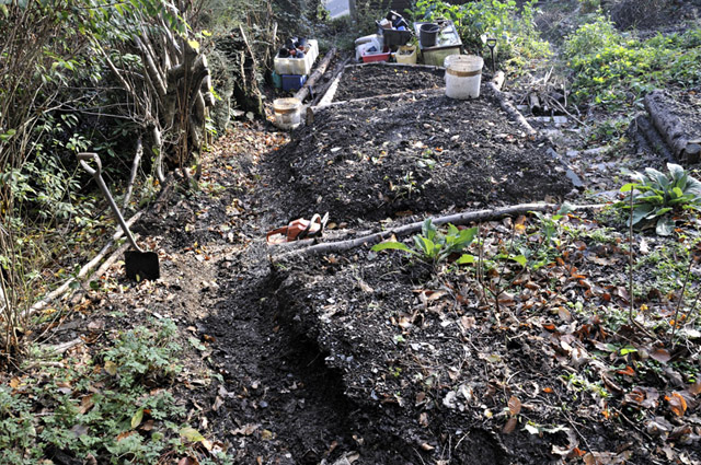
Pleasant weather in late autumn is a perfect excuse to get out there and attend to the long list of garden-jobs. I don't mind weeds as such as they provide ground-cover out-of-season and biomass for composting at other times, but one I have had a big problem with is the creeping buttercup that spreads everywhere from both sides. So I made a clearing down the worst-affected side in order to make controlling it easier:
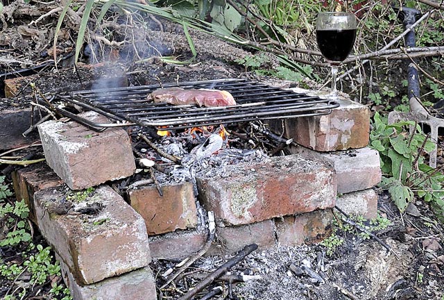
The weather was so pleasant that on November 27th I ate and drank up there after finishing work - no better way to cook one of Wil Lloyd's excellent steaks - sod the austerity (well, if only for an hour or two!).....
Taken on the same afternoon - a red campion - several stems had blooms, bearing testimony to the mildness of the conditions....

There have still been no hard frosts as such at the time of writing, so I'm getting greens as well as more traditional winter veg. Mixed results with parsnips - out of six I lifted, three were OK and the rest not - but the OK ones are excellent......

As November waned, much stormier weather started to arrive from the Atlantic, including several surging ANA-type cold fronts that produced line convection (or squall-lines). In an ANA-type cold front, cold air surging forward undercuts the moist warm air ahead and lifts it sharply in a backwards direction (i.e. against the synoptic steering-flow). Thus, the surface front is marked by a powerful, linear updraught-base (often with a drastic decrease in light-levels), whilst just behind that a narrow (often no more than 2-3 km), linear band of torrential rain (sometimes hail or snow) is present. The diagram below is a cross-section:

The rainband is known as a squall-line because the heavy precipitation, which may or may not be accompanied by lightning, comes with very high, gusty winds: the rain flies at you horizontally from seemingly all directions for several minutes until the line has passed. Squall-lines may occur within a wider band of ordinary rain or be followed by a complete clearance to blue sky with scattered shower-clouds.
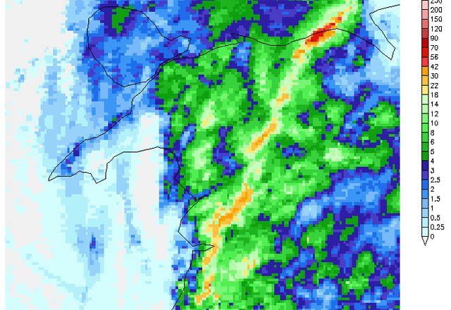
The radar image below is from the squall-line of November 29th. The bright colours mark it. As you can see, the brightest areas do not form one continuous line but occur as segments, slightly offset from one another, almost like a series of waves. What is happening here is that the very strong wind-shear that usually accompanies such events has broken the line into what is known in radar parlance as a line-echo wave-pattern (or LEWP). These are more significant than simple squall-lines as they can produce especially damaging winds: firstly if a segment surges forwards (a bowing segment) then damaging straight-line winds can occur (downbursts) and secondly the ends of each segment are the location for very high vorticity, so that strong rotation can occur and generate tornadic vortices. On the 29th there were a number of reports of tornado activity - including one that cut a neat path of devastation through a caravan-site on Anglesey.
Here the arrival of the surface front was marked by ever-gloomier light levels before the heavens opened:

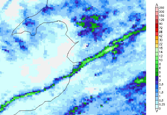
I had not thought of these fronts as having much photographic potential, but when the next daylight one was due on December 8th I thought I'd check it out. It was nowhere near as strong as that of November 29th, but nevertheless a squall-line finally developed just as it hit the coast, so I had time to grab my gear and head just out of Machynlleth....
I parked-up so that I could shoot from an open drivers' window whilst the wind would be hitting the opposite side of the vehicle. Sure enough the sky darkened, but a much brighter area raced in from over the horizon, which turned out to be the squall itself....
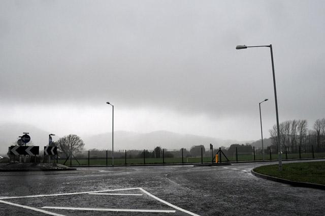
In this shot the leading edge is literally just past that field....

Here it is about to hit. The high winds and torrential rain are evident....

Now it arrived and I risked one shot looking down the road.
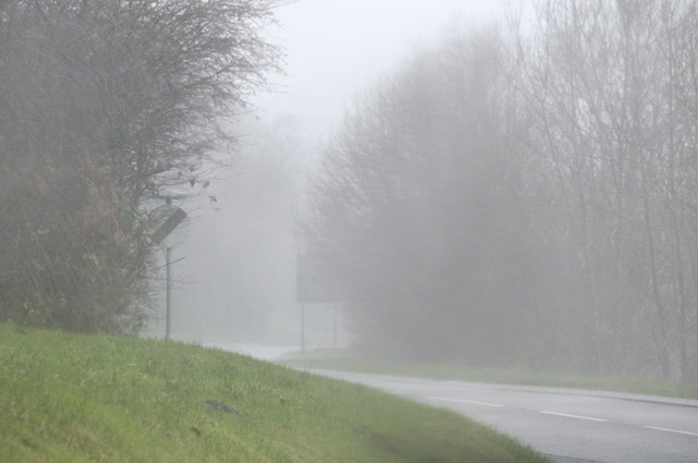
Moments later, it had moved off and just light drizzly rain remained. I learned a few good lessons on this trip that I will try and make use of next time: a good vantage-point is essential and with good foreground where one can see distant things like trees disappearing one by one into the poor visibility and blinding rain of the squall. Looking forward to giving this another try at a better vantage-point. The important thing is to head for the middle of a segment as this is where the approach should be most impressive yet safest - all squall-line tornadoes are rain-wrapped so one cannot see them coming, so avoiding the ends of segments seems sensible!
All the way through to mid-December, very deep areas of low pressure piled in one after another with storm-force winds that affected Wales on several occasions, gales in between and a real pasting being taken by Scotland, where winds topped hurricane-force and gusts well over 100mph were recorded.
On the 13th I headed down to Borth to take a look at the sea, which was in angry mode. The buoy in the image below is a navigation-hazard marker to stop boats coming too close to the new artificial reef that is near completion.
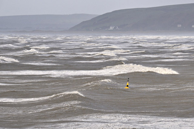
It's a large buoy but this is a huge swell!
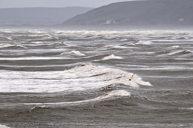
This shot shows waves breaking over the new reef. Locals reckon it is working well, reducing the energy of the long-fetch swell-waves that do all the damage.....

Whilst here we have the natural breakwater of the South Reef, with a huge wave breaking right over Camel Rock in the background:
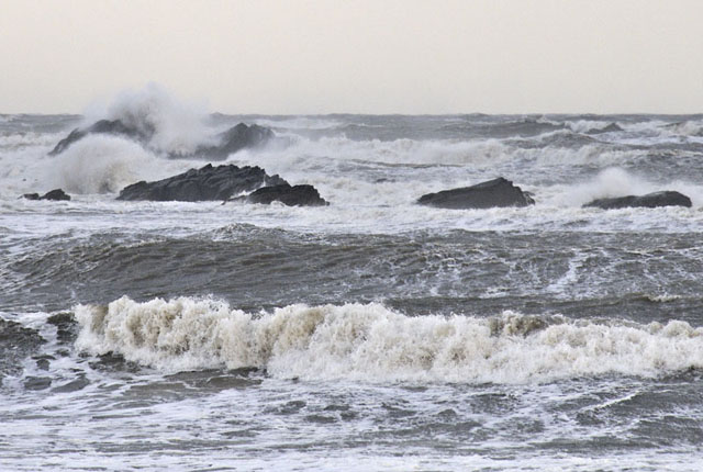
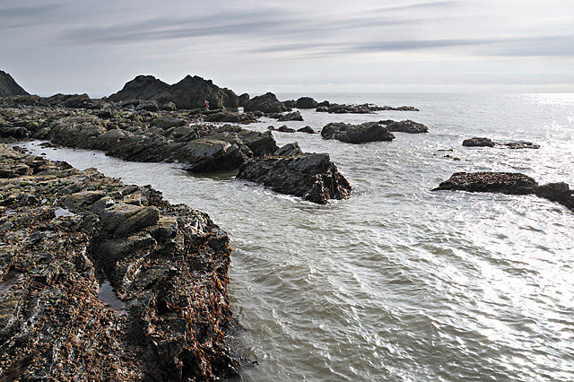
For comparison, this is Camel Rock on a pleasant summer afternoon - note the people stood under its right-hand side.....
Down the road at Ynyslas, and looking back towards the sun, a break in the clouds let the light play silver patterns on the surf that seemed to commence somewhere over the horizon:
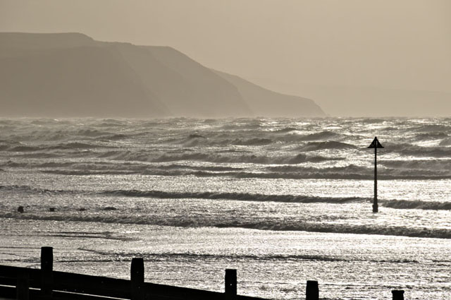
It broke through a small gap in a bank of cumulus that was whizzing past on the gale to give an excellent burst of crepuscular rays - the scattering of the light - and indeed the general haze - all down to the spray that filled the air. The cumulus developed into modest convective showers as it moved inland (southern areas saw strong thunderstorms at the same time), and as this was a patch of good light I followed it inland and uphill.....
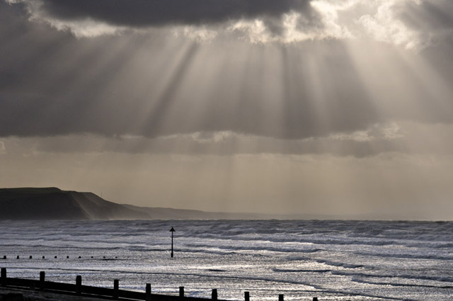
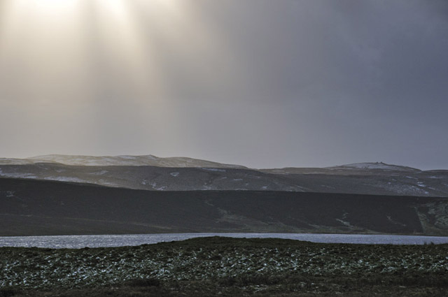
Although the signs were out on the mountain road, I thought I'd take a look and was able to get to the top without incident, to be greeted by more crepuscular rays shining down on the top of Carn Hyddgen, with its twin Bronze-age stone cairns. Glaslyn lies in the foreground, its waters chopped-up by the gale. Snow, and piles of hailstones, lay in hollows either side of the road.....
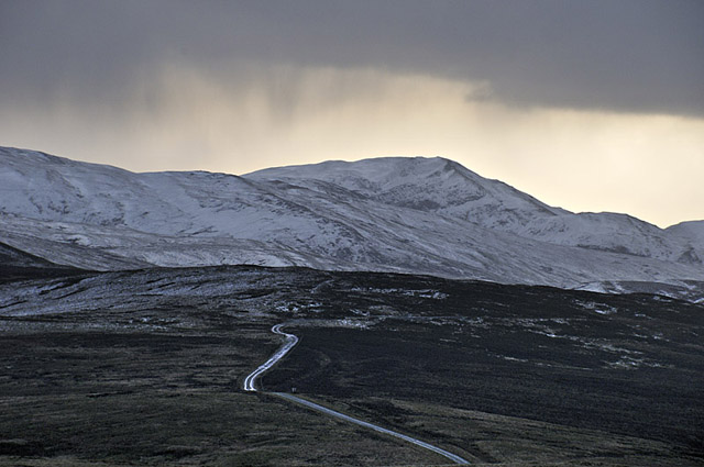
Further snow-showers came in over Plynlimon, which already had a good coating, drifted in places. Temperatures were falling in the late-afternoon light and, fully expectant of widespread ice as the wet road-surface went below zero, I turned and left the wintry uplands in peace.
+++ NOTE TO HILLGOERS +++
The admixture of snow and hailstones plus strong winds and little freeze-thaw has led to hazardous conditions in the mountains - a party had a cornice go under them on the NE Ridge of Y Garn on December 17th and when they plus the debris landed in the gully below it avalanched on a pretty big scale with tragic consequences. It seems that the snow is pretty unstable in places right now so mind how you go.
So that's likely it for 2011, and another year approaches. I hope you've enjoyed this years' offerings: it's been a mixed old bag as ever but with some pleasing results - I think the highlight must be the incredible night I spent watching the exceptional noctilucent clouds high in the mountains, but the autumn funnel-cloud outbreak and supercell were other reminders of the awesome wonder of Nature - never resting, always changing. It is right that we should hold her in awe and treat her with the deepest respect.
Best wishes for 2012 to all my readers.
BACK TO WEATHER-BLOG MENU
New! Fine Art Prints & digital images for sale-
Welsh Weather & Dyfi Valley landscapes Slide-Library - Click HERE