BACK TO WEATHER-BLOG MENU
New! Fine Art Prints & digital images for sale-
Welsh Weather & Dyfi Valley landscapes Slide-Library - Click HERE
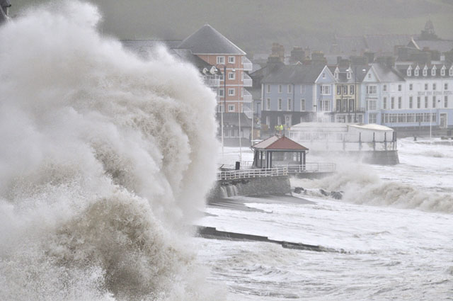
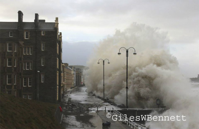
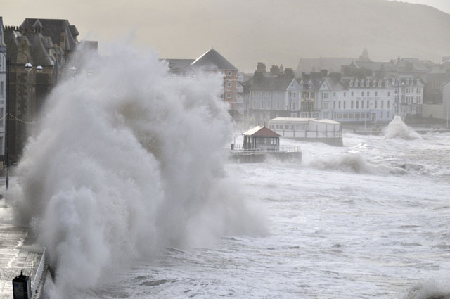
I have lived in this part of the world for over 30 years and have seen many coastal storms, but nothing quite like these. Frequent trips to the Midlands to visit a very poorly close relative led to me not seeing the storm of the 3rd, but hard on its heels there arrived another which was almost as intense in its ferocity, as the above image indicates.
Why were they so bad? For several reasons acting in combination. Firstly, they coincided with spring tides: out of a range of high water heights for a typical year of 3.3 to 5.7 metres, the 3rd's high water heights were 5.5m for the morning tide and 5.1m for the evening tide: on the 6th the values were 5.1 and 4.8 metres.
Secondly, there was a storm-surge. Under a low pressure system, where there is less atmospheric pressure at sea level, the sea surface bulges upwards by about a centimetre for every millibar less pressure. Standard or average sea-level air pressure is about 1013 millibars: both these storms were extremely deep with central pressures of less than 950 millibars.
Another ingredient in a storm-surge is the effect of the wind on the sea - it literally piles it up and drives it along. Thus, the strength and direction/length of track of a storm's winds are important. In this instance, the southwesterly to westerly winds were pretty much spanning the entire Atlantic because of the sheer size of these storm systems.
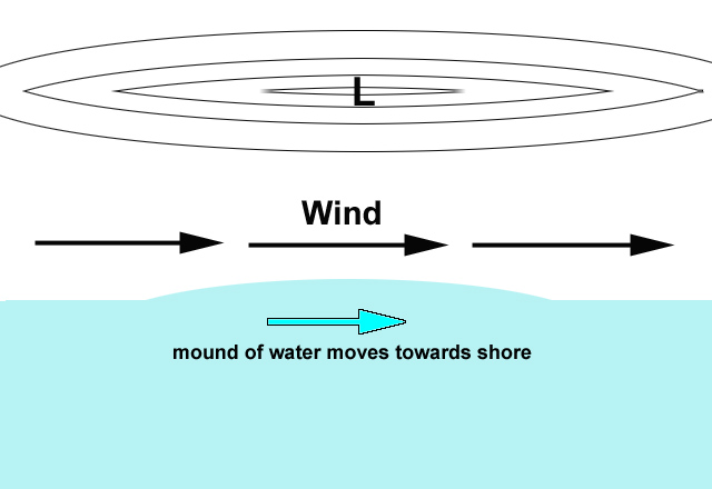
A storm-surge out in the open sea is not a problem, but when it encounters land it has nowhere else to go, and when it encounters a bay like Cardigan Bay it gets piled up even more. Finally, just like one sees with a tsunami, it starts to increase in height upon reaching the shallows inshore. The forecast surges for these storms added getting on for a metre to the height of the tide: it was what high tide would be like after a metre of sea-level rise.
The way in which these two phenomenal storms developed is of considerable interest. Atlantic storms result from the meeting of warm Tropical and cold Arctic air and the greater the temperature contrast between the airmasses the more intense the storm will be. On January 2nd, extremely cold air moved southwards to affect eastern Canada: one way to look for cold air is its thickness on weather charts. This is the distance from the surface up to the 500 millibar air pressure level and is measured in decametres (dam): 1 dam = 10 metres of height. Just to give some typical values: in the UK, summer values from 535-565 dam are typical (anything over 564 dam is generally a heatwave), whilst in winter values from 550 down to 510 dam are met with. Avid fans of cold weather look for the position of the 528 dam line on charts because anything below that raises the possibility of snow.
The cold air in this case had a phenomenally low value of 478 dam! Meanwhile, the warm air coming up from the direction of Bermuda was around 560 dam - such a strong contrast setting the scene for a very large thermal gradient just off the eastern seaboard of North America - a highly developmental scenario. Not only that, but at the same time an exceptionally powerful Jetstreak within the overall Polar Jetstream was roaring overhead, as the following chart (at a height of about 8000m above sea-level) shows:
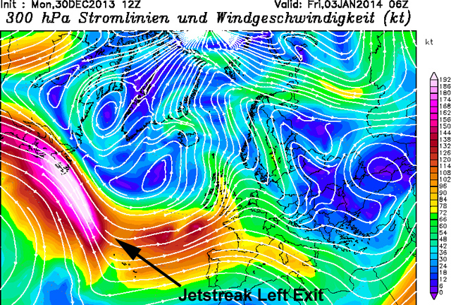
In this chart, the developing storm found itself in the most favourable position possible with respect to the Jetstreak - on its Polar, Left Exit region, where mass ascent of air takes place, really cranking up activity below.
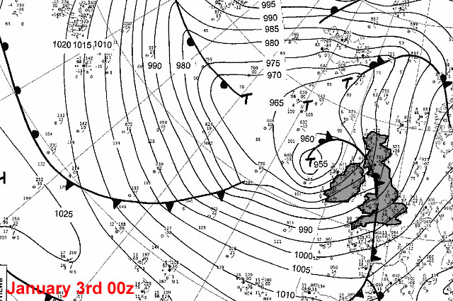
Here is a synoptic surface pressure chart for 00z on January 3rd - Newfoundland is visible top left and I've (rather badly) outlined and shaded the UK and Ireland. The storm has raced across the Atlantic and is now off the west coast of Ireland at 955mb, filling already, but as you can see gale- to storm-force winds from a west to south-west direction extend right across the Atlantic, propelling the storm-surge towards Europe and generating enormous waves out in the open ocean - the K2 Buoy off SW Ireland reported waves to 45ft on the morning of the 3rd. Once formed, some of these waves persist and travel all the way to the coasts of Europe, appearing as long-period ground-swells that can occur even when there is little wind (or an offshore wind) locally. It is these swells, atop the storm-surge, that really do the damage.
By the same time on the 4th, the situation was starting to ease, but off the east coast of North America, another storm had already developed - this brought heavy snowfalls to some north-eastern states.
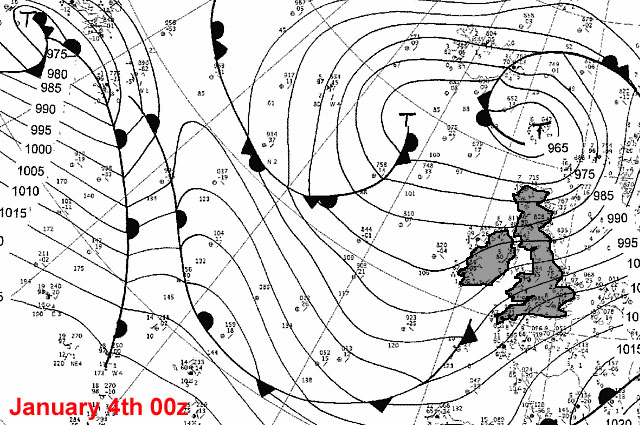
24 hours later, this new storm was in the Mid Atlantic with a very low central pressure and hurricane-force winds around its centre. These were to generate the huge swells that reached the Welsh coast on the 6th:
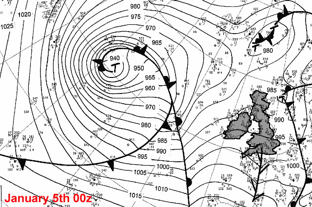
00z on the 6th and the storm - filling but still very powerful - is off western Ireland:
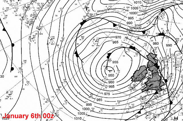
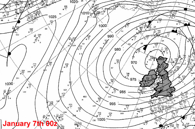
On the 7th it went past N Scotland and dissipated further again to the NE, bringing this exceptional spell of severe weather to an end.
On the ground, the Environment Agency issued a swathe of Flood Watches on the morning of the 3rd, upgrading them to Flood Warnings and in some case Severe Flood Warnings (issued when a danger to life is recognised) through the day. Winds increased to storm force locally by the evening, when mass-evacuations were made of seafront properties at Aberystwyth and Borth in advance of the evening high tide. Here's a flavour of the action on the 3rd (thanks to Giles Bennett for permission to use):
Returning to Wales late on the 4th, I made plans to investigate the aftermath on the afternoon of the 5th, when conditions were relatively quiet, albeit rather overcast and damp. I started at Tywyn, where severe damage had led to the closure of the Cambrian Coast line - and the road that runs alongside it down to Aber Dysinni:
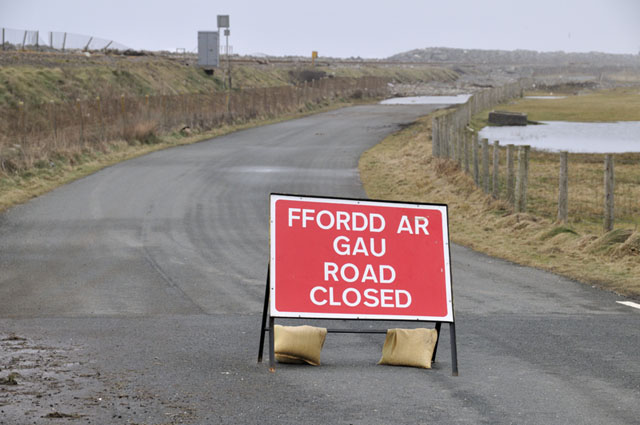
I investigated to find destruction of a considerable scale - this is why the road was closed:
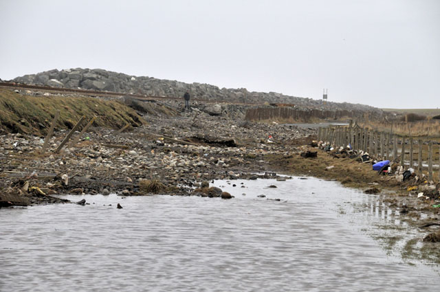
As for the railway:
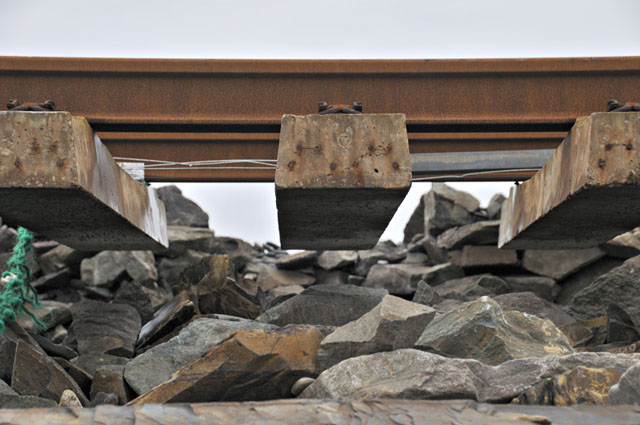
The track-bed and security-fence had both gone for a long section:
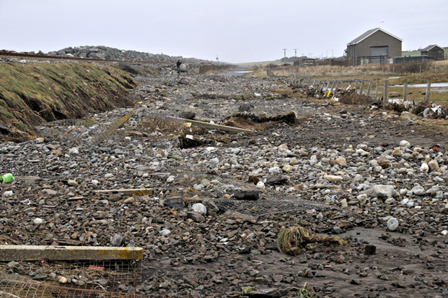
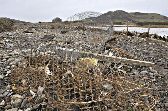
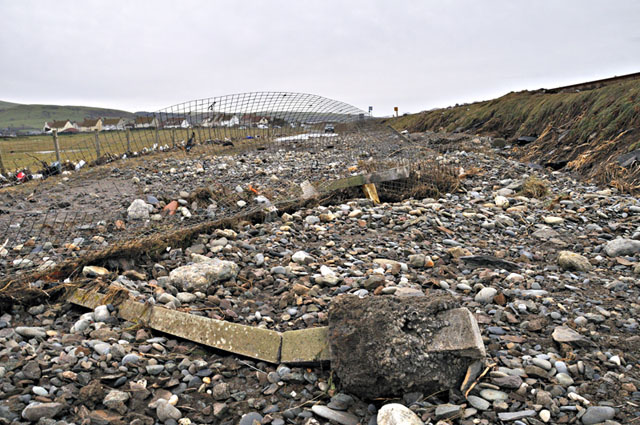
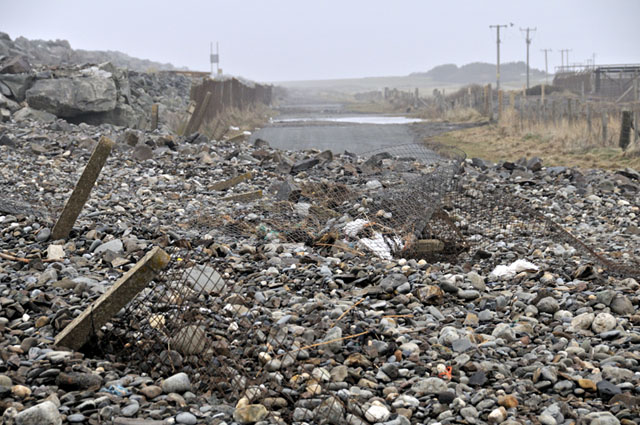
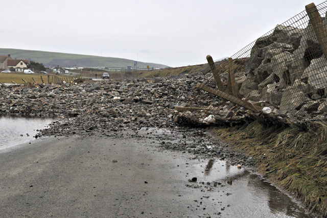
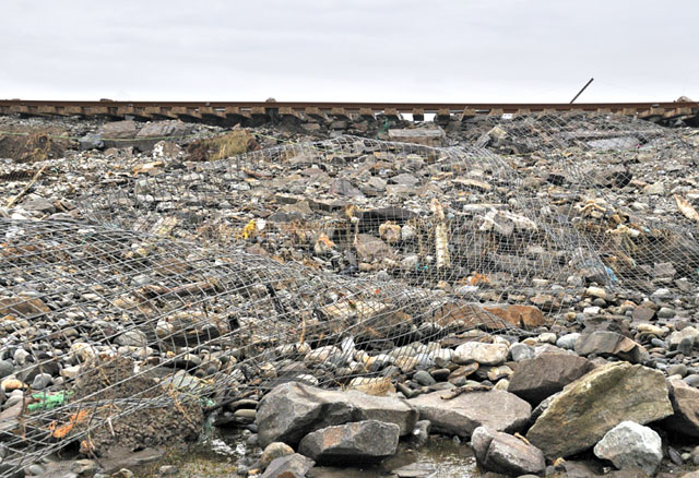
That's the worst I've seen at this spot. Overtopping does occur occasionally, but generally just a small amount of ballast gets moved. This was on another scale altogether.
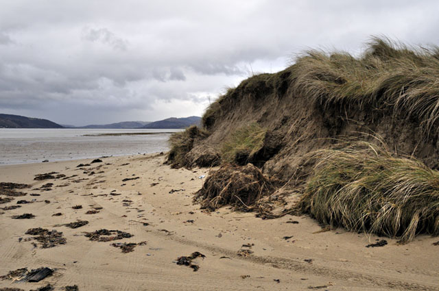
Borth next: this was the damage to the sand-dunes at the entrance to Ynyslas Beach. I haven't had time to check along the open coast, but I suspect severe dune damage is extensive. On this occasion I concentrated on stuff that would be cleared away soon....
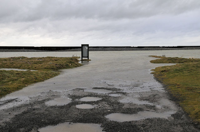
The Ynyslas Golf Course Crossing carpark was a lake! Further towards the village, debris covered the course itself:
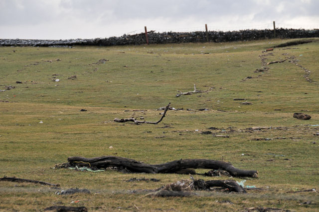
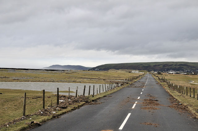
Coming into Borth, I crept through a section of quite deep floodwater, a small remnant of what had been a major flood - the debris left behind, looking back towards Ynyslas, is indicative of their former extent:
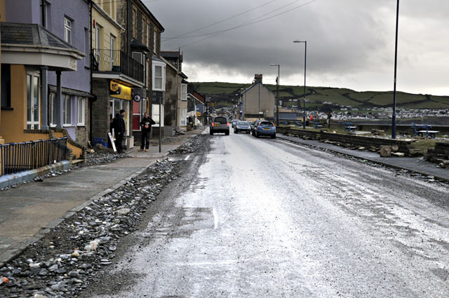
Some clearing up had already been done in the village:
I continued to Aberystwyth to see what was left of the Prom. Paving blocks and slabs had been ripped out and were strewn everywhere, mixed with tonnes and tonnes of sand and shingle:
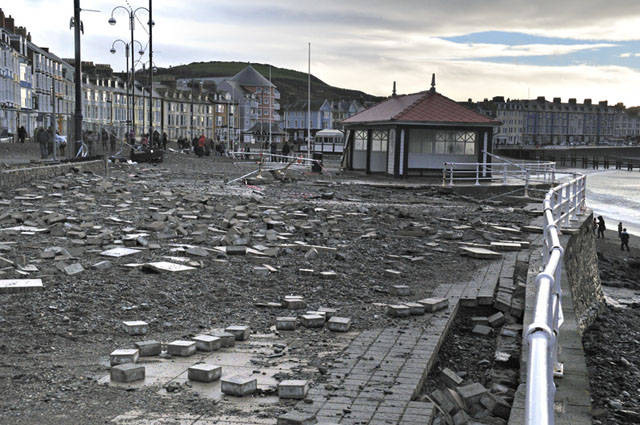
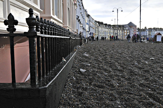
The Prom's railings were bent and broken, their great foundation-stones tossed like pebbles:
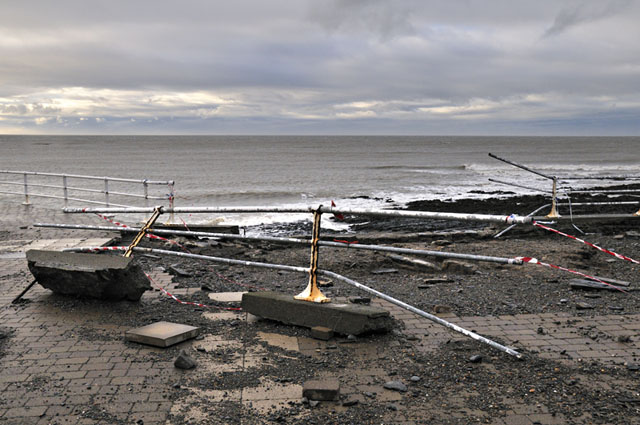
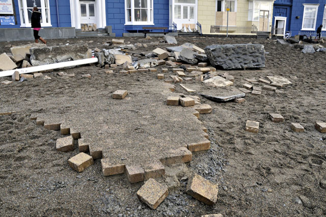
In places, the Prom had been badly holed:
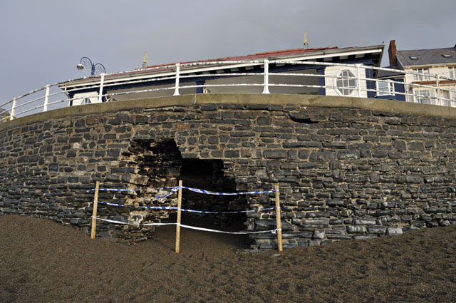
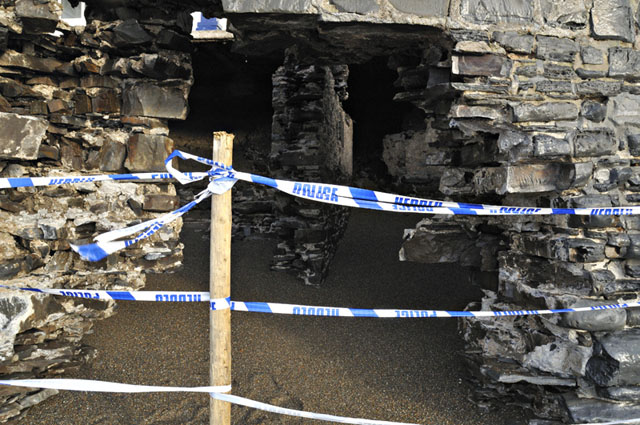
Having a quick artsy moment here!
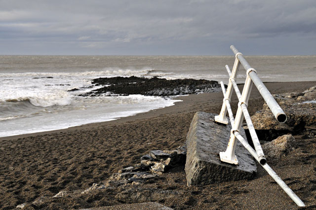
And another...
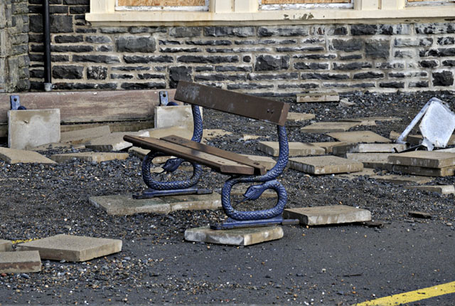
On the 6th, I had to go back to Aberystwyth and timed my visit to arrive two hours prior to high water, starting the shoot on the minor road that runs along above the south side of the Harbour - a safe vantage-point from which to photograph the swell. Safety is paramount when photographing storms of any type and huge swells rolling in are especially risky, as someone found out a day or two previously when his photography trip ended with a lifeboat rescue!
The sea-state wasn't too bad - a gale was blowing from the south (sending spray sideways) rather than onshore, but the huge isolated swells could periodically be seen coming over the horizon, breaking in the distance as on they came:
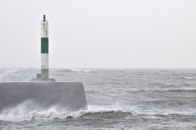
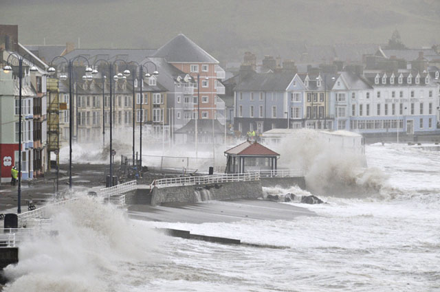
As the tide rose, the crashing waves became more and more impressive:
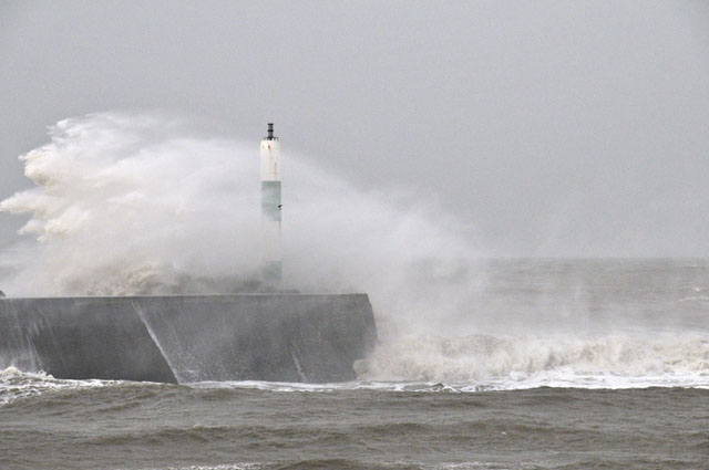
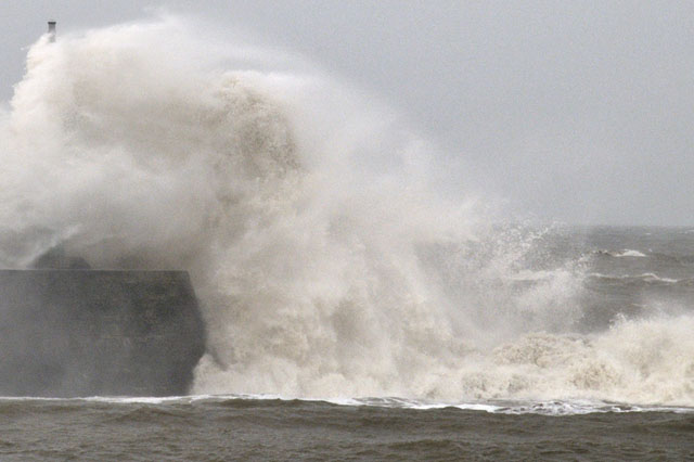
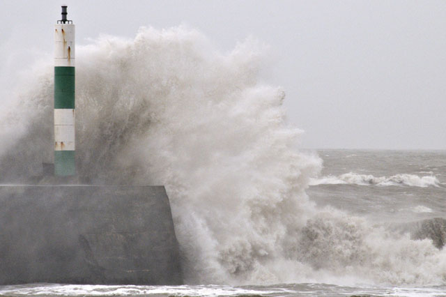
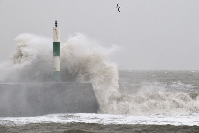
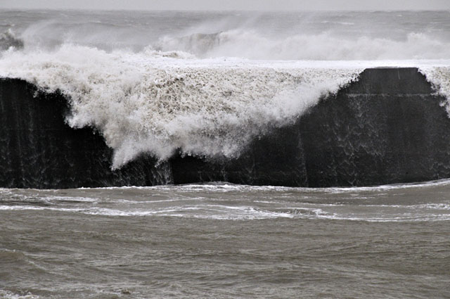
At times, the swells were arriving in sets, making for extremely unpleasant and dangerous conditions at the mouth of the Harbour:
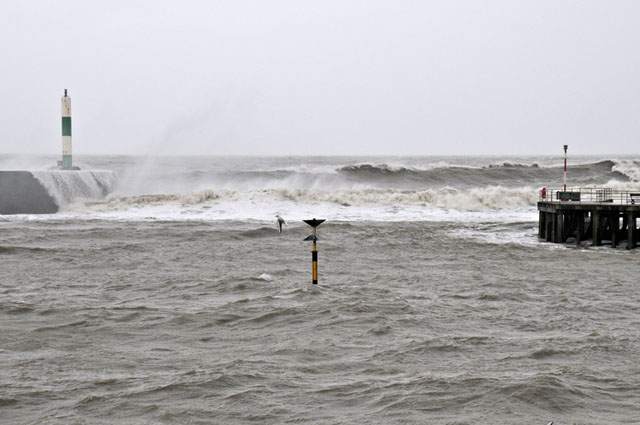
Moving back to a second high vantage-point, I noted the height of the tide in the Harbour - not quite as high as in the March 2008 surge but on that occasion a sub-950 millibar low was actually centered over Wales!
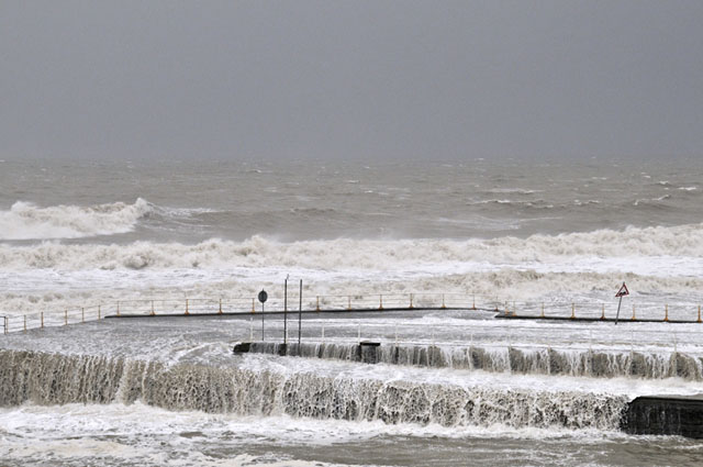
This spot gives a good view of the southern end of the Prom. Some big swells were rolling in and I took a series of wavecrash shots: note that the road-sign (R) seems to become progressively more bent-over through time!
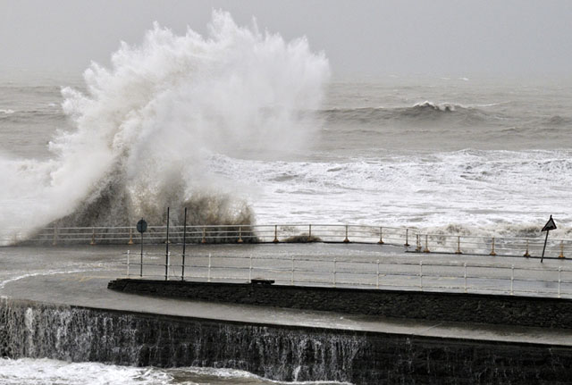
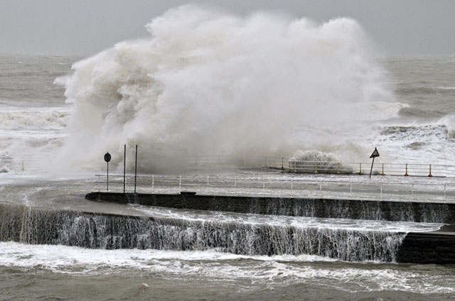
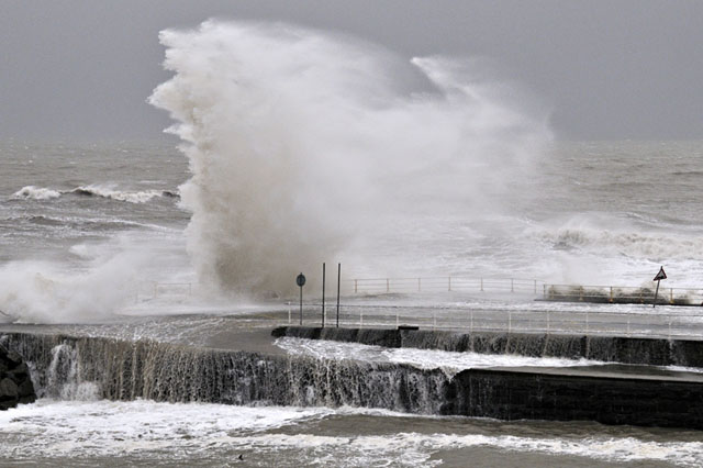
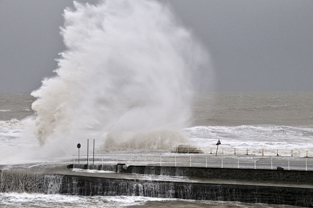
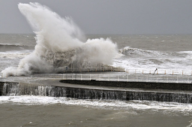
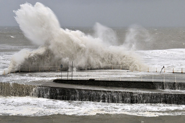
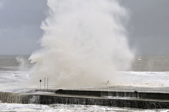
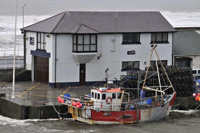
A big squall then arrived and I abandoned my spot, stopping just for a few shots looking to the harbour mouth - the only way to get this was through the windscreen but it shows how awful the conditions had become:
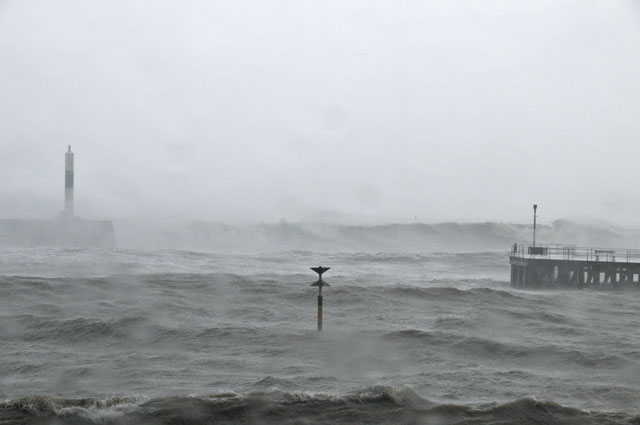
Driving back into Aberystwyth itself, the squall finally blew over: with high tide a few minutes away I found somewhere to park and set off on foot up Constitution Hill, to the north of the end of the Prom, and a safe and excellent vantage-point. Dozens of other photographers were present - it was like a USA storm-chaser "convergence"! The police were taking no chances and had every road onto the Prom sealed-off - with a view like this I had nothing to complain about, though!
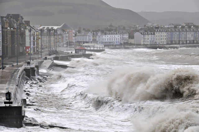
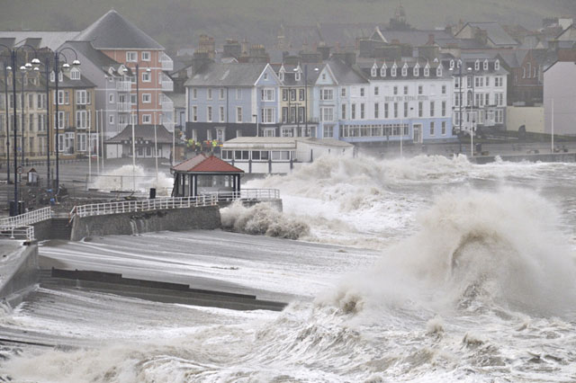
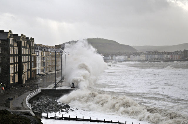
These were truly mountainous seas: the swells took no notice of the sea-wall, breaking onto the middle of Prom itself (this was where most of the serious damage, illustrated above, occurred.....
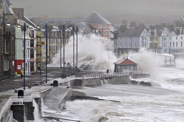
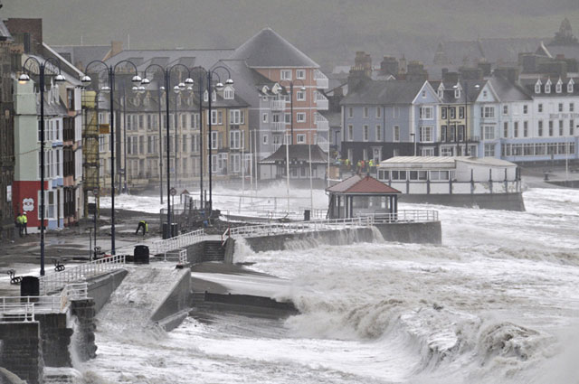
Nearer to me, waves were breaking against the wall, spray being hurled tens of feet upwards:
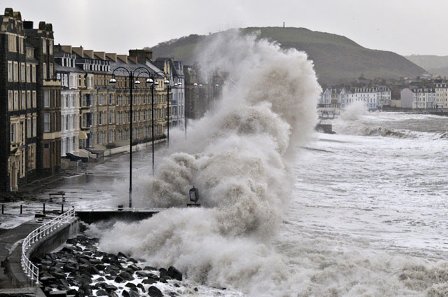
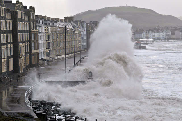
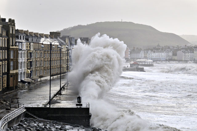
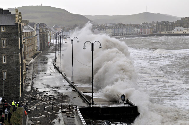
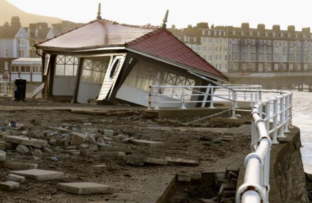
More squally showers then moved in, prompting a departure to get on with the other things I had to do. However, the destruction was to continue: an hour or two later I learned that the famous and Grade 2 Listed Shelter (built in the 1920s) on the Prom had collapsed. The sea breached the wall beneath it, completely undermining the structure - thanks again to Giles Bennett for letting me use his image of what's left:
These storms have been exceptional in their size and ferocity and have brought to an end a run of severe weather that started in December. As to the rest of the month? Continuing unsettled a lot of the time, but it doesn't currently look half as wild as what has recently passed, and it may finally turn a bit colder - more seasonal at times - into the second half of January. More soon!
BACK TO WEATHER-BLOG MENU
New! Fine Art Prints & digital images for sale-
Welsh Weather & Dyfi Valley landscapes Slide-Library - Click HERE