|
NEWS ITEM ADDED 22nd NOVEMBER 2006
WELSH
RIGS COVERAGE TO NOVEMBER 2006
The map
R shows how progress is being made in Central Wales to audit our
important geodiversity sites in the last 18 months. Sites now
recognised as RIGS are plotted as red dots.
The map also shows sites that have been notified or audited since 1993
by NEWRIGS in Clwyd and Gwynedd & Mon RIGS in NW Wales.
Thanks to Raymond Roberts, of the CCW Mold office, for creating the map.
|
 |
************************************************************************************************************
NEWS ITEM ADDED 16th OCTOBER 2006
GEOLOGICAL
BACKGROUND TO THE CENTRAL WALES Pb-Zn-Cu-Ag MINING DISTRICT:
A CENTRAL WALES RIGS - SPIRIT OF THE MINERS - CCW - EA PROJECT
The Central Wales RIGS group is helping to explain the geological
background of this once important mining district by erecting bilingual
information panels at three of the more important mining sites in
Ceredigion: Cwmystwyth, Cwmrheidol and Cwmsymlog. John Mason, among the
most knowledgeable mineral experts in Wales, has done most to design
the panels.

Why these sites? Cwmystwyth (above) is perhaps the most conspicuous
mining area in the county, attracting a lot of curiosity from local
visitors and tourists. Cwmrheidol is interesting largely because it
gives us information on environmental hazards posed by some mines; that
panel will be erected in the next few weeks. Cwmsymlog is special
because its mines were a rich source of silver that once led to the
foundation of an Aberystwyth Mint. The RIGS panel will be incorporated
in an elaborate display that also covers the heritage aspects of the
valley and especially the restoration of the mine chimney.
In preparing the new information panels, RIGS has received the support
of the Spirit of the Miners heritage project. The Countryside Council
for Wales has helped fund the Cwmystwyth and Cwmsymlog panels, whilst
the Environment Agency Wales has part-funded the one in Cwmrheidol.
Staff of each of these organizations have also given much technical
advice and encouragement. Landowners, too, have been most helpful.
Feedback from Cwmystwyth indicates that the reaction from local
residents has been very positive.

Above: The Cwmystwyth information panel, at
the eastern end of the site close to Nant Watkyn (the pink house and
pottery).
************************************************************************************************************
NEWS ITEM ADDED 10th JUNE 2006
CURRENT
STATUS OF GEOLOGICAL RESEARCH IN THE LOWER PALAEOZOIC AND OLDER ROCKS
OF WALES - written
by Bill Fitches
An informal workshop on current research in Wales was held on 25th May
at the isotope labs at the British Geological Survey in Keyworth. It
was attended by about 15 people, including Bill Fitches and John Mason
of Central Wales RIGS. News on Central Wales from the meeting includes
the following topics.
The British Geological Survey began a month ago to map the Llanidloes
1:50,000 sheet. This project is to be carried out by a 7-person team in
12 months, and a preliminary map should be prepared in 2008. A sheet
description booklet will eventually accompany the map. The Welshpool
sheet has recently been remapped (mostly by Dr Richard Cave, retired
from BGS, who is particularly helpful with RIGS advice) and should be
available later this year or early in 2008, together with the sheet
description. Plans are made to remap the Knighton sheet in 2007-8. The
mysteries of the Dinas Mawddwy sheet will remain indefinitely.
Jane Evans of the NERC Isotope Geochemistry Labs reported work in
progress with BGS mappers on the Treffgarne Volcanics: erupted in the
late Arenig - early `Llanvirn'. She has also obtained c.450 Ma Nd-Sm
ages from diagenetic monazite in parts of Central Wales. Future isotope
work will focus on the Stanner-Hanter igneous complex in east Wales.
Mike Howe (BGS) notes that a lot of BGS data are now accessible through
the Web: palaeo, borehole, mineralogy, petrology, etc. They may
accessed through the BGS website, following the link http://www.bgs.ac.uk/geoindex/.
John Mason (CWRIGS) described the unusual mineralogy of syntectonic
veins in brittle layers of NW Wales. Some rare earth-bearing minerals
appear to have good potential for dating by Sm/Nd methods so might
provide a way of dating deformation in the Welsh Basin. He also
discussed the mineralogy and possible origins of iron-rich
sedimentary-volcanic rocks in the Cadair Idris region, suspecting that
black-smokers may have been involved.
Alex Page (Leicester PhD) is working on effects of diagenesis, burial
metamorphism and deformation on graptolites in the Welsh Basin. He
infers that several of the changes, such as replacement or enveloping
by chlorite, involve a volume loss during burial and before deformation.
Sarah Sherlock (Leicester PhD) is studying strain shadows on
graptolites in the Llangurig-Rhayader district. During cleavage
formation, white micas and other minerals grew as fibres on the edges
of fossilised graptolites. Sarah showed by using Ar/Ar isotope analysis
that the growth, and hence cleavage formation, took place at c.396 Ma
(early mid Devonian). Jack Soper pointed out that the c. 1.5 Ma time
span for cleavage formation would indicate the shortest time length
known for any orogeny. Bill Fitches suggested carrying out similar
studies on a N-S traverse through the Welsh Basin to test for southward
migration of deformation related to Iapetus closure as advocated in
some geotectonic models. Other participants advocated expanding the
project to include the Lake District, again to detect migration.
Mark Williams (Portsmouth) is attempting to model early Palaeozoic
oceanography, based largely on fossil communities and Pliocene
analogues, which might lead on to climate modelling for that era. He
pointed out that the Welsh Basin is ideal for this type of work, having
a very wide range of faunal types (graptolites, trilobites, etc.) that
can provide information, together with particularly accurate and
detailed stratigraphic control. One target of this study will be to
trace the effects of the Hirnantian (late Ordovician) glacial event
throughout the various palaeolatitude zones. Another objective is to
test whether various types of graptolite occupied different levels in
the oceans.
Nigel Woodcock (Cambridge) reviewed the ideas he and Jack Soper have
published on the geotectonic evolution of southern Britain in the
Silurian-Devonian. One key point of their interpretation is that much
of Wales was covered by several kilometres of Old Red Sandstone as a
result of rifting and subsidence in a strike-slip regime. That
conclusion is based on correlating illite crystallinity data with
metamorphic temperatures and those inferred temperatures with depth of
burial. Mid Wales may not have been covered by ORS. Another key point
of their presentation was the suggestion that the deformation of the
Welsh Basin took place after ORS burial in the early-mid Devonian as a
consequence of the closure of the Rheic Ocean in southern Britain and
further south during a proto-Variscan event. It was not, as usually
considered, caused by the Acadian closure of the Iapetus Ocean between
the Southern Uplands and England and Wales. If anyone finds a lost
Rheic suture zone in southern Wales or southern England, please report
it to Nigel and Jack. Details of this model are given in the paper:
Soper, N.J. & Woodcock, N.H. (2003). The lost Lower Old Red
Sandstone of England and Wales: a record of post-Iapetan flexure or
Early Devonian transtension? Geological Magazine, 140, 627-647.
************************************************************************************************************
NEWS ITEM
ADDED 9th JUNE 2006
RIGS LEAFLET NOW AVAILABLE ONLINE!
A leaflet explaining, in Welsh and English, the role of RIGS groups in
Wales, has now been produced. Hard copies are available from Bill
Fitches or alternatively you may wish to download the leaflet in PDF
format (only 247k) by clicking HERE.
************************************************************************************************************
NEWS ITEM ADDED 12th MAY 2006
Over the May Bank Holiday long weekend (29th April-1st May, 2006), Bill
Fitches of the Central Wales and Association of Welsh RIGS led a
fieldtrip to Anglesey for the Severnside Branch of the Open University
Geological Society. The 30-strong group, which included OUGS members
from Cornwall and northern England as well as Severnside, were based at
the Trearddur Bay Holiday Bungalows on Holy Island.
Most of the Saturday was spent on Rhoscolyn Head on Holy Island,
studying the Late Precambrian - Early Palaeozoic sedimentary rocks of
the Monian Complex and traversing the Rhoscolyn Anticline of uncertain
age. Despite the intense and complicated structures and the metamorphic
overprint, we found examples of graded bedding, sole marks and other
turbidite features as well as a conglomerate-filled channel. We also
found spectacular pre-lithification structures produced by dewatering
that were then deformed after lithification by tectonic folds and
cleavage.
Traversing across the Rhoscolyn Anticline, we used small-scale folds to
determine the shape and orientation of the major fold. The steep to
overturned SE limb comprises mainly S-bend folds, the hinge area
includes M-folds, whilst the NW limb contains mainly Z-folds. Boudins
and folded boudins were found in places. A poignant aspect of this
traverse is the memorial plinth to Dennis Wood, who inspired
generations of geology students through his teaching and friendship
here and overseas. The plinth is sited on the anticline crest next to
the Coast Guard lookout, appropriately selected to remind us of his
contributions to Anglesey tectonics.
Saturday's excursion finished by studying the serpentinite beside the
road between Rhoscolyn and Four-Mile Bridge. The nearby gabbro quarry,
however, has been fenced off from the normal access track, despite its
GCR status and RIGS designation. This inaccessibility hindered our
ponderings on the significance of the ultrabasic-basic bodies in this
area: intrusive masses or a dismembered ophiolite?
Sunday morning saw us at Cemaes Bay exploring the world-famous Gwna
Melange, another part of the Monian Complex. Here we debated the
possible origins of this widespread unit that contains fragments of
limestone, dolomite, quartzite, basalt and other rock-types held in a
sandy to muddy matrix. Greenly favoured a tectonic origin, but his
successors have preferred a sedimentary explanation, notably as an
olistostrome formed as the various components slid and slumped from a
shelf into deeper marine settings. The Gadlys Quarry, between Cemaes
and Llanbadrig, and once used for making lime, is cut in a huge
kilometre-scale raft in the olistostrome. Careful hunting in the
limestone revealed examples of the algal laminations and small domed
stromatolites discovered by Margaret Wood and colleagues in the 70s.
The age of these fossils is still uncertain as they range from Late
Precambrian to Early Palaeozoic.
On Sunday afternoon, we were introduced by David Jenkins to the
Industrial Heritage trail of the Parys Mountain mining complex, the
`Copper Mountain', near Amlwch. The mines, going back to the Bronze
Age, were once world-renowned for copper production, gave us the term
copper-bottomed, and helped our Elizabethan ships to turn on a sixpence
and defeat more ponderous enemies. This open-cast site is now famous
for its lurid landscape, coloured by various iron-rich minerals, which
mimics many a modern volcano. It was occasionally used by the BBC in
the 1970s as an "extraterrestrial" filming location for Dr Who! David
demonstrated the extreme acidity (pH about 1.4) of some surface water,
noting that our ancestors used that property to cure animal hoof
problems: some sheep-dip! A search for graptolites in the Silurian
slates in the core of the Parys Mountain Syncline yielded several
straight Monograptids, whilst Jenny Baker found some unusual curly
versions that may have research potential.
Llanddwyn Island, near Newborough, was our destination on the morning
of Bank Holiday Monday. Just outracing the rising tide, we viewed the
spectacular pillow lavas in the crags between the island and mainland,
noting the way-up signatures, looking for vesicles and chilled margins,
finding inter-pillow jasper-carbonate-epidote aggregates, and examples
of breccia that resulted from implosions of pillows. This assemblage,
probably of back-arc basin origin, may be part of a major raft within
the Gwna Melange. The tide got its own back, beating us to the Tertiary
basalt dykes that cut the pillow lavas in places.
Before dispersing at lunchtime, we visited a blueschist site in SE
Anglesey, recently designated a RIGS by the Gwynedd & Mon RIGS
group. These basic rocks are distinctly blue-purple because of their
high Na-amphibole content and are more easily studied here than the
more traditional Marquis of Anglesey's statue site. Particular thanks
for access are due to Mr & Mrs Jones who own and farm this land.
Thanks are also given to Margaret Wood, chair of the Gwynedd & Mon
and Association of Welsh RIGS groups, who made useful suggestions on
the itinerary. Margaret is heavily committed to helping Anglesey
achieve Geopark status later this year, and we wish her and her team
all success in their application.
A gallery of images from the trip can be enjoyed by clicking HERE.
************************************************************************************************************
NEWS ITEM ADDED 4th APRIL 2006
Nant-y-Moch Field Trip, 1st April, 2006
The Central Wales RIGS group visited the Nantymoch area near Plynlimon
on Saturday 1st April, braving a cold wind and occasional hail shower.
26 people joined in the trip, and we were pleased to welcome along
members of the Mid Wales Geological Society, the Cambrian Mountains
Society, some from Shropshire and others from South Wales. Geology
teacher, Brian Clissold, transported several of us in the Penglais
school mini-bus.
 One
main objective was to examine the c. 430-420 million year old Late
Ordovician and Early Silurian sedimentary rocks exposed in the quarries
of Carn Owen (L). They are included in one of our Regionally Important
Geodiversity Sites. In the main quarry, we admired the chaotic
assemblage of sandstone blocks in a mudstone matrix, the Late
Ordovician Carn Owen melange, and discussed possible origins:
unconsolidated mud injected upwards into sand layers by diapiric
action?; the collapse of a submarine channel margin? Richard Cave
showed us a copy of the 1:10,000 scale map he had made of the area when
compiling the 1:50,000 Aberystwyth sheet for the British Geological
Survey in the 1980s. Denis Bates showed maps he prepared while training
Geology undergraduates at Aberystwyth University, whilst Brian Clissold
explained how Penglais geology classes are taught to map in the same
area. Denis, Richard and Richard Hartnup gave an account of the
industrial history of the Carn Owen quarries and the mines nearby. One
main objective was to examine the c. 430-420 million year old Late
Ordovician and Early Silurian sedimentary rocks exposed in the quarries
of Carn Owen (L). They are included in one of our Regionally Important
Geodiversity Sites. In the main quarry, we admired the chaotic
assemblage of sandstone blocks in a mudstone matrix, the Late
Ordovician Carn Owen melange, and discussed possible origins:
unconsolidated mud injected upwards into sand layers by diapiric
action?; the collapse of a submarine channel margin? Richard Cave
showed us a copy of the 1:10,000 scale map he had made of the area when
compiling the 1:50,000 Aberystwyth sheet for the British Geological
Survey in the 1980s. Denis Bates showed maps he prepared while training
Geology undergraduates at Aberystwyth University, whilst Brian Clissold
explained how Penglais geology classes are taught to map in the same
area. Denis, Richard and Richard Hartnup gave an account of the
industrial history of the Carn Owen quarries and the mines nearby.
The Ordovician-Silurian boundary was picked out on the east flank of
Carn Owen, largely on the basis of the transition from grey to black
mudstones. Bill Fitches explained that the grey sediments were
deposited on a well-oxygenated seafloor, whereas the black mudstones
containing much rusting pyrite and graptolite fossils record anaerobic
bottom conditions. On the west flank of Carn Owen, we found loose
pieces of shale containing pyritised graptolites and orthocone shells.
A good example of an orthocone, 5cm long, is illustrated below: it was
found here back in the 1980s.
 Bill
drew attention to the global context of Carn Owen. In the Late
Ordovician Africa, S. America, Australia & Antarctica made up the
Gondwana Supercontinent: Wales and neighbouring parts of Europe were
situated some distance from Gondwana. In the Hirnantian stage of the
Late Ordovician, an icecap formed on parts of Gondwana that lay at the
south pole. To make the ice-cap, water was withdrawn from the oceans,
leading to a global sea-level drop of 200 m and the exposure of shallow
marine platforms to erosion. Eastern Wales was probably exposed in this
way and it is possible that some of the submarine channels in eastern
and central Wales were cut at this stage: palaeovalleys containing
highly disturbed sediments, much like the one at Carn Owen, are a
characteristic Hirnantian feature of Algeria, Libya, Saudi Arabia and
elsewhere. When the ice-cap melted, about 2 million years later in the
Early Silurian, global sea-level rose again and flooded the shallow
shelf areas with organic-rich black mud. These muds, including the
famous Tannezuft Shale of Libya that closely resembles our black shale
in Central Wales, generated huge amounts of oil and gas which migrated
into the Late Ordovician palaeovalley sandstone reservoirs. Very likely
our Late Ordovician and Early Silurian rocks also formed a hydrocarbon
play, but fortunately/unfortunately the oil and gas were dispersed by
heating during deep burial and by folding and faulting. Now for power
we have to make do with windmills covering our hills instead of nodding
donkeys. Bill
drew attention to the global context of Carn Owen. In the Late
Ordovician Africa, S. America, Australia & Antarctica made up the
Gondwana Supercontinent: Wales and neighbouring parts of Europe were
situated some distance from Gondwana. In the Hirnantian stage of the
Late Ordovician, an icecap formed on parts of Gondwana that lay at the
south pole. To make the ice-cap, water was withdrawn from the oceans,
leading to a global sea-level drop of 200 m and the exposure of shallow
marine platforms to erosion. Eastern Wales was probably exposed in this
way and it is possible that some of the submarine channels in eastern
and central Wales were cut at this stage: palaeovalleys containing
highly disturbed sediments, much like the one at Carn Owen, are a
characteristic Hirnantian feature of Algeria, Libya, Saudi Arabia and
elsewhere. When the ice-cap melted, about 2 million years later in the
Early Silurian, global sea-level rose again and flooded the shallow
shelf areas with organic-rich black mud. These muds, including the
famous Tannezuft Shale of Libya that closely resembles our black shale
in Central Wales, generated huge amounts of oil and gas which migrated
into the Late Ordovician palaeovalley sandstone reservoirs. Very likely
our Late Ordovician and Early Silurian rocks also formed a hydrocarbon
play, but fortunately/unfortunately the oil and gas were dispersed by
heating during deep burial and by folding and faulting. Now for power
we have to make do with windmills covering our hills instead of nodding
donkeys.
John Mason led us down the incline from the Carn Owen quarries to the
site of the Hafan Mine, situated on the Hafan Fault and another of our
Central Wales RIGS. Here we found on the mine dumps samples of galena
(lead ore), sphalerite (zinc ore) and chalcopyrite (copper ore),
embedded in brown ferroan dolomite (iron-rich carbonate) and white
quartz. The polyphase nature of the mineralisation in Central Wales was
explained: in simplistic terms, early polymetallic mineralisation
involved lead, zinc and copper but also notable silver, iron, nickel,
cobalt, antimony and traces of arsenic and gold. This was followed in
places by renewed brecciation and the deposition of locally major
quantities of ferroan dolomite. Later mineralisation was contrastingly
simple in its mineralogy, involving large tonnages of galena and
sphalerite with quartz, whilst the final stage of mineral deposition
consisted of abundant marcasite. It was explained that the
fragmentation (brecciation) of the mineral veins, the deposition of
minerals and the faulting were all caused by hydraulic fracture
processes: hot, high-pressure, saline fluids circulating in the crust
scavenged metals from the deep rocks then burst their way towards the
surface to make the mineral veins and provoke faulting.
 Returning
to the icy history of the region, Eva Sahlin took us to the viewpoint
at the eastern end of Nantymoch Dam to show us a Holocene spill way,
some 10,000 years old. While we were appropriately lashed by
hailstones, Eva pointed out that the valley seen below the dam is part
of an Ice Age feature, higher parts of which are drowned by the
reservoir. The valley is too big to have been carved by the little,
misfit stream now flowing along it, so this valley and several others
in this part of Ceredigion are interpreted to have been cut by
melt-waters from the Welsh icesheet. Eva also indicated on maps the
positions of other Ice Age features in the region, notably striated
rock surfaces and small cirques related to the latest phases of
glaciation and deglaciation. In view of the interest in this topic, we
will ask Eva to run a longer field trip in Central Wales to show us
more of her PhD work on the Quaternary - once the hills of Ceredigion
have thawed out a bit more. Returning
to the icy history of the region, Eva Sahlin took us to the viewpoint
at the eastern end of Nantymoch Dam to show us a Holocene spill way,
some 10,000 years old. While we were appropriately lashed by
hailstones, Eva pointed out that the valley seen below the dam is part
of an Ice Age feature, higher parts of which are drowned by the
reservoir. The valley is too big to have been carved by the little,
misfit stream now flowing along it, so this valley and several others
in this part of Ceredigion are interpreted to have been cut by
melt-waters from the Welsh icesheet. Eva also indicated on maps the
positions of other Ice Age features in the region, notably striated
rock surfaces and small cirques related to the latest phases of
glaciation and deglaciation. In view of the interest in this topic, we
will ask Eva to run a longer field trip in Central Wales to show us
more of her PhD work on the Quaternary - once the hills of Ceredigion
have thawed out a bit more.
************************************************************************************************************
|
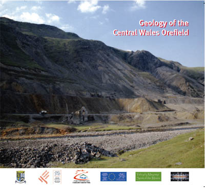 The
Central Wales RIGS publication, "Geology of the Central Wales
Orefield", is now out and available free from Tourist Information
Centres in the Cambrian Mountains area.
The
Central Wales RIGS publication, "Geology of the Central Wales
Orefield", is now out and available free from Tourist Information
Centres in the Cambrian Mountains area.